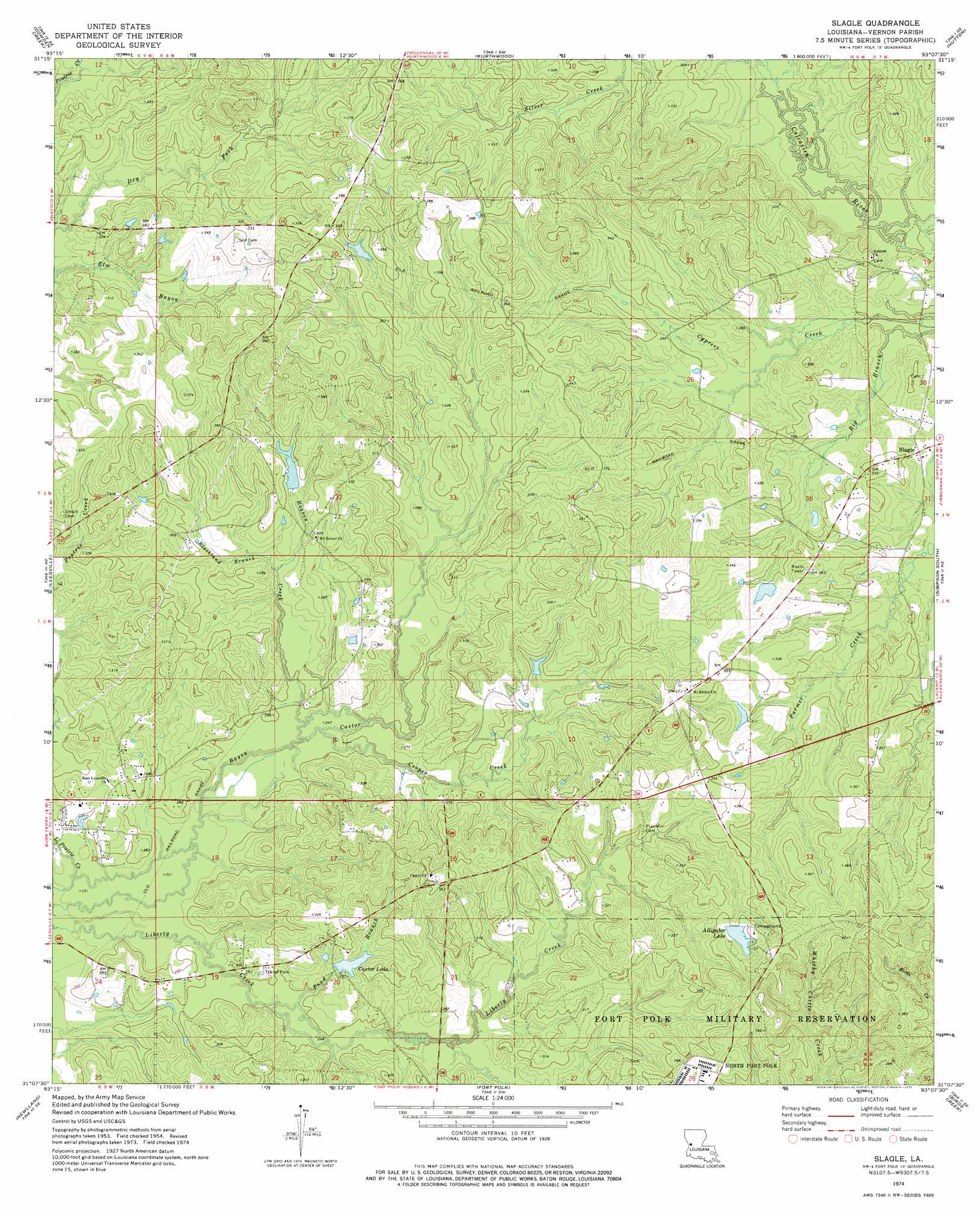
Slagle Topo Map Louisiana
To zoom in, hover over the map of Slagle
USGS Topo Quad 31093b2 - 1:24,000 scale
| Topo Map Name: | Slagle |
| USGS Topo Quad ID: | 31093b2 |
| Print Size: | ca. 21 1/4" wide x 27" high |
| Southeast Coordinates: | 31.125° N latitude / 93.125° W longitude |
| Map Center Coordinates: | 31.1875° N latitude / 93.1875° W longitude |
| U.S. State: | LA |
| Filename: | o31093b2.jpg |
| Download Map JPG Image: | Slagle topo map 1:24,000 scale |
| Map Type: | Topographic |
| Topo Series: | 7.5´ |
| Map Scale: | 1:24,000 |
| Source of Map Images: | United States Geological Survey (USGS) |
| Alternate Map Versions: |
Slagle LA 1954, updated 1958 Download PDF Buy paper map Slagle LA 1974, updated 1975 Download PDF Buy paper map Slagle LA 2012 Download PDF Buy paper map Slagle LA 2015 Download PDF Buy paper map |
1:24,000 Topo Quads surrounding Slagle
Florien |
Peason |
Kisatchie |
Bayou Livrogne |
Gorum |
Hornbeck |
Dowden Creek |
Kurthwood |
Simpson North |
Temple |
Little Sandy Creek |
Leesville |
Slagle |
Simpson South |
Lacamp |
Burr Ferry |
Newllano |
Fort Polk |
Birds Creek |
Fullerton Lake |
Knight |
Rose Pine |
Hurricane Branch |
Sugrue |
Pitkin |
> Back to 31093a1 at 1:100,000 scale
> Back to 31092a1 at 1:250,000 scale
> Back to U.S. Topo Maps home
Slagle topo map: Gazetteer
Slagle: Dams
Alligator Lake Dam elevation 124m 406′Castor Lake Dam elevation 82m 269′
Slagle: Populated Places
Slagle elevation 84m 275′Slagle: Post Offices
Slagle Post Office elevation 86m 282′Slagle: Reservoirs
Alligator Lake elevation 107m 351′Castor Lake elevation 78m 255′
Slagle: Streams
Beason Creek elevation 73m 239′Blackland Branch elevation 79m 259′
Cooper Creek elevation 75m 246′
Pond Branch elevation 74m 242′
Slagle digital topo map on disk
Buy this Slagle topo map showing relief, roads, GPS coordinates and other geographical features, as a high-resolution digital map file on DVD: