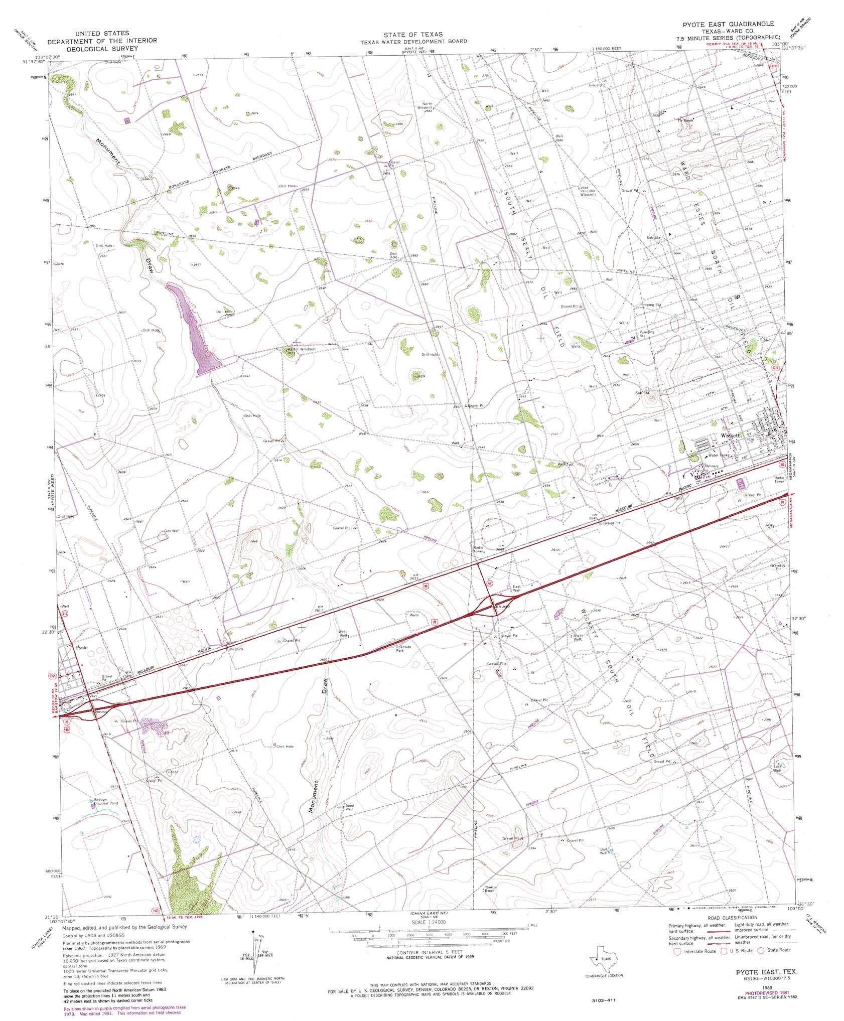
Pyote East Topo Map Texas
To zoom in, hover over the map of Pyote East
USGS Topo Quad 31103e1 - 1:24,000 scale
| Topo Map Name: | Pyote East |
| USGS Topo Quad ID: | 31103e1 |
| Print Size: | ca. 21 1/4" wide x 27" high |
| Southeast Coordinates: | 31.5° N latitude / 103° W longitude |
| Map Center Coordinates: | 31.5625° N latitude / 103.0625° W longitude |
| U.S. State: | TX |
| Filename: | o31103e1.jpg |
| Download Map JPG Image: | Pyote East topo map 1:24,000 scale |
| Map Type: | Topographic |
| Topo Series: | 7.5´ |
| Map Scale: | 1:24,000 |
| Source of Map Images: | United States Geological Survey (USGS) |
| Alternate Map Versions: |
Pyote East TX 1969, updated 1971 Download PDF Buy paper map Pyote East TX 1969, updated 1981 Download PDF Buy paper map Pyote East TX 2010 Download PDF Buy paper map Pyote East TX 2013 Download PDF Buy paper map Pyote East TX 2016 Download PDF Buy paper map |
1:24,000 Topo Quads surrounding Pyote East
Cheyenne Draw Se |
Wink North |
Kermit |
Wheeler Ranch |
Amburgey Ranch |
Soda Lake Ne |
Wink South |
Pyote Ne |
China Ranch |
Cowden Place |
Soda Lake Se |
Pyote West |
Pyote East |
Monahans |
Monahans Se |
Quito Draw |
China Lake |
China Lake Ne |
7 L Ranch |
Ozark Lake |
Old X Ranch |
Ligon Ranch |
Rio Pecos Ranch |
Grandfalls Sw |
Grandfalls |
> Back to 31103e1 at 1:100,000 scale
> Back to 31102a1 at 1:250,000 scale
> Back to U.S. Topo Maps home
Pyote East topo map: Gazetteer
Pyote East: Dams
Monument Pond Dam elevation 803m 2634′Pyote East: Oilfields
South Sealy Oil Field elevation 816m 2677′Wickett South Oil Field elevation 794m 2604′
Pyote East: Populated Places
Wickett elevation 813m 2667′Pyote East: Reservoirs
Monument Pond elevation 803m 2634′Pyote East: Wells
Bull Well elevation 794m 2604′East Well elevation 806m 2644′
East Well elevation 791m 2595′
North Well elevation 800m 2624′
Sand Well elevation 795m 2608′
West Well elevation 795m 2608′
Pyote East digital topo map on disk
Buy this Pyote East topo map showing relief, roads, GPS coordinates and other geographical features, as a high-resolution digital map file on DVD: