Ozark Lake Topo Map Texas
To zoom in, hover over the map of Ozark Lake
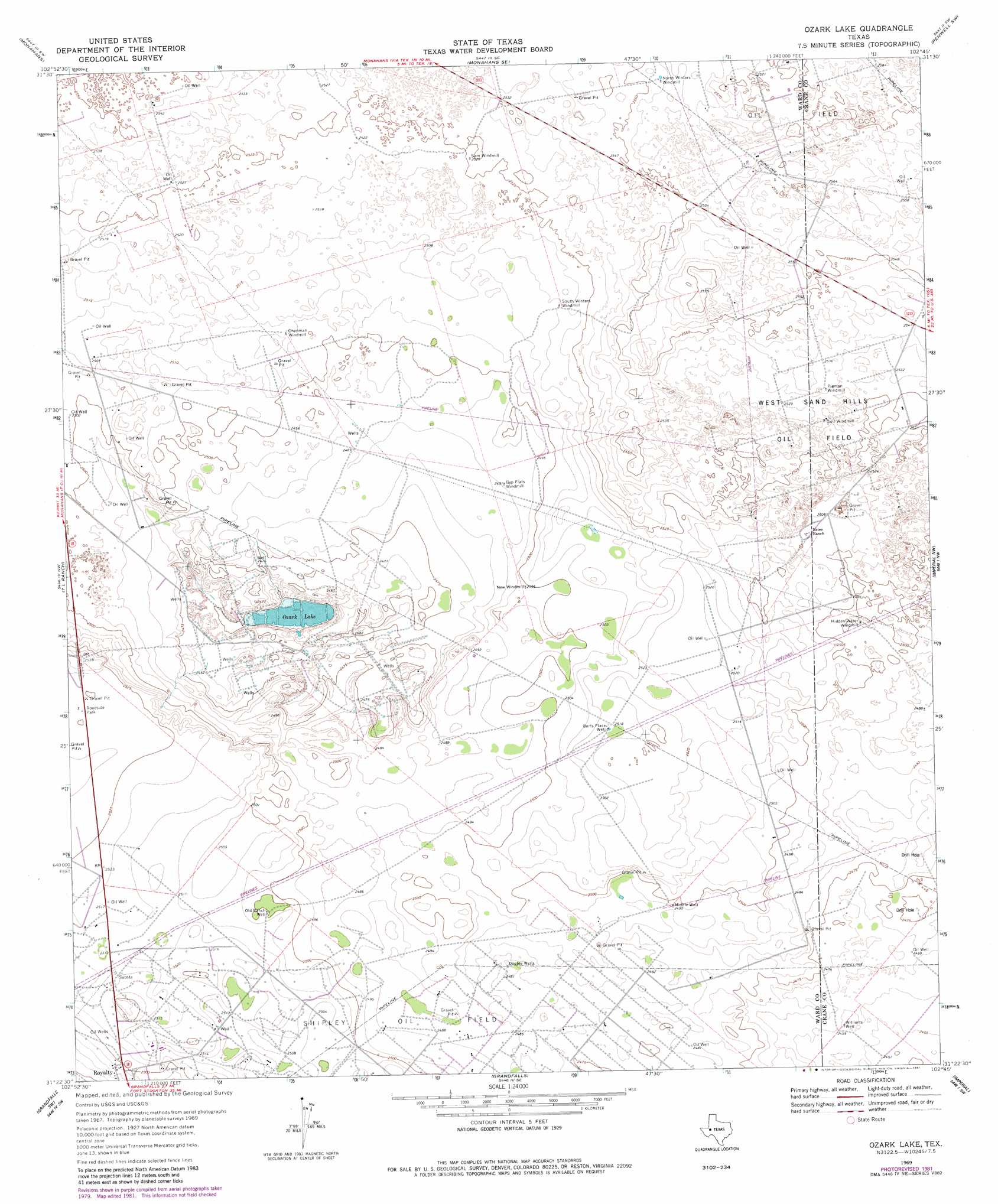
USGS Topo Quad 31102d7 - 1:24,000 scale
| Topo Map Name: | Ozark Lake |
| USGS Topo Quad ID: | 31102d7 |
| Print Size: | ca. 21 1/4" wide x 27" high |
| Southeast Coordinates: | 31.375° N latitude / 102.75° W longitude |
| Map Center Coordinates: | 31.4375° N latitude / 102.8125° W longitude |
| U.S. State: | TX |
| Filename: | o31102d7.jpg |
| Download Map JPG Image: | Ozark Lake topo map 1:24,000 scale |
| Map Type: | Topographic |
| Topo Series: | 7.5´ |
| Map Scale: | 1:24,000 |
| Source of Map Images: | United States Geological Survey (USGS) |
| Alternate Map Versions: |
Ozark Lake TX 1969, updated 1971 Download PDF Buy paper map Ozark Lake TX 1969, updated 1981 Download PDF Buy paper map Ozark Lake TX 2010 Download PDF Buy paper map Ozark Lake TX 2012 Download PDF Buy paper map Ozark Lake TX 2016 Download PDF Buy paper map |
1:24,000 Topo Quads surrounding Ozark Lake
Pyote Ne |
China Ranch |
Cowden Place |
Metz |
Penwell |
Pyote East |
Monahans |
Monahans Se |
Penwell Sw |
Penwell Se |
China Lake Ne |
7 L Ranch |
Ozark Lake |
Imperial Nw |
Tubbs Corner |
Rio Pecos Ranch |
Grandfalls Sw |
Grandfalls |
Imperial |
Juan Cordona Lake |
Coyanosa |
Diamond Y Spring Nw |
Diamond Y Spring Ne |
Buena Vista |
Buena Vista Ne |
> Back to 31102a1 at 1:100,000 scale
> Back to 31102a1 at 1:250,000 scale
> Back to U.S. Topo Maps home
Ozark Lake topo map: Gazetteer
Ozark Lake: Lakes
Ozark Lake elevation 746m 2447′Ozark Lake: Wells
Berts Place Well elevation 768m 2519′Double Wells elevation 756m 2480′
Middle Well elevation 761m 2496′
Old Ranch Well elevation 762m 2500′
Williams Well elevation 750m 2460′
Ozark Lake digital topo map on disk
Buy this Ozark Lake topo map showing relief, roads, GPS coordinates and other geographical features, as a high-resolution digital map file on DVD: