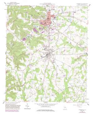
Sandersville Topo Map Georgia
To zoom in, hover over the map of Sandersville
USGS Topo Quad 32082h7 - 1:24,000 scale
| Topo Map Name: | Sandersville |
| USGS Topo Quad ID: | 32082h7 |
| Print Size: | ca. 21 1/4" wide x 27" high |
| Southeast Coordinates: | 32.875° N latitude / 82.75° W longitude |
| Map Center Coordinates: | 32.9375° N latitude / 82.8125° W longitude |
| U.S. State: | GA |
| Filename: | o32082h7.jpg |
| Download Map JPG Image: | Sandersville topo map 1:24,000 scale |
| Map Type: | Topographic |
| Topo Series: | 7.5´ |
| Map Scale: | 1:24,000 |
| Source of Map Images: | United States Geological Survey (USGS) |
| Alternate Map Versions: |
Sandersville GA 1962, updated 1963 Download PDF Buy paper map Sandersville GA 1962, updated 1981 Download PDF Buy paper map Sandersville GA 1962, updated 1986 Download PDF Buy paper map Sandersville GA 2011 Download PDF Buy paper map Sandersville GA 2014 Download PDF Buy paper map |
1:24,000 Topo Quads surrounding Sandersville
> Back to 32082e1 at 1:100,000 scale
> Back to 32082a1 at 1:250,000 scale
> Back to U.S. Topo Maps home
Sandersville topo map: Gazetteer
Sandersville: Airports
Kaolin Field elevation 131m 429′Memorial Hospital of Washington County Heliport elevation 141m 462′
Sandersville: Dams
Dixie Land Lake Dam elevation 103m 337′Kings Pond Dam elevation 112m 367′
Lower Yarbrough Lake Dam elevation 128m 419′
Political Pond Dam elevation 109m 357′
Smith Pond Dam elevation 126m 413′
Taylor Lake Dam elevation 104m 341′
Thiele Kaolin Mining Company Lake Dam elevation 111m 364′
Upper Yarbrough Lake Dam elevation 128m 419′
Sandersville: Lakes
Anderson Pond elevation 122m 400′Sandersville: Parks
Church-Smith-Harris Streets Historic District elevation 138m 452′North Harris Street Historic District elevation 139m 456′
Tennille City Park elevation 140m 459′
Sandersville: Populated Places
Sandersville elevation 137m 449′Tennille elevation 142m 465′
Sandersville: Post Offices
Sandersville Post Office elevation 138m 452′Tennille Post Office elevation 141m 462′
Sandersville: Reservoirs
Cedar Meadow Pond elevation 107m 351′Dixie Land Lake elevation 103m 337′
Harrison Pond elevation 110m 360′
Kings Pond elevation 112m 367′
Lower Yarbrough Lake elevation 128m 419′
Political Pond elevation 109m 357′
Segars Pond elevation 128m 419′
Smith Pond elevation 126m 413′
Taylor Lake elevation 104m 341′
Thiele Kaolin Mining Company Lake elevation 111m 364′
Upper Yarbrough Lake elevation 128m 419′
Sandersville: Streams
Cold Creek elevation 118m 387′Tanyard Branch elevation 88m 288′
Sandersville digital topo map on disk
Buy this Sandersville topo map showing relief, roads, GPS coordinates and other geographical features, as a high-resolution digital map file on DVD:
South Carolina, Western North Carolina & Northeastern Georgia
Buy digital topo maps: South Carolina, Western North Carolina & Northeastern Georgia


