Ward Topo Map Alabama
To zoom in, hover over the map of Ward
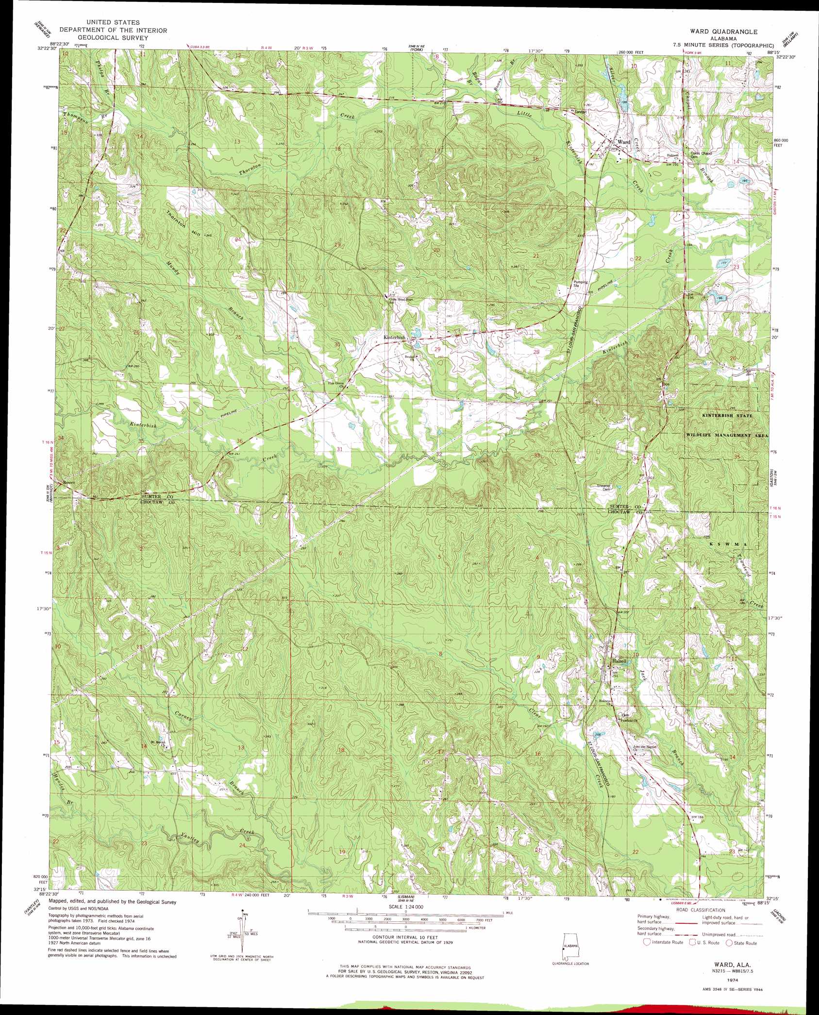
USGS Topo Quad 32088c3 - 1:24,000 scale
| Topo Map Name: | Ward |
| USGS Topo Quad ID: | 32088c3 |
| Print Size: | ca. 21 1/4" wide x 27" high |
| Southeast Coordinates: | 32.25° N latitude / 88.25° W longitude |
| Map Center Coordinates: | 32.3125° N latitude / 88.3125° W longitude |
| U.S. State: | AL |
| Filename: | o32088c3.jpg |
| Download Map JPG Image: | Ward topo map 1:24,000 scale |
| Map Type: | Topographic |
| Topo Series: | 7.5´ |
| Map Scale: | 1:24,000 |
| Source of Map Images: | United States Geological Survey (USGS) |
| Alternate Map Versions: |
Ward AL 1974, updated 1978 Download PDF Buy paper map Ward AL 2011 Download PDF Buy paper map Ward AL 2014 Download PDF Buy paper map |
1:24,000 Topo Quads surrounding Ward
Lauderdale |
Tamola |
Boyd |
Livingston |
Brewersville |
Toomsuba |
Kewanee |
York |
Bellamy |
Coatopa |
Vimville |
Whynot |
Ward |
Gaston |
Whitfield |
Snell |
Yantley |
Lisman |
Jachin |
Pennington |
Sykes |
Hinton |
Land |
Butler |
Putnam |
> Back to 32088a1 at 1:100,000 scale
> Back to 32088a1 at 1:250,000 scale
> Back to U.S. Topo Maps home
Ward topo map: Gazetteer
Ward: Dams
Thomas E Huckabee Lake Dam elevation 70m 229′Ward: Parks
Kinterbish State Wildlife Management Area elevation 89m 291′Ward: Populated Places
Charles elevation 70m 229′Halsell elevation 76m 249′
Kinterbish elevation 80m 262′
Ward elevation 62m 203′
Ward: Post Offices
Ward Post Office elevation 64m 209′Ward: Reservoirs
Thomas E Huckabee Lake elevation 70m 229′Ward: Streams
Bogan Branch elevation 59m 193′Boone Branch elevation 58m 190′
Chapel Branch elevation 52m 170′
Hyndes Branch elevation 67m 219′
Johnson Creek elevation 79m 259′
Little Kinterbish Creek elevation 50m 164′
Mundy Branch elevation 61m 200′
Phelps Branch elevation 81m 265′
Silver Creek elevation 52m 170′
Thompson Branch elevation 80m 262′
Thornton Creek elevation 59m 193′
Ward: Summits
Thornton Hill elevation 107m 351′Ward digital topo map on disk
Buy this Ward topo map showing relief, roads, GPS coordinates and other geographical features, as a high-resolution digital map file on DVD:
Gulf Coast (LA, MS, AL, FL) & Southwestern Georgia
Buy digital topo maps: Gulf Coast (LA, MS, AL, FL) & Southwestern Georgia
 & Southwestern Georgia map DVD")