Van Topo Map Texas
To zoom in, hover over the map of Van
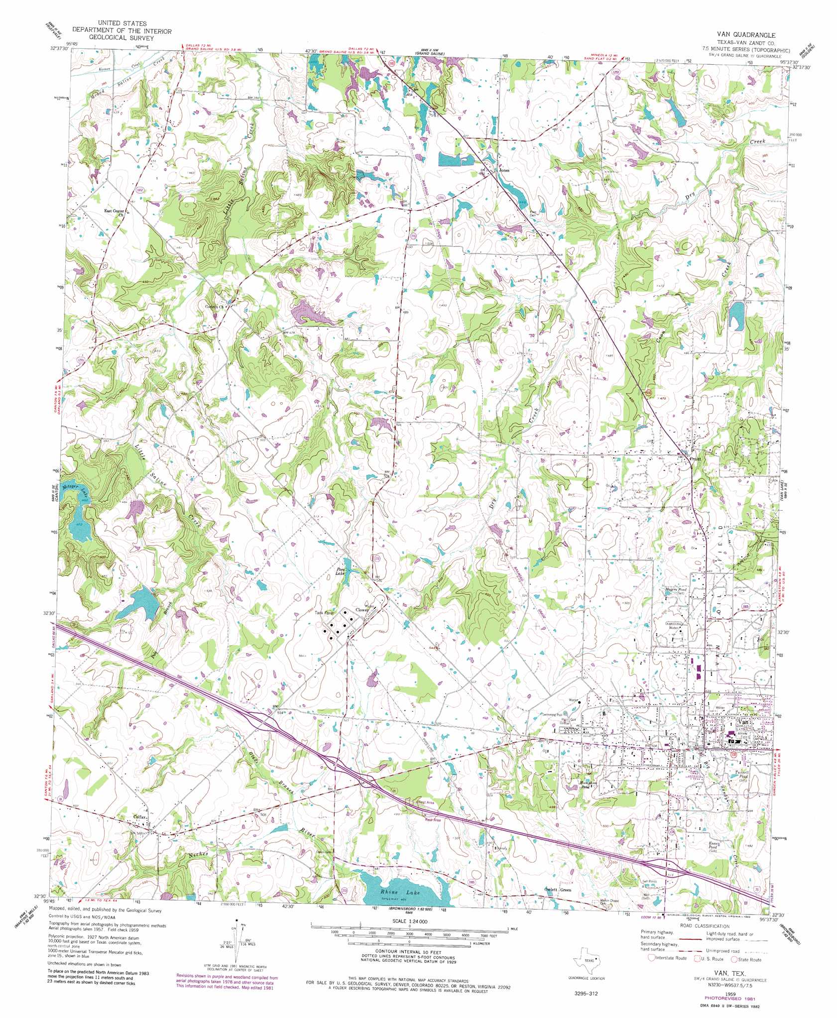
USGS Topo Quad 32095e6 - 1:24,000 scale
| Topo Map Name: | Van |
| USGS Topo Quad ID: | 32095e6 |
| Print Size: | ca. 21 1/4" wide x 27" high |
| Southeast Coordinates: | 32.5° N latitude / 95.625° W longitude |
| Map Center Coordinates: | 32.5625° N latitude / 95.6875° W longitude |
| U.S. State: | TX |
| Filename: | o32095e6.jpg |
| Download Map JPG Image: | Van topo map 1:24,000 scale |
| Map Type: | Topographic |
| Topo Series: | 7.5´ |
| Map Scale: | 1:24,000 |
| Source of Map Images: | United States Geological Survey (USGS) |
| Alternate Map Versions: |
Van TX 1959, updated 1960 Download PDF Buy paper map Van TX 1959, updated 1982 Download PDF Buy paper map Van TX 2010 Download PDF Buy paper map Van TX 2012 Download PDF Buy paper map Van TX 2016 Download PDF Buy paper map |
1:24,000 Topo Quads surrounding Van
Iron Bridge Dam |
Emory South |
Alba |
Calvary |
Quitman |
Edgewood |
Fruitvale |
Grand Saline |
Golden |
Mineola |
Myrtle Springs |
Canton |
Van |
Van Lake |
Lindale |
Phalba |
Martins Mill |
Ben Wheeler |
Carroll |
Mount Sylvan |
Stockard |
Murchinson West |
Murchinson East |
Brownsboro |
Chandler |
> Back to 32095e1 at 1:100,000 scale
> Back to 32094a1 at 1:250,000 scale
> Back to U.S. Topo Maps home
Van topo map: Gazetteer
Van: Airports
N D Ranch Airport elevation 164m 538′Van: Dams
Metzger Dam Number 1 elevation 141m 462′Metzger Dam Number 2 elevation 144m 472′
Metzger Dam Number 3 elevation 156m 511′
Neill Lake Dam elevation 134m 439′
Poco Club Dam elevation 154m 505′
Van: Oilfields
Van Oil Field elevation 146m 479′Van: Populated Places
Clower elevation 172m 564′Colfax elevation 173m 567′
Jones elevation 138m 452′
Owlett Green elevation 146m 479′
Pruitt elevation 139m 456′
Van elevation 149m 488′
Van: Reservoirs
Enas Pond elevation 141m 462′Humphree Pond elevation 150m 492′
Magers Pond elevation 145m 475′
Metzger Lake elevation 140m 459′
Metzger Lake Number 1 elevation 141m 462′
Metzger Lake Number 2 elevation 144m 472′
Metzger Lake Number 3 elevation 156m 511′
Neill Lake elevation 134m 439′
Poco Club Lake elevation 154m 505′
Poco Lake elevation 160m 524′
Rhine Lake elevation 142m 465′
Tunnell Pond elevation 147m 482′
Van: Streams
Coon Creek elevation 115m 377′Glade Branch elevation 143m 469′
Pole Branch elevation 142m 465′
Van digital topo map on disk
Buy this Van topo map showing relief, roads, GPS coordinates and other geographical features, as a high-resolution digital map file on DVD: