Tuscola Topo Map Texas
To zoom in, hover over the map of Tuscola
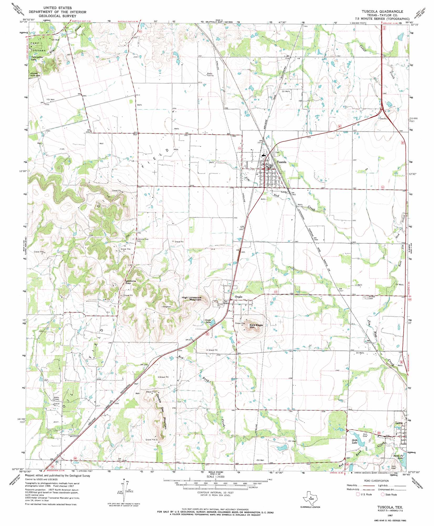
USGS Topo Quad 32099b7 - 1:24,000 scale
| Topo Map Name: | Tuscola |
| USGS Topo Quad ID: | 32099b7 |
| Print Size: | ca. 21 1/4" wide x 27" high |
| Southeast Coordinates: | 32.125° N latitude / 99.75° W longitude |
| Map Center Coordinates: | 32.1875° N latitude / 99.8125° W longitude |
| U.S. State: | TX |
| Filename: | o32099b7.jpg |
| Download Map JPG Image: | Tuscola topo map 1:24,000 scale |
| Map Type: | Topographic |
| Topo Series: | 7.5´ |
| Map Scale: | 1:24,000 |
| Source of Map Images: | United States Geological Survey (USGS) |
| Alternate Map Versions: |
Tuscola TX 1967, updated 1969 Download PDF Buy paper map Tuscola TX 2010 Download PDF Buy paper map Tuscola TX 2012 Download PDF Buy paper map Tuscola TX 2016 Download PDF Buy paper map |
1:24,000 Topo Quads surrounding Tuscola
Merkel West |
Merkel East |
Abilene West |
Abilene East |
Kirby Lake Ne |
Mountain Pass |
View |
Buffalo Gap |
Potosi |
Eula |
Shep |
Lake Abilene |
Tuscola |
Lawn |
Oplin |
Wingate |
Bradshaw |
Bald Knob |
Goldsboro |
Mcewen Draw |
Wilmeth |
Winters |
Crews |
Novice West |
Novice East |
> Back to 32099a1 at 1:100,000 scale
> Back to 32098a1 at 1:250,000 scale
> Back to U.S. Topo Maps home
Tuscola topo map: Gazetteer
Tuscola: Dams
Lake Stith Dam elevation 587m 1925′Soil Conservation Service Site 17b1 Dam elevation 616m 2020′
Tuscola: Gaps
Lemons Gap elevation 672m 2204′Tuscola: Populated Places
Guion elevation 613m 2011′Ovalo elevation 616m 2020′
Tuscola elevation 603m 1978′
Tuscola: Reservoirs
Caterpillar Lake elevation 597m 1958′Lake Stith elevation 587m 1925′
Ovalo Lake elevation 622m 2040′
Soil Conservation Service Site 17b1 Reservoir elevation 616m 2020′
Stith Lake elevation 583m 1912′
Tuscola: Streams
East Jim Ned Creek elevation 589m 1932′Tuscola: Summits
Bald Eagle Mountain elevation 693m 2273′Double Gap Mountain elevation 681m 2234′
High Lonesome Mountain elevation 674m 2211′
Tuscola digital topo map on disk
Buy this Tuscola topo map showing relief, roads, GPS coordinates and other geographical features, as a high-resolution digital map file on DVD: