Gin Creek Topo Map Alabama
To zoom in, hover over the map of Gin Creek
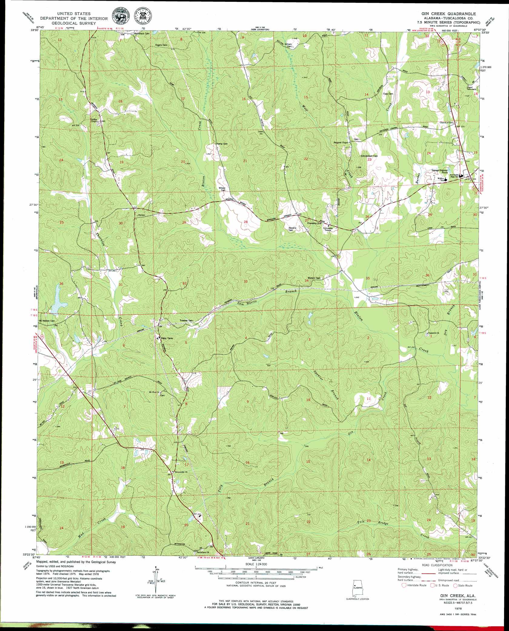
USGS Topo Quad 33087d6 - 1:24,000 scale
| Topo Map Name: | Gin Creek |
| USGS Topo Quad ID: | 33087d6 |
| Print Size: | ca. 21 1/4" wide x 27" high |
| Southeast Coordinates: | 33.375° N latitude / 87.625° W longitude |
| Map Center Coordinates: | 33.4375° N latitude / 87.6875° W longitude |
| U.S. State: | AL |
| Filename: | o33087d6.jpg |
| Download Map JPG Image: | Gin Creek topo map 1:24,000 scale |
| Map Type: | Topographic |
| Topo Series: | 7.5´ |
| Map Scale: | 1:24,000 |
| Source of Map Images: | United States Geological Survey (USGS) |
| Alternate Map Versions: |
Gin Creek AL 1978, updated 1979 Download PDF Buy paper map Gin Creek AL 2011 Download PDF Buy paper map Gin Creek AL 2014 Download PDF Buy paper map |
1:24,000 Topo Quads surrounding Gin Creek
Belk |
Fayette |
Bankston |
Berry |
Oakman |
Kennedy |
Newtonville |
New Lexington |
Berry Se |
Wiley |
Palmetto |
Brownville |
Gin Creek |
Lake Tuscaloosa North |
Windham Springs |
Gordo |
Elrod |
Lake Lurleen |
Lake Tuscaloosa South |
Lake Nicol |
Kirk |
Romulus |
Coker |
Tuscaloosa |
Cottondale |
> Back to 33087a1 at 1:100,000 scale
> Back to 33086a1 at 1:250,000 scale
> Back to U.S. Topo Maps home
Gin Creek topo map: Gazetteer
Gin Creek: Dams
Pine Lake Dam elevation 97m 318′Gin Creek: Mines
Fulmer Mine elevation 107m 351′Hoehn Mine elevation 103m 337′
Gin Creek: Parks
Northside Stadium elevation 99m 324′Gin Creek: Populated Places
Montgomery Lakes elevation 118m 387′Gin Creek: Reservoirs
Pine Lake elevation 97m 318′Gin Creek: Springs
Espy Springs elevation 120m 393′Gin Creek: Streams
Barbee Creek elevation 76m 249′Dry Branch elevation 71m 232′
Espy Creek elevation 78m 255′
Gin Creek elevation 72m 236′
Sam Norris Branch elevation 77m 252′
Spencer Branch elevation 78m 255′
Tilly Branch elevation 85m 278′
Wolf Creek elevation 77m 252′
Gin Creek digital topo map on disk
Buy this Gin Creek topo map showing relief, roads, GPS coordinates and other geographical features, as a high-resolution digital map file on DVD: