Valley View Topo Map Texas
To zoom in, hover over the map of Valley View
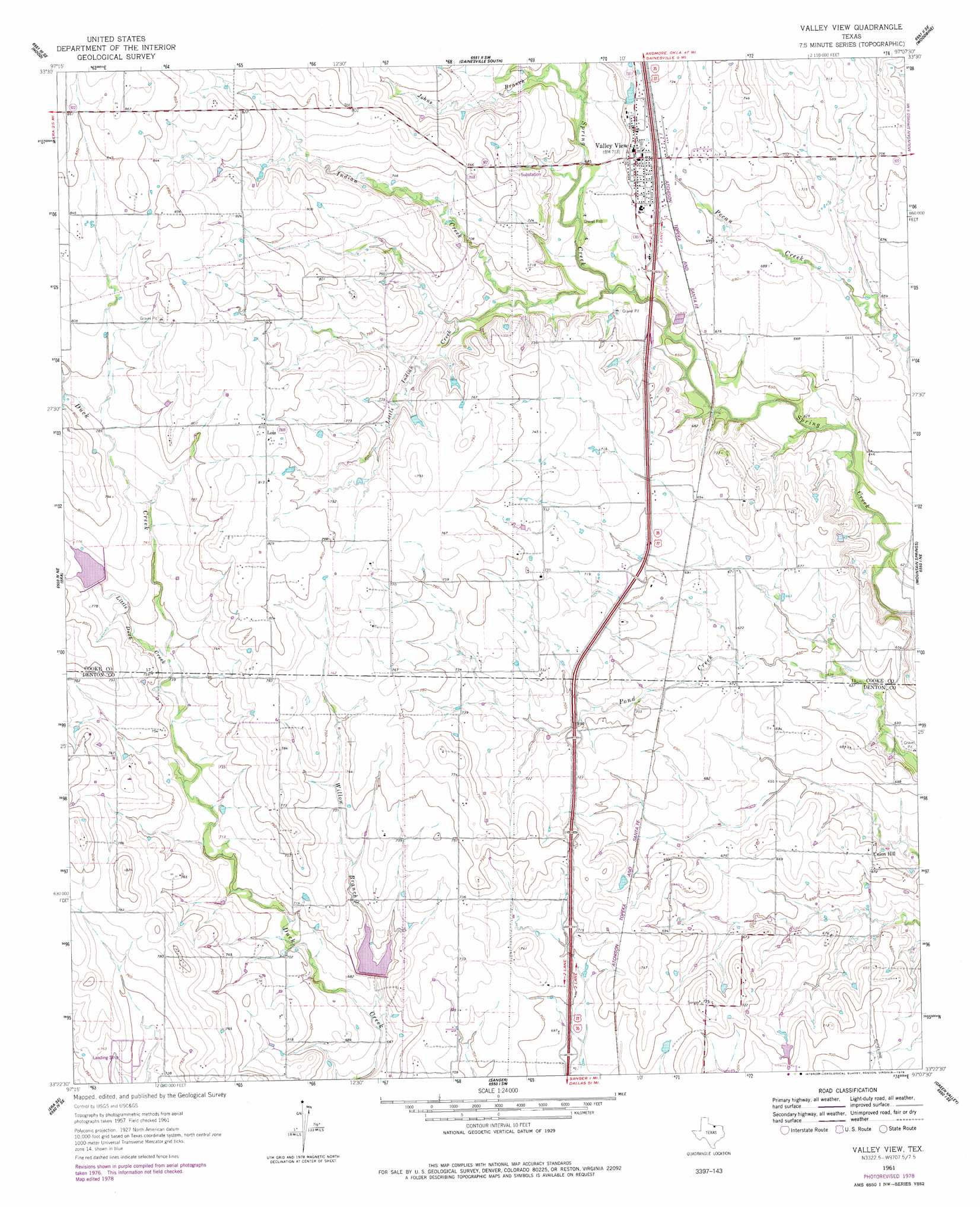
USGS Topo Quad 33097d2 - 1:24,000 scale
| Topo Map Name: | Valley View |
| USGS Topo Quad ID: | 33097d2 |
| Print Size: | ca. 21 1/4" wide x 27" high |
| Southeast Coordinates: | 33.375° N latitude / 97.125° W longitude |
| Map Center Coordinates: | 33.4375° N latitude / 97.1875° W longitude |
| U.S. State: | TX |
| Filename: | o33097d2.jpg |
| Download Map JPG Image: | Valley View topo map 1:24,000 scale |
| Map Type: | Topographic |
| Topo Series: | 7.5´ |
| Map Scale: | 1:24,000 |
| Source of Map Images: | United States Geological Survey (USGS) |
| Alternate Map Versions: |
Valley View TX 1961, updated 1963 Download PDF Buy paper map Valley View TX 1961, updated 1978 Download PDF Buy paper map Valley View TX 2010 Download PDF Buy paper map Valley View TX 2013 Download PDF Buy paper map Valley View TX 2016 Download PDF Buy paper map |
1:24,000 Topo Quads surrounding Valley View
Muenster West |
Muenster East |
Gainesville North |
Callisburg |
Whitesboro |
Freemound |
Hood |
Gainesville South |
Woodbine |
Collinsville |
Greenwood |
Era |
Valley View |
Mountain Springs |
Pilot Point |
Slidell |
Era Se |
Sanger |
Green Valley |
Aubrey |
Bluett |
Ponder |
Denton West |
Denton East |
Little Elm |
> Back to 33097a1 at 1:100,000 scale
> Back to 33096a1 at 1:250,000 scale
> Back to U.S. Topo Maps home
Valley View topo map: Gazetteer
Valley View: Airports
Bar V-K Ranch Airport elevation 221m 725′Horseshoe Lake Airport elevation 215m 705′
Valley View: Dams
Soil Conservation Service Site 52 Dam elevation 233m 764′Soil Conservation Service Site 53 Dam elevation 208m 682′
Valley View: Populated Places
Lois elevation 247m 810′Union Hill elevation 200m 656′
Valley View elevation 220m 721′
Valley View: Reservoirs
Soil Conservation Service Site 52 Reservoir elevation 233m 764′Soil Conservation Service Site 53 Reservoir elevation 208m 682′
Valley View: Streams
Indian Creek elevation 198m 649′Johns Branch elevation 204m 669′
Little Duck Creek elevation 221m 725′
Little Indian Creek elevation 204m 669′
Willow Branch elevation 201m 659′
Valley View digital topo map on disk
Buy this Valley View topo map showing relief, roads, GPS coordinates and other geographical features, as a high-resolution digital map file on DVD: