Wickenburg Topo Map Arizona
To zoom in, hover over the map of Wickenburg
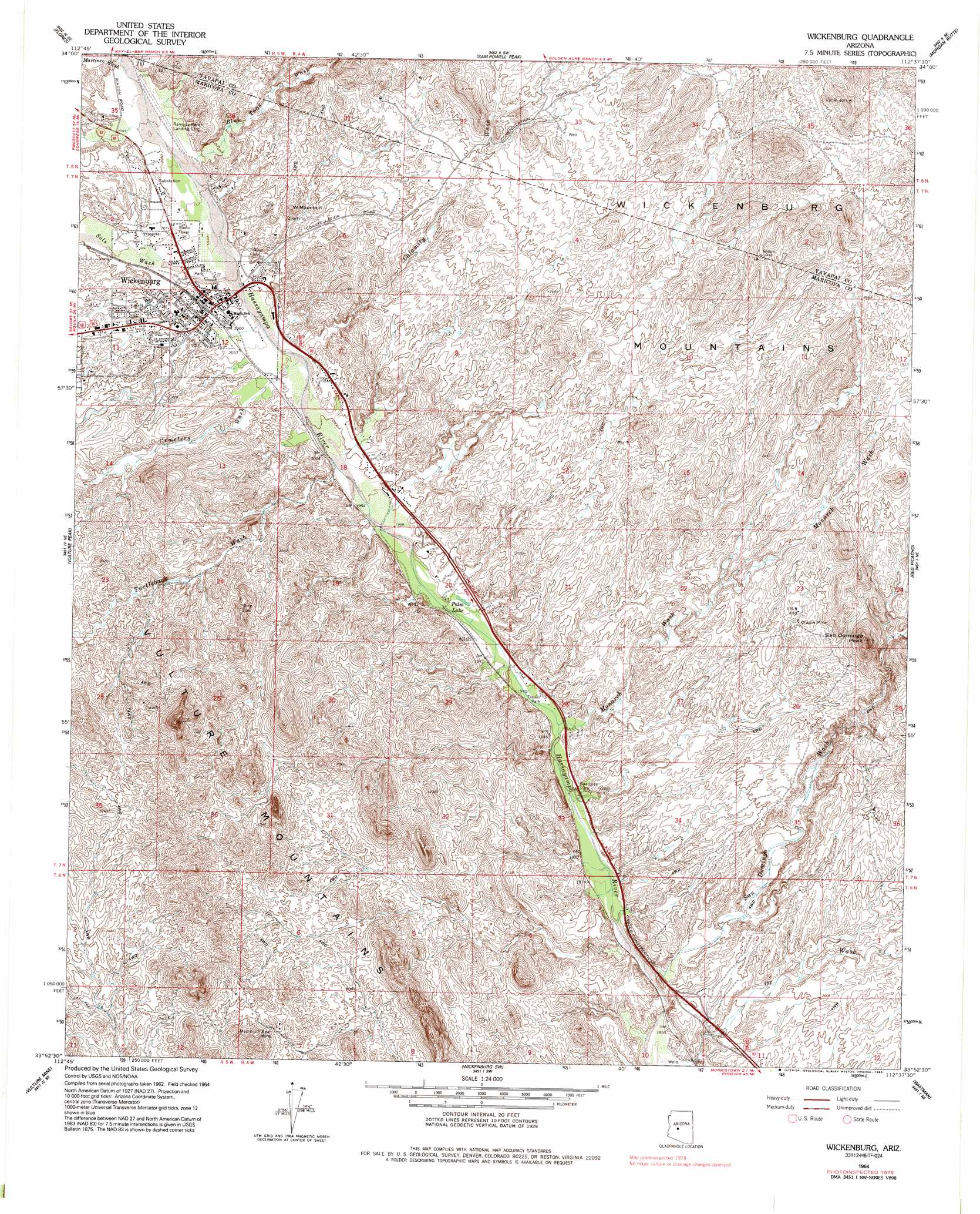
USGS Topo Quad 33112h6 - 1:24,000 scale
| Topo Map Name: | Wickenburg |
| USGS Topo Quad ID: | 33112h6 |
| Print Size: | ca. 21 1/4" wide x 27" high |
| Southeast Coordinates: | 33.875° N latitude / 112.625° W longitude |
| Map Center Coordinates: | 33.9375° N latitude / 112.6875° W longitude |
| U.S. State: | AZ |
| Filename: | o33112h6.jpg |
| Download Map JPG Image: | Wickenburg topo map 1:24,000 scale |
| Map Type: | Topographic |
| Topo Series: | 7.5´ |
| Map Scale: | 1:24,000 |
| Source of Map Images: | United States Geological Survey (USGS) |
| Alternate Map Versions: |
Wickenburg AZ 1964, updated 1965 Download PDF Buy paper map Wickenburg AZ 1964, updated 1970 Download PDF Buy paper map Wickenburg AZ 1964, updated 1984 Download PDF Buy paper map Wickenburg AZ 2011 Download PDF Buy paper map Wickenburg AZ 2014 Download PDF Buy paper map |
1:24,000 Topo Quads surrounding Wickenburg
O'Neill Pass |
Congress |
Yarnell |
Wagoner |
Minnehaha |
Congress Sw |
Flores |
Sam Powell Peak |
Morgan Butte |
Copperopolis |
Outlaw Hill |
Vulture Peak |
Wickenburg |
Red Picacho |
Garfias Mountain |
Wildcat Well |
Vulture Mine |
Wickenburg Sw |
Wittmann |
Hieroglyphic Mountains Sw |
Belmont Mountain |
Star Well |
Daggs Tank |
White Tank Mountains Ne |
Mcmicken Dam |
> Back to 33112e1 at 1:100,000 scale
> Back to 33112a1 at 1:250,000 scale
> Back to U.S. Topo Maps home
Wickenburg topo map: Gazetteer
Wickenburg: Airports
Rio Vista Hills Airport elevation 667m 2188′Wickenburg: Dams
Sunnycove Dam elevation 675m 2214′Sunset Dam elevation 662m 2171′
Wickenburg: Lakes
Palm Lake elevation 597m 1958′Wickenburg: Mines
Dragon Mine elevation 691m 2267′Mammoth Spar Mine elevation 707m 2319′
Wickenburg: Parks
Casandro Park elevation 653m 2142′Coffinger Park elevation 626m 2053′
Constellation Park elevation 688m 2257′
MacGuire Park elevation 648m 2125′
Stone Park elevation 623m 2043′
Wickenburg: Populated Places
Allah elevation 596m 1955′Wickenburg elevation 627m 2057′
Wickenburg: Post Offices
Wickenburg Post Office elevation 624m 2047′Wickenburg: Streams
Blue Tank Wash elevation 632m 2073′Calamity Wash elevation 633m 2076′
Cemetery Wash elevation 615m 2017′
Martinez Wash elevation 640m 2099′
Mockingbird Wash elevation 601m 1971′
Monarch Wash elevation 583m 1912′
Ox Wash elevation 560m 1837′
San Domingo Wash elevation 0m 0′
Sols Wash elevation 623m 2043′
Turtleback Wash elevation 606m 1988′
Wickenburg: Summits
Mockingbird Hill elevation 693m 2273′San Domingo Peak elevation 0m 0′
W Mountain elevation 707m 2319′
West Mountain elevation 700m 2296′
Wickenburg digital topo map on disk
Buy this Wickenburg topo map showing relief, roads, GPS coordinates and other geographical features, as a high-resolution digital map file on DVD: