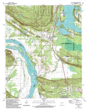
Mayflower Topo Map Arkansas
To zoom in, hover over the map of Mayflower
USGS Topo Quad 34092h4 - 1:24,000 scale
| Topo Map Name: | Mayflower |
| USGS Topo Quad ID: | 34092h4 |
| Print Size: | ca. 21 1/4" wide x 27" high |
| Southeast Coordinates: | 34.875° N latitude / 92.375° W longitude |
| Map Center Coordinates: | 34.9375° N latitude / 92.4375° W longitude |
| U.S. State: | AR |
| Filename: | o34092h4.jpg |
| Download Map JPG Image: | Mayflower topo map 1:24,000 scale |
| Map Type: | Topographic |
| Topo Series: | 7.5´ |
| Map Scale: | 1:24,000 |
| Source of Map Images: | United States Geological Survey (USGS) |
| Alternate Map Versions: |
Mayflower AR 1953, updated 1957 Download PDF Buy paper map Mayflower AR 1953, updated 1970 Download PDF Buy paper map Mayflower AR 1953, updated 1971 Download PDF Buy paper map Mayflower AR 1953, updated 1976 Download PDF Buy paper map Mayflower AR 1953, updated 1982 Download PDF Buy paper map Mayflower AR 1987, updated 1987 Download PDF Buy paper map Mayflower AR 1987, updated 1992 Download PDF Buy paper map Mayflower AR 1994, updated 2000 Download PDF Buy paper map Mayflower AR 2011 Download PDF Buy paper map Mayflower AR 2014 Download PDF Buy paper map |
1:24,000 Topo Quads surrounding Mayflower
> Back to 34092e1 at 1:100,000 scale
> Back to 34092a1 at 1:250,000 scale
> Back to U.S. Topo Maps home
Mayflower topo map: Gazetteer
Mayflower: Airports
Pine Village Airport elevation 184m 603′Mayflower: Bends
Fletcher Bend elevation 75m 246′Mayflower: Crossings
Interchange 135 elevation 85m 278′Interchange 142 elevation 84m 275′
Mayflower: Dams
Davis Lake Dam elevation 149m 488′Jewell Lake Dam elevation 88m 288′
L D Rogers Lake Dam elevation 110m 360′
Lake Conway Dam elevation 79m 259′
Lake Conway Nursey Pond Dam elevation 82m 269′
Roberts Minnow Pond Dam elevation 83m 272′
Stone Lake Dam elevation 83m 272′
Mayflower: Gaps
Rocky Gap elevation 118m 387′Mayflower: Guts
Bell Slough elevation 79m 259′Mayflower: Islands
Beaverdam Island elevation 81m 265′Mayflower: Lakes
Cobb Lake (historical) elevation 81m 265′Grassy Lake elevation 86m 282′
Greens Lake (historical) elevation 81m 265′
Mayflower: Parks
Bell Slough State Wildlife Management Area elevation 87m 285′Fletcher Bend Public Use Area elevation 76m 249′
Palarm Public Use Area elevation 80m 262′
Pierce Creek Public Boat Landing elevation 81m 265′
Mayflower: Populated Places
Catorce (historical) elevation 83m 272′Mayflower elevation 89m 291′
Monnie Springs elevation 88m 288′
Mount Pilgrim elevation 87m 285′
Palarm elevation 82m 269′
Roland elevation 84m 275′
West Marche elevation 90m 295′
Mayflower: Reservoirs
Davis Lake elevation 149m 488′Jewell Lake elevation 88m 288′
L D Rogers Lake elevation 110m 360′
Lake Conway elevation 79m 259′
Lake Conway Nursery Pond elevation 82m 269′
Roberts Pond elevation 83m 272′
Stone Lake elevation 83m 272′
Mayflower: Ridges
Cedar Ridge elevation 120m 393′Jones Hill elevation 138m 452′
Mayflower: Streams
Beaver Creek elevation 76m 249′Beaverdam Creek elevation 76m 249′
Mayflower: Summits
Reynolds Mountain elevation 230m 754′Mayflower: Swamps
Flag Pond elevation 79m 259′Tupelo Gum Pond elevation 81m 265′
Mayflower digital topo map on disk
Buy this Mayflower topo map showing relief, roads, GPS coordinates and other geographical features, as a high-resolution digital map file on DVD:


