Cato Topo Map Arkansas
To zoom in, hover over the map of Cato
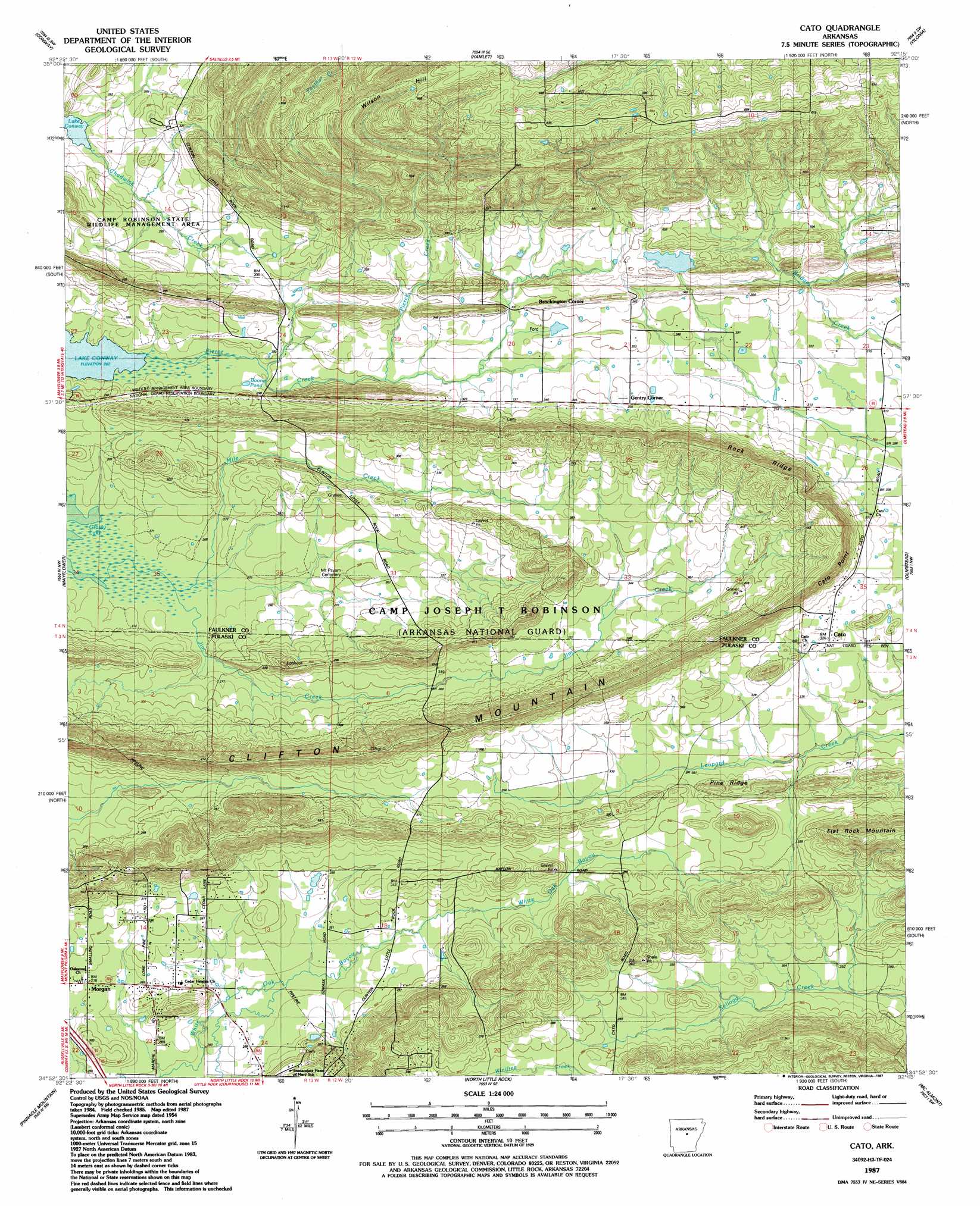
USGS Topo Quad 34092h3 - 1:24,000 scale
| Topo Map Name: | Cato |
| USGS Topo Quad ID: | 34092h3 |
| Print Size: | ca. 21 1/4" wide x 27" high |
| Southeast Coordinates: | 34.875° N latitude / 92.25° W longitude |
| Map Center Coordinates: | 34.9375° N latitude / 92.3125° W longitude |
| U.S. State: | AR |
| Filename: | o34092h3.jpg |
| Download Map JPG Image: | Cato topo map 1:24,000 scale |
| Map Type: | Topographic |
| Topo Series: | 7.5´ |
| Map Scale: | 1:24,000 |
| Source of Map Images: | United States Geological Survey (USGS) |
| Alternate Map Versions: |
Cato AR 1953 Download PDF Buy paper map Cato AR 1953, updated 1957 Download PDF Buy paper map Cato AR 1953, updated 1971 Download PDF Buy paper map Cato AR 1953, updated 1978 Download PDF Buy paper map Cato AR 1987, updated 1987 Download PDF Buy paper map Cato AR 1994, updated 2000 Download PDF Buy paper map Cato AR 2011 Download PDF Buy paper map Cato AR 2014 Download PDF Buy paper map |
1:24,000 Topo Quads surrounding Cato
Menifee |
Greenbrier |
Holland |
Enola |
Mount Vernon |
Gleason |
Conway |
Hamlet |
Vilonia |
Mountain Springs |
Fourche |
Mayflower |
Cato |
Olmstead |
Cabot |
Ferndale |
Pinnacle Mountain |
North Little Rock |
Mcalmont |
Jacksonville |
Congo |
Alexander |
Little Rock |
Sweet Home |
Scott |
> Back to 34092e1 at 1:100,000 scale
> Back to 34092a1 at 1:250,000 scale
> Back to U.S. Topo Maps home
Cato topo map: Gazetteer
Cato: Airports
Bobwhite Hill Ranch Airport elevation 104m 341′Cato: Cliffs
Cato Point elevation 138m 452′Cato: Dams
Meers Lake Dam elevation 109m 357′Cato: Lakes
Boone Pond elevation 84m 275′Cato: Parks
Camp Robinson State Wildlife Management ARea elevation 90m 295′Cato: Populated Places
Brockington Corner elevation 119m 390′Cato elevation 102m 334′
Chadwick (historical) elevation 99m 324′
Gentry Corner elevation 108m 354′
Morgan elevation 84m 275′
Cato: Reservoirs
Meers Lake elevation 109m 357′Cato: Ridges
Clifton Mountain elevation 163m 534′Pine Ridge elevation 114m 374′
Rock Ridge elevation 162m 531′
Cato: Streams
Caney Creek elevation 80m 262′Chadwick Creek elevation 81m 265′
Jim Creek elevation 78m 255′
Mile Creek elevation 80m 262′
Pierce Creek elevation 80m 262′
Cato: Summits
Blue Hill elevation 119m 390′Flat Rock Mountain elevation 159m 521′
Wilson Hill elevation 225m 738′
Cato digital topo map on disk
Buy this Cato topo map showing relief, roads, GPS coordinates and other geographical features, as a high-resolution digital map file on DVD: