Mesita De Yeso Topo Map New Mexico
To zoom in, hover over the map of Mesita De Yeso
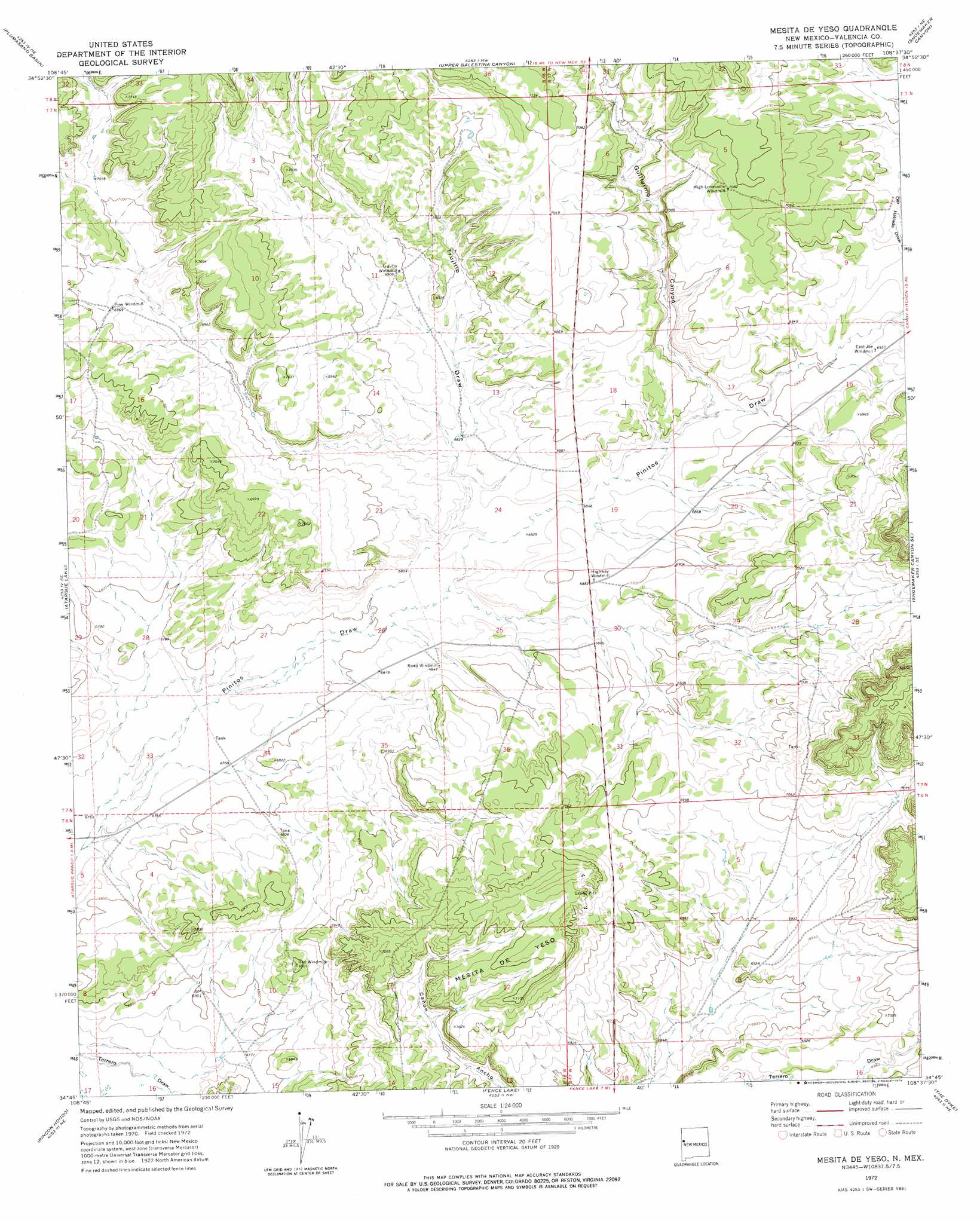
USGS Topo Quad 34108g6 - 1:24,000 scale
| Topo Map Name: | Mesita De Yeso |
| USGS Topo Quad ID: | 34108g6 |
| Print Size: | ca. 21 1/4" wide x 27" high |
| Southeast Coordinates: | 34.75° N latitude / 108.625° W longitude |
| Map Center Coordinates: | 34.8125° N latitude / 108.6875° W longitude |
| U.S. State: | NM |
| Filename: | o34108g6.jpg |
| Download Map JPG Image: | Mesita De Yeso topo map 1:24,000 scale |
| Map Type: | Topographic |
| Topo Series: | 7.5´ |
| Map Scale: | 1:24,000 |
| Source of Map Images: | United States Geological Survey (USGS) |
| Alternate Map Versions: |
Mesita De Yeso NM 1972, updated 1976 Download PDF Buy paper map Mesita De Yeso NM 2010 Download PDF Buy paper map Mesita De Yeso NM 2013 Download PDF Buy paper map Mesita De Yeso NM 2017 Download PDF Buy paper map |
1:24,000 Topo Quads surrounding Mesita De Yeso
Tekapo |
Zuni |
Horsehead Canyon |
Pescado |
Togeye Lake |
Ojo Caliente Reservoir |
Plumasano Basin |
Upper Galestina Canyon |
Shoemaker Canyon |
Nicoll Lake |
Venadito Camp |
Atarque Lake |
Mesita De Yeso |
Shoemaker Canyon Se |
Red Lake Mission |
Cantaralo Spring |
Rincon Hondo |
Fence Lake |
The Dyke |
Chimney Hill |
Twentytwo Spring |
Moreno Hill |
Fence Lake Sw |
Cerro Prieto |
Techado |
> Back to 34108e1 at 1:100,000 scale
> Back to 34108a1 at 1:250,000 scale
> Back to U.S. Topo Maps home
Mesita De Yeso topo map: Gazetteer
Mesita De Yeso: Summits
Mesita De Yeso elevation 2166m 7106′Mesita De Yeso: Valleys
Guillermo Canyon elevation 2092m 6863′Ojo Hallado Draw elevation 2111m 6925′
Trujillo Draw elevation 2073m 6801′
Mesita De Yeso: Wells
Highway Water Well elevation 2099m 6886′Pine Windmill elevation 2127m 6978′
Trujillo Water Well elevation 2105m 6906′
Mesita De Yeso digital topo map on disk
Buy this Mesita De Yeso topo map showing relief, roads, GPS coordinates and other geographical features, as a high-resolution digital map file on DVD: