Shoemaker Canyon Topo Map New Mexico
To zoom in, hover over the map of Shoemaker Canyon
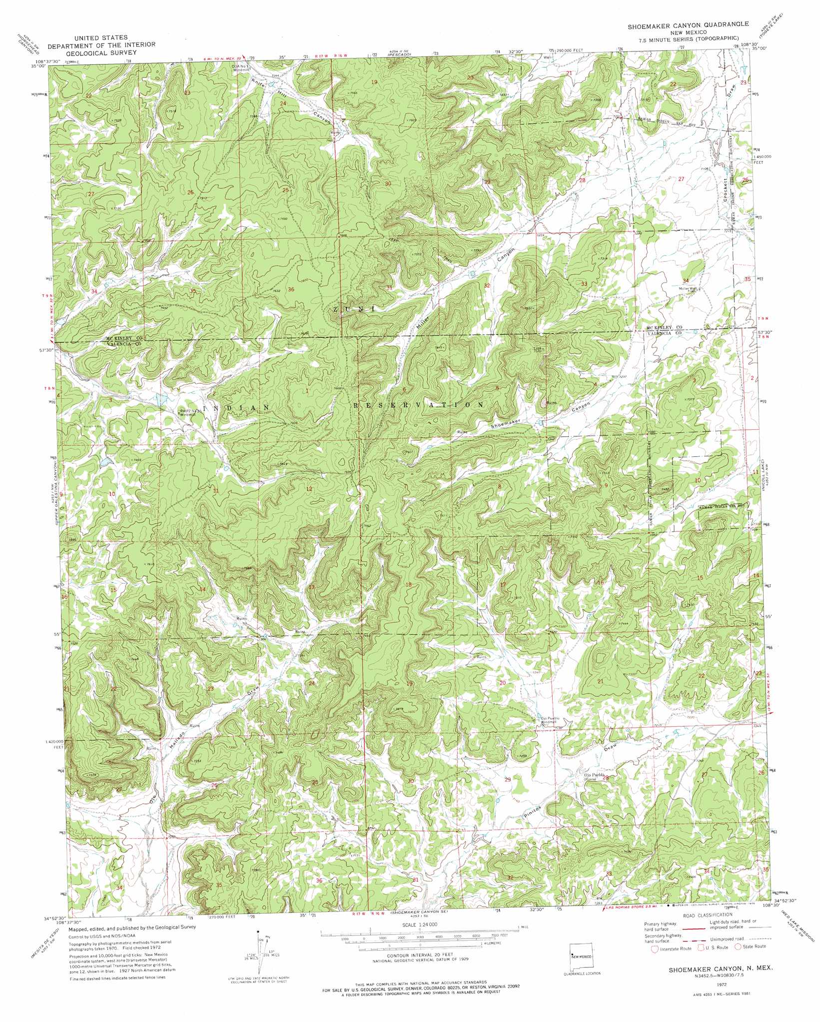
USGS Topo Quad 34108h5 - 1:24,000 scale
| Topo Map Name: | Shoemaker Canyon |
| USGS Topo Quad ID: | 34108h5 |
| Print Size: | ca. 21 1/4" wide x 27" high |
| Southeast Coordinates: | 34.875° N latitude / 108.5° W longitude |
| Map Center Coordinates: | 34.9375° N latitude / 108.5625° W longitude |
| U.S. State: | NM |
| Filename: | o34108h5.jpg |
| Download Map JPG Image: | Shoemaker Canyon topo map 1:24,000 scale |
| Map Type: | Topographic |
| Topo Series: | 7.5´ |
| Map Scale: | 1:24,000 |
| Source of Map Images: | United States Geological Survey (USGS) |
| Alternate Map Versions: |
Shoemaker Canyon NM 1972, updated 1976 Download PDF Buy paper map Shoemaker Canyon NM 2010 Download PDF Buy paper map Shoemaker Canyon NM 2013 Download PDF Buy paper map Shoemaker Canyon NM 2017 Download PDF Buy paper map |
1:24,000 Topo Quads surrounding Shoemaker Canyon
Vanderwagen Draw |
Horsehead Canyon Nw |
Burned Timber Canyon |
Ramah |
Kettner Canyon |
Zuni |
Horsehead Canyon |
Pescado |
Togeye Lake |
El Morro |
Plumasano Basin |
Upper Galestina Canyon |
Shoemaker Canyon |
Nicoll Lake |
Goat Hill |
Atarque Lake |
Mesita De Yeso |
Shoemaker Canyon Se |
Red Lake Mission |
Cerro Alto |
Rincon Hondo |
Fence Lake |
The Dyke |
Chimney Hill |
Cerro Pomo |
> Back to 34108e1 at 1:100,000 scale
> Back to 34108a1 at 1:250,000 scale
> Back to U.S. Topo Maps home
Shoemaker Canyon topo map: Gazetteer
Shoemaker Canyon: Airports
Candy Kitchen Ranch Airport elevation 2204m 7230′Shoemaker Canyon: Springs
Aragon Springs elevation 2198m 7211′Shoemaker Canyon: Valleys
Miller Canyon elevation 2189m 7181′Shoemaker Canyon elevation 2193m 7194′
Shoemaker Canyon: Wells
Miller Well elevation 2184m 7165′Shoemaker Canyon digital topo map on disk
Buy this Shoemaker Canyon topo map showing relief, roads, GPS coordinates and other geographical features, as a high-resolution digital map file on DVD: