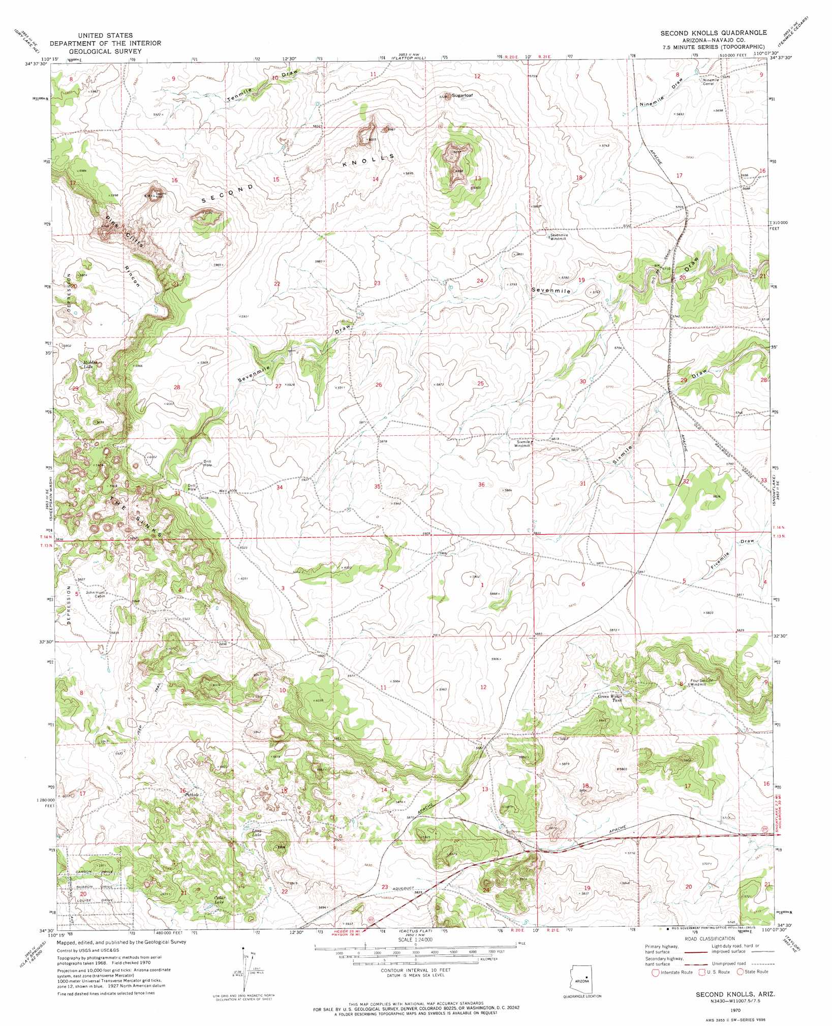
Second Knolls Topo Map Arizona
To zoom in, hover over the map of Second Knolls
USGS Topo Quad 34110e2 - 1:24,000 scale
| Topo Map Name: | Second Knolls |
| USGS Topo Quad ID: | 34110e2 |
| Print Size: | ca. 21 1/4" wide x 27" high |
| Southeast Coordinates: | 34.5° N latitude / 110.125° W longitude |
| Map Center Coordinates: | 34.5625° N latitude / 110.1875° W longitude |
| U.S. State: | AZ |
| Filename: | o34110e2.jpg |
| Download Map JPG Image: | Second Knolls topo map 1:24,000 scale |
| Map Type: | Topographic |
| Topo Series: | 7.5´ |
| Map Scale: | 1:24,000 |
| Source of Map Images: | United States Geological Survey (USGS) |
| Alternate Map Versions: |
Second Knolls AZ 1970, updated 1973 Download PDF Buy paper map Second Knolls AZ 2011 Download PDF Buy paper map Second Knolls AZ 2014 Download PDF Buy paper map |
1:24,000 Topo Quads surrounding Second Knolls
Chimney Canyon |
Saunders Draw |
Porter Canyon |
Woodruff |
Padilla Tank |
Dry Lake Nw |
Dry Lake Ne |
Flattop Hill |
Tenmile Cedars |
Hay Hollow |
Zeniff |
Sheepskin Wash |
Second Knolls |
Snowflake |
Point Of The Mountain |
Aripine |
Big Pug Tank |
Cactus Flat |
Taylor |
Mesa Redonda Nw |
Day Spring |
Clay Springs |
Pinedale |
Show Low North |
Silver Springs |
> Back to 34110e1 at 1:100,000 scale
> Back to 34110a1 at 1:250,000 scale
> Back to U.S. Topo Maps home
Second Knolls topo map: Gazetteer
Second Knolls: Basins
The Sinks elevation 1789m 5869′Second Knolls: Lakes
Cedar Lake elevation 1793m 5882′Hidden Lake elevation 1768m 5800′
Long Lake elevation 1777m 5830′
Pothole elevation 1774m 5820′
Second Knolls: Reservoirs
Green Water Tank elevation 1751m 5744′Second Knolls: Summits
Second Knolls elevation 0m 0′Sugarloaf elevation 1800m 5905′
Second Knolls digital topo map on disk
Buy this Second Knolls topo map showing relief, roads, GPS coordinates and other geographical features, as a high-resolution digital map file on DVD: