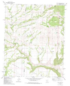
Pilot Knob Topo Map Arizona
To zoom in, hover over the map of Pilot Knob
USGS Topo Quad 34113g3 - 1:24,000 scale
| Topo Map Name: | Pilot Knob |
| USGS Topo Quad ID: | 34113g3 |
| Print Size: | ca. 21 1/4" wide x 27" high |
| Southeast Coordinates: | 34.75° N latitude / 113.25° W longitude |
| Map Center Coordinates: | 34.8125° N latitude / 113.3125° W longitude |
| U.S. State: | AZ |
| Filename: | o34113g3.jpg |
| Download Map JPG Image: | Pilot Knob topo map 1:24,000 scale |
| Map Type: | Topographic |
| Topo Series: | 7.5´ |
| Map Scale: | 1:24,000 |
| Source of Map Images: | United States Geological Survey (USGS) |
| Alternate Map Versions: |
Pilot Knob AZ 1980, updated 1980 Download PDF Buy paper map Pilot Knob AZ 2011 Download PDF Buy paper map Pilot Knob AZ 2014 Download PDF Buy paper map |
1:24,000 Topo Quads surrounding Pilot Knob
> Back to 34113e1 at 1:100,000 scale
> Back to 34112a1 at 1:250,000 scale
> Back to U.S. Topo Maps home
Pilot Knob topo map: Gazetteer
Pilot Knob: Basins
Pilot Knob Basin elevation 1459m 4786′Pilot Knob: Reservoirs
Devils Bathtub elevation 1453m 4767′Indian Tank elevation 1340m 4396′
Johns Tank elevation 1414m 4639′
Pinky Tank elevation 1276m 4186′
Rabbit Hollow Tank elevation 1389m 4557′
Red Canyon Tank elevation 1416m 4645′
Steamboat Tank elevation 1314m 4311′
Swale Tank elevation 1385m 4543′
Wagon Tongue Tank elevation 1647m 5403′
Wikieup Tank elevation 1342m 4402′
Pilot Knob: Springs
Chalk Spring elevation 1572m 5157′Cottonwood Spring elevation 1429m 4688′
Northwater Spring elevation 1291m 4235′
Pilot Knob Spring elevation 1477m 4845′
Pilot Knob: Streams
Adobe Creek elevation 1262m 4140′Hop Creek elevation 1378m 4520′
Spencer Creek elevation 1043m 3421′
Pilot Knob: Summits
Goodwin Mesa elevation 1395m 4576′Pilot Knob elevation 1803m 5915′
Southeast Mesa elevation 1431m 4694′
Pilot Knob: Valleys
Hawk Canyon elevation 1223m 4012′Rag Canyon elevation 1291m 4235′
Red Canyon elevation 1043m 3421′
Pilot Knob digital topo map on disk
Buy this Pilot Knob topo map showing relief, roads, GPS coordinates and other geographical features, as a high-resolution digital map file on DVD:


