Farmlife Topo Map North Carolina
To zoom in, hover over the map of Farmlife
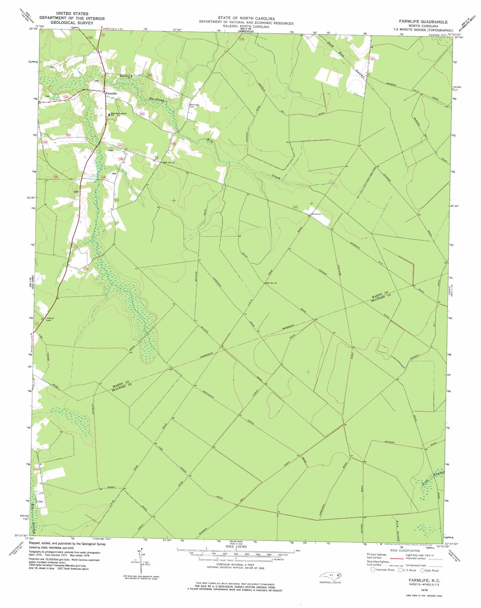
USGS Topo Quad 35076f8 - 1:24,000 scale
| Topo Map Name: | Farmlife |
| USGS Topo Quad ID: | 35076f8 |
| Print Size: | ca. 21 1/4" wide x 27" high |
| Southeast Coordinates: | 35.625° N latitude / 76.875° W longitude |
| Map Center Coordinates: | 35.6875° N latitude / 76.9375° W longitude |
| U.S. State: | NC |
| Filename: | o35076f8.jpg |
| Download Map JPG Image: | Farmlife topo map 1:24,000 scale |
| Map Type: | Topographic |
| Topo Series: | 7.5´ |
| Map Scale: | 1:24,000 |
| Source of Map Images: | United States Geological Survey (USGS) |
| Alternate Map Versions: |
Farmlife NC 1978, updated 1978 Download PDF Buy paper map Farmlife NC 1997, updated 2001 Download PDF Buy paper map Farmlife NC 2010 Download PDF Buy paper map Farmlife NC 2013 Download PDF Buy paper map Farmlife NC 2016 Download PDF Buy paper map |
1:24,000 Topo Quads surrounding Farmlife
Hamilton |
Quitsna |
Windsor South |
Woodard |
Westover |
Robersonville East |
Williamston |
Jamesville |
Plymouth West |
Plymouth East |
Leggetts Crossroads |
Old Ford |
Farmlife |
Hoke |
Pike Road |
Grimesland |
Washington |
Bunyan |
Pinetown |
Pantego |
Wilmar |
Hackney |
Blounts Bay |
Bath |
Ransomville |
> Back to 35076e1 at 1:100,000 scale
> Back to 35076a1 at 1:250,000 scale
> Back to U.S. Topo Maps home
Farmlife topo map: Gazetteer
Farmlife: Populated Places
Farmlife elevation 10m 32′Farmlife: Post Offices
Amherst Post Office elevation 7m 22′Farmlife digital topo map on disk
Buy this Farmlife topo map showing relief, roads, GPS coordinates and other geographical features, as a high-resolution digital map file on DVD:
Atlantic Coast (NY, NJ, PA, DE, MD, VA, NC)
Buy digital topo maps: Atlantic Coast (NY, NJ, PA, DE, MD, VA, NC)
 map DVD")