Grimesland Topo Map North Carolina
To zoom in, hover over the map of Grimesland
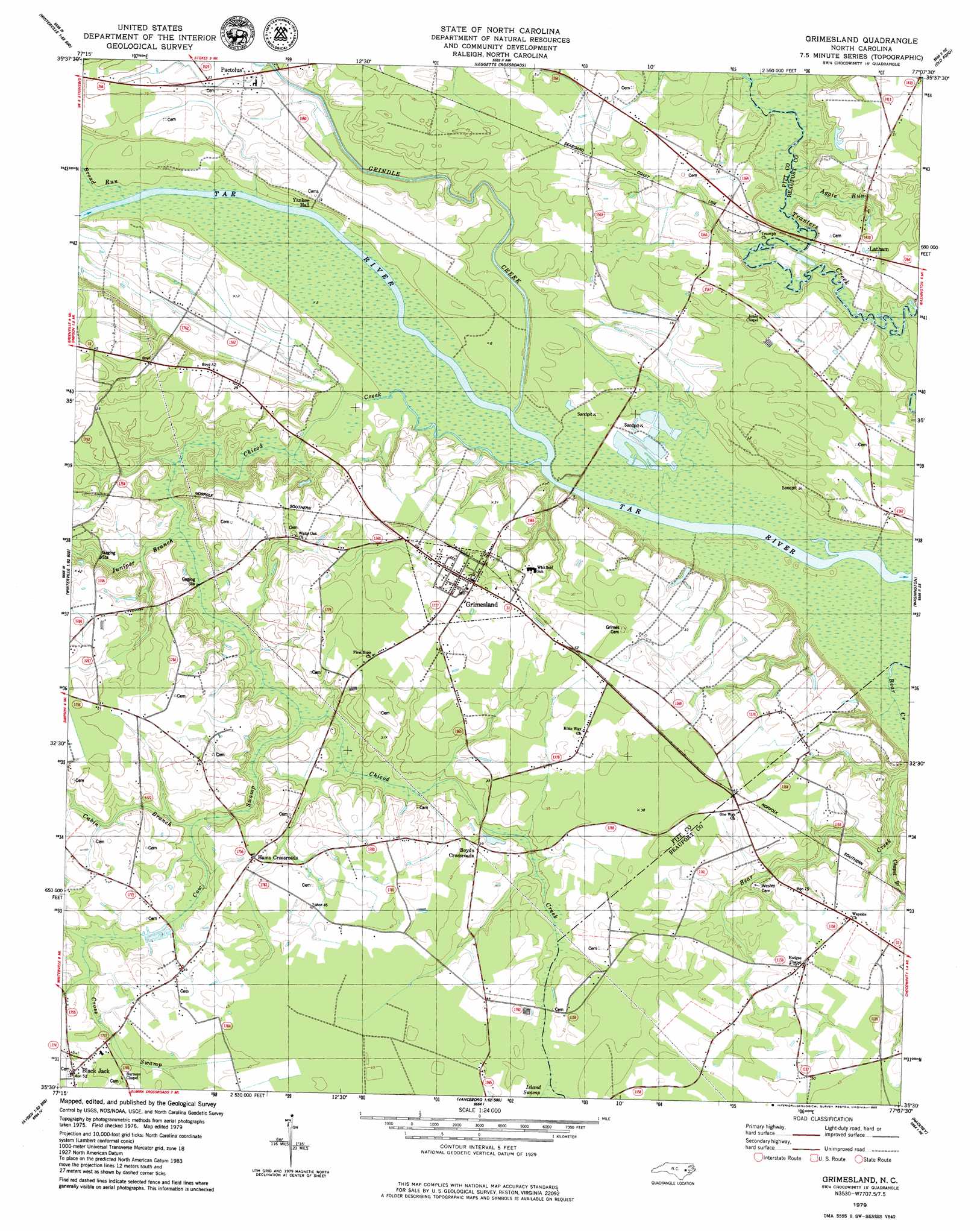
USGS Topo Quad 35077e2 - 1:24,000 scale
| Topo Map Name: | Grimesland |
| USGS Topo Quad ID: | 35077e2 |
| Print Size: | ca. 21 1/4" wide x 27" high |
| Southeast Coordinates: | 35.5° N latitude / 77.125° W longitude |
| Map Center Coordinates: | 35.5625° N latitude / 77.1875° W longitude |
| U.S. State: | NC |
| Filename: | o35077e2.jpg |
| Download Map JPG Image: | Grimesland topo map 1:24,000 scale |
| Map Type: | Topographic |
| Topo Series: | 7.5´ |
| Map Scale: | 1:24,000 |
| Source of Map Images: | United States Geological Survey (USGS) |
| Alternate Map Versions: |
Grimesland NC 1979, updated 1980 Download PDF Buy paper map Grimesland NC 2010 Download PDF Buy paper map Grimesland NC 2013 Download PDF Buy paper map Grimesland NC 2016 Download PDF Buy paper map |
1:24,000 Topo Quads surrounding Grimesland
Conetoe |
Robersonville West |
Robersonville East |
Williamston |
Jamesville |
Greenville Nw |
Greenville Ne |
Leggetts Crossroads |
Old Ford |
Farmlife |
Greenville Sw |
Greenville Se |
Grimesland |
Washington |
Bunyan |
Ayden |
Gardnerville |
Wilmar |
Hackney |
Blounts Bay |
Grifton |
Fort Barnwell |
Vanceboro |
Ernul |
Edward |
> Back to 35077e1 at 1:100,000 scale
> Back to 35076a1 at 1:250,000 scale
> Back to U.S. Topo Maps home
Grimesland topo map: Gazetteer
Grimesland: Lakes
Grimes Millpond elevation 7m 22′Grimesland: Populated Places
Black Jack elevation 14m 45′Boyd Crossroads elevation 11m 36′
Grimesland elevation 12m 39′
Hams Crossroads elevation 12m 39′
Latham elevation 5m 16′
Grimesland: Streams
Aggie Run elevation 0m 0′Broad Run elevation 0m 0′
Cabin Branch elevation 7m 22′
Chapel Branch elevation 2m 6′
Chicod Creek elevation 0m 0′
Cow Swamp elevation 4m 13′
Cross Swamp elevation 9m 29′
Grindle Creek elevation 0m 0′
Island Swamp elevation 10m 32′
Juniper Branch elevation 1m 3′
Panther Creek elevation 0m 0′
Grimesland digital topo map on disk
Buy this Grimesland topo map showing relief, roads, GPS coordinates and other geographical features, as a high-resolution digital map file on DVD:
Atlantic Coast (NY, NJ, PA, DE, MD, VA, NC)
Buy digital topo maps: Atlantic Coast (NY, NJ, PA, DE, MD, VA, NC)
 map DVD")