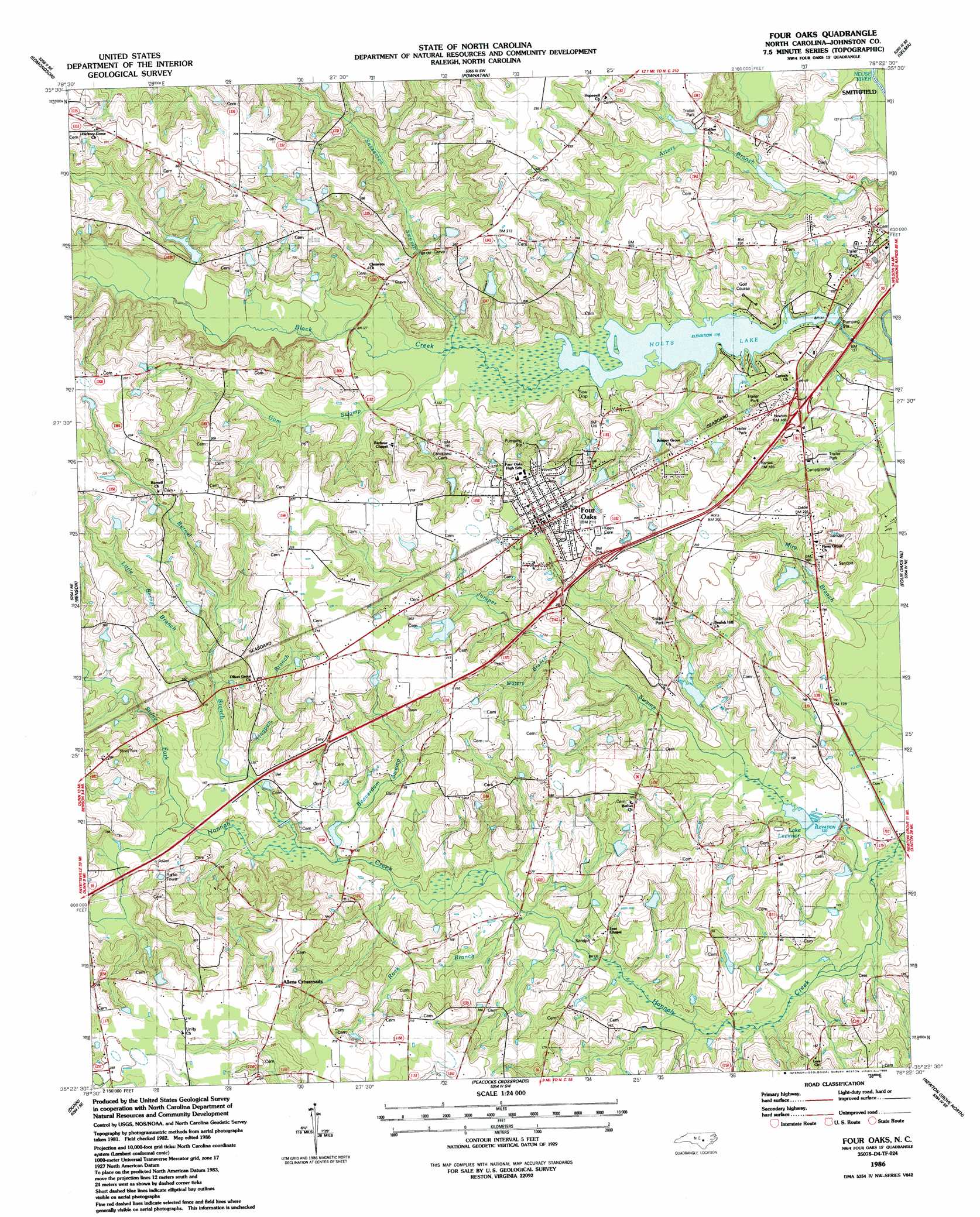
Four Oaks Topo Map North Carolina
To zoom in, hover over the map of Four Oaks
USGS Topo Quad 35078d4 - 1:24,000 scale
| Topo Map Name: | Four Oaks |
| USGS Topo Quad ID: | 35078d4 |
| Print Size: | ca. 21 1/4" wide x 27" high |
| Southeast Coordinates: | 35.375° N latitude / 78.375° W longitude |
| Map Center Coordinates: | 35.4375° N latitude / 78.4375° W longitude |
| U.S. State: | NC |
| Filename: | o35078d4.jpg |
| Download Map JPG Image: | Four Oaks topo map 1:24,000 scale |
| Map Type: | Topographic |
| Topo Series: | 7.5´ |
| Map Scale: | 1:24,000 |
| Source of Map Images: | United States Geological Survey (USGS) |
| Alternate Map Versions: |
Four Oaks NC 1986, updated 1986 Download PDF Buy paper map Four Oaks NC 1997, updated 2000 Download PDF Buy paper map Four Oaks NC 2010 Download PDF Buy paper map Four Oaks NC 2013 Download PDF Buy paper map Four Oaks NC 2016 Download PDF Buy paper map |
1:24,000 Topo Quads surrounding Four Oaks
Lake Wheeler |
Garner |
Clayton |
Flowers |
Stancils Chapel |
Angier |
Edmondson |
Powhatan |
Selma |
Kenly West |
Coats |
Benson |
Four Oaks |
Four Oaks Ne |
Princeton |
Erwin |
Dunn |
Peacocks Crossroads |
Newton Grove North |
Grantham |
Wade |
Mingo |
Timothy |
Newton Grove South |
Dobbersville |
> Back to 35078a1 at 1:100,000 scale
> Back to 35078a1 at 1:250,000 scale
> Back to U.S. Topo Maps home
Four Oaks topo map: Gazetteer
Four Oaks: Bridges
Hockaday Bridge elevation 37m 121′Lee Bridge elevation 34m 111′
Parker Bridge elevation 38m 124′
Four Oaks: Dams
Holts Pond Dam elevation 34m 111′Keen Pond Dam Number One elevation 53m 173′
Lake Austin Pond Dam elevation 44m 144′
Lake Lauderdale Dam elevation 47m 154′
Lassiter Pond Dam elevation 56m 183′
Tar Heel Farm Pond Dam elevation 42m 137′
Thomas Lake Dam elevation 39m 127′
Whitley Pond Dam Number One elevation 44m 144′
Four Oaks: Lakes
Holts Lake elevation 34m 111′Four Oaks: Populated Places
Allens Crossroads elevation 66m 216′Four Oaks elevation 60m 196′
Spilona elevation 68m 223′
The Oaks elevation 60m 196′
Four Oaks: Reservoirs
Johnson Pond elevation 41m 134′Keen Pond elevation 53m 173′
Lake Austin elevation 44m 144′
Lake Lauderdale elevation 47m 154′
Lake Levinson elevation 33m 108′
Lassiter Pond elevation 56m 183′
Tar Heel Farm Pond elevation 42m 137′
Whitley Pond Number One elevation 44m 144′
Four Oaks: Streams
Beaverdam Swamp elevation 36m 118′Bernal Branch elevation 37m 121′
Gum Swamp elevation 36m 118′
Hogpen Branch elevation 40m 131′
Juniper Swamp elevation 31m 101′
Little Bernal Branch elevation 46m 150′
Rock Branch elevation 36m 118′
Sassarixa Swamp elevation 41m 134′
Stony Fork elevation 38m 124′
Watery Branch elevation 43m 141′
Four Oaks digital topo map on disk
Buy this Four Oaks topo map showing relief, roads, GPS coordinates and other geographical features, as a high-resolution digital map file on DVD:
South Carolina, Western North Carolina & Northeastern Georgia
Buy digital topo maps: South Carolina, Western North Carolina & Northeastern Georgia