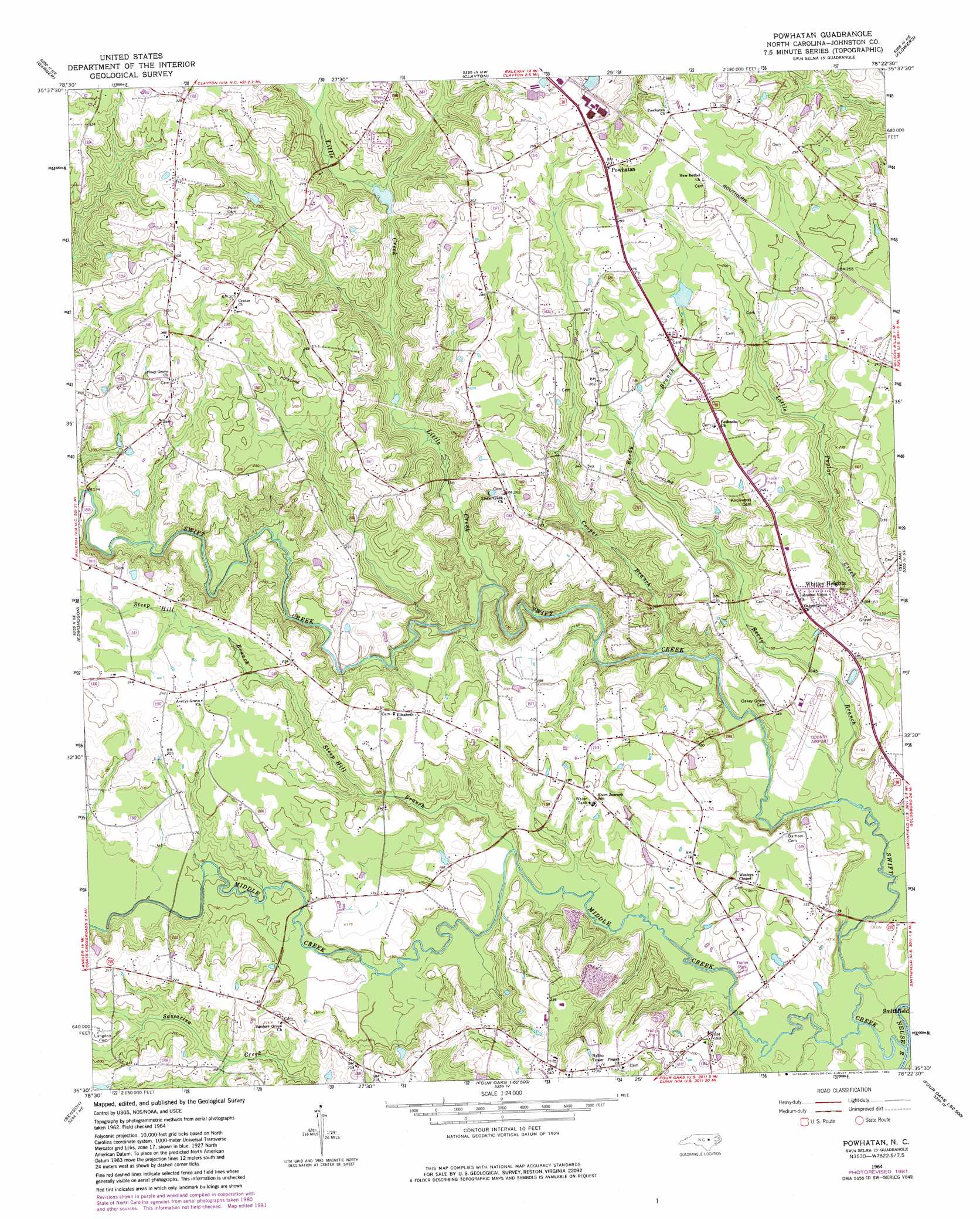
Powhatan Topo Map North Carolina
To zoom in, hover over the map of Powhatan
USGS Topo Quad 35078e4 - 1:24,000 scale
| Topo Map Name: | Powhatan |
| USGS Topo Quad ID: | 35078e4 |
| Print Size: | ca. 21 1/4" wide x 27" high |
| Southeast Coordinates: | 35.5° N latitude / 78.375° W longitude |
| Map Center Coordinates: | 35.5625° N latitude / 78.4375° W longitude |
| U.S. State: | NC |
| Filename: | o35078e4.jpg |
| Download Map JPG Image: | Powhatan topo map 1:24,000 scale |
| Map Type: | Topographic |
| Topo Series: | 7.5´ |
| Map Scale: | 1:24,000 |
| Source of Map Images: | United States Geological Survey (USGS) |
| Alternate Map Versions: |
Powhatan NC 1964, updated 1965 Download PDF Buy paper map Powhatan NC 1964, updated 1976 Download PDF Buy paper map Powhatan NC 1964, updated 1982 Download PDF Buy paper map Powhatan NC 1993, updated 1999 Download PDF Buy paper map Powhatan NC 2010 Download PDF Buy paper map Powhatan NC 2013 Download PDF Buy paper map Powhatan NC 2016 Download PDF Buy paper map |
1:24,000 Topo Quads surrounding Powhatan
Raleigh West |
Raleigh East |
Knightdale |
Zebulon |
Middlesex |
Lake Wheeler |
Garner |
Clayton |
Flowers |
Stancils Chapel |
Angier |
Edmondson |
Powhatan |
Selma |
Kenly West |
Coats |
Benson |
Four Oaks |
Four Oaks Ne |
Princeton |
Erwin |
Dunn |
Peacocks Crossroads |
Newton Grove North |
Grantham |
> Back to 35078e1 at 1:100,000 scale
> Back to 35078a1 at 1:250,000 scale
> Back to U.S. Topo Maps home
Powhatan topo map: Gazetteer
Powhatan: Airports
Johnston County Airport elevation 47m 154′Powhatan: Populated Places
Powhatan elevation 92m 301′Whitley Heights elevation 56m 183′
Powhatan: Streams
Cooper Branch elevation 40m 131′Little Creek elevation 44m 144′
Middle Creek elevation 32m 104′
Reedy Branch elevation 36m 118′
Steep Hill Branch elevation 38m 124′
Swift Creek elevation 32m 104′
Powhatan digital topo map on disk
Buy this Powhatan topo map showing relief, roads, GPS coordinates and other geographical features, as a high-resolution digital map file on DVD:
South Carolina, Western North Carolina & Northeastern Georgia
Buy digital topo maps: South Carolina, Western North Carolina & Northeastern Georgia