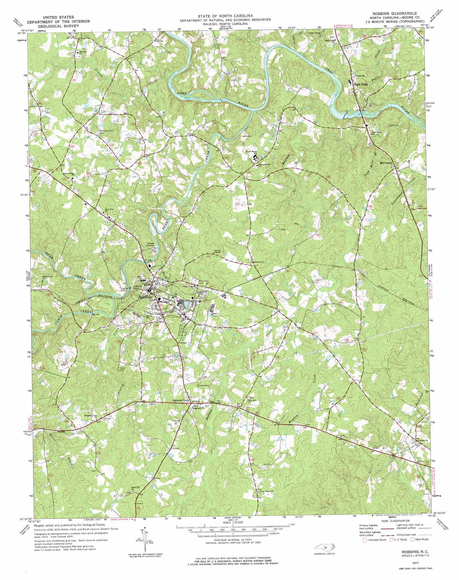
Robbins Topo Map North Carolina
To zoom in, hover over the map of Robbins
USGS Topo Quad 35079d5 - 1:24,000 scale
| Topo Map Name: | Robbins |
| USGS Topo Quad ID: | 35079d5 |
| Print Size: | ca. 21 1/4" wide x 27" high |
| Southeast Coordinates: | 35.375° N latitude / 79.5° W longitude |
| Map Center Coordinates: | 35.4375° N latitude / 79.5625° W longitude |
| U.S. State: | NC |
| Filename: | o35079d5.jpg |
| Download Map JPG Image: | Robbins topo map 1:24,000 scale |
| Map Type: | Topographic |
| Topo Series: | 7.5´ |
| Map Scale: | 1:24,000 |
| Source of Map Images: | United States Geological Survey (USGS) |
| Alternate Map Versions: |
Robbins NC 1977, updated 1977 Download PDF Buy paper map Robbins NC 2010 Download PDF Buy paper map Robbins NC 2013 Download PDF Buy paper map Robbins NC 2016 Download PDF Buy paper map |
1:24,000 Topo Quads surrounding Robbins
Asheboro |
Ramseur |
Coleridge |
Siler City |
Siler City Ne |
Seagrove |
Erect |
Bennett |
Bear Creek |
Goldston |
Star |
Spies |
Robbins |
Putnam |
White Hill |
Biscoe |
Candor |
Zion Grove |
Carthage |
Vass |
Harrisville |
Norman |
West End |
Southern Pines |
Niagara |
> Back to 35079a1 at 1:100,000 scale
> Back to 35078a1 at 1:250,000 scale
> Back to U.S. Topo Maps home
Robbins topo map: Gazetteer
Robbins: Populated Places
Garners Store elevation 155m 508′High Falls elevation 111m 364′
McConnell elevation 120m 393′
Robbins elevation 132m 433′
Robbins: Streams
Bear Creek elevation 91m 298′Buck Branch elevation 102m 334′
Buffalo Creek elevation 81m 265′
Cabin Creek elevation 101m 331′
Cedar Creek elevation 90m 295′
Falls Creek elevation 81m 265′
Gold Mine Branch elevation 91m 298′
Grassy Creek elevation 98m 321′
Marleys Branch elevation 103m 337′
Meadow Creek elevation 120m 393′
Simlin Creek elevation 99m 324′
Robbins digital topo map on disk
Buy this Robbins topo map showing relief, roads, GPS coordinates and other geographical features, as a high-resolution digital map file on DVD:
South Carolina, Western North Carolina & Northeastern Georgia
Buy digital topo maps: South Carolina, Western North Carolina & Northeastern Georgia