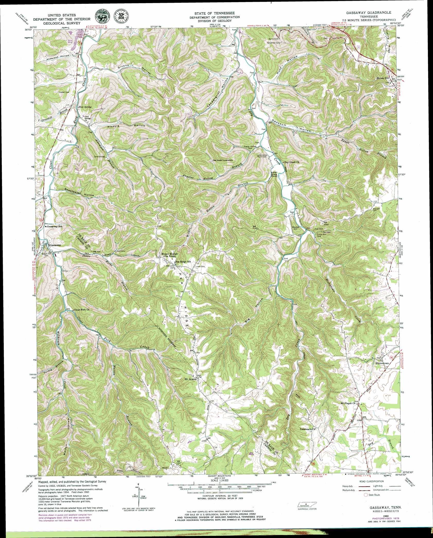
Gassaway Topo Map Tennessee
To zoom in, hover over the map of Gassaway
USGS Topo Quad 35085h8 - 1:24,000 scale
| Topo Map Name: | Gassaway |
| USGS Topo Quad ID: | 35085h8 |
| Print Size: | ca. 21 1/4" wide x 27" high |
| Southeast Coordinates: | 35.875° N latitude / 85.875° W longitude |
| Map Center Coordinates: | 35.9375° N latitude / 85.9375° W longitude |
| U.S. State: | TN |
| Filename: | o35085h8.jpg |
| Download Map JPG Image: | Gassaway topo map 1:24,000 scale |
| Map Type: | Topographic |
| Topo Series: | 7.5´ |
| Map Scale: | 1:24,000 |
| Source of Map Images: | United States Geological Survey (USGS) |
| Alternate Map Versions: |
Gassaway TN 1960, updated 1961 Download PDF Buy paper map Gassaway TN 1960, updated 1970 Download PDF Buy paper map Gassaway TN 1960, updated 1979 Download PDF Buy paper map Gassaway TN 2010 Download PDF Buy paper map Gassaway TN 2013 Download PDF Buy paper map Gassaway TN 2016 Download PDF Buy paper map |
1:24,000 Topo Quads surrounding Gassaway
Shop Springs |
New Middleton |
Gordonsville |
Buffalo Valley |
Baxter |
Watertown |
Alexandria |
Liberty |
Center Hill Dam |
Silver Point |
Milton |
Auburntown |
Gassaway |
Smithville |
Sligo Bridge |
Readyville |
Woodbury |
Short Mountain |
Dibrell |
Campaign |
Beechgrove |
Hollow Springs |
Centertown |
Mcminnville |
Cardwell Mountain |
> Back to 35085e1 at 1:100,000 scale
> Back to 35084a1 at 1:250,000 scale
> Back to U.S. Topo Maps home
Gassaway topo map: Gazetteer
Gassaway: Capes
Indian Grave Point elevation 195m 639′Gassaway: Populated Places
Bluhmtown elevation 336m 1102′Gassaway elevation 200m 656′
Haleville (historical) elevation 184m 603′
Mount Ararat elevation 355m 1164′
Pisgah elevation 339m 1112′
Rabbit Bluff (historical) elevation 218m 715′
Snows Hill elevation 346m 1135′
Youngblood (historical) elevation 207m 679′
Gassaway: Ridges
Copling Ridge elevation 346m 1135′Pea Ridge elevation 346m 1135′
Gassaway: Springs
Blue Spring elevation 189m 620′Gassaway: Streams
Adamson Branch elevation 183m 600′Bluhmtown Creek elevation 198m 649′
Connell Creek elevation 198m 649′
Egypt Hollow Branch elevation 184m 603′
Frazier Hollow Branch elevation 189m 620′
Greenhill Branch elevation 187m 613′
Martin Branch elevation 220m 721′
Sycamore Creek elevation 194m 636′
Three Forks Branch elevation 201m 659′
Turkey Branch elevation 216m 708′
Wilder Hollow Branch elevation 193m 633′
Wilmouth Creek elevation 206m 675′
Gassaway: Summits
Round Hill elevation 250m 820′Gassaway: Valleys
Anderson Hollow elevation 180m 590′Big Hollow elevation 206m 675′
Cave Hollow elevation 200m 656′
Cubbins Hollow elevation 199m 652′
Frazier Hollow elevation 191m 626′
Givens Hollow elevation 183m 600′
Hunt Hollow elevation 191m 626′
Melton Hollow elevation 226m 741′
Opossum Hollow elevation 188m 616′
Pistole Hollow elevation 190m 623′
Sweetwater Hollow elevation 195m 639′
Vandergriff Hollow elevation 188m 616′
Vickers Hollow elevation 199m 652′
Wilder Hollow elevation 193m 633′
Gassaway digital topo map on disk
Buy this Gassaway topo map showing relief, roads, GPS coordinates and other geographical features, as a high-resolution digital map file on DVD: