Manila North Topo Map Arkansas
To zoom in, hover over the map of Manila North
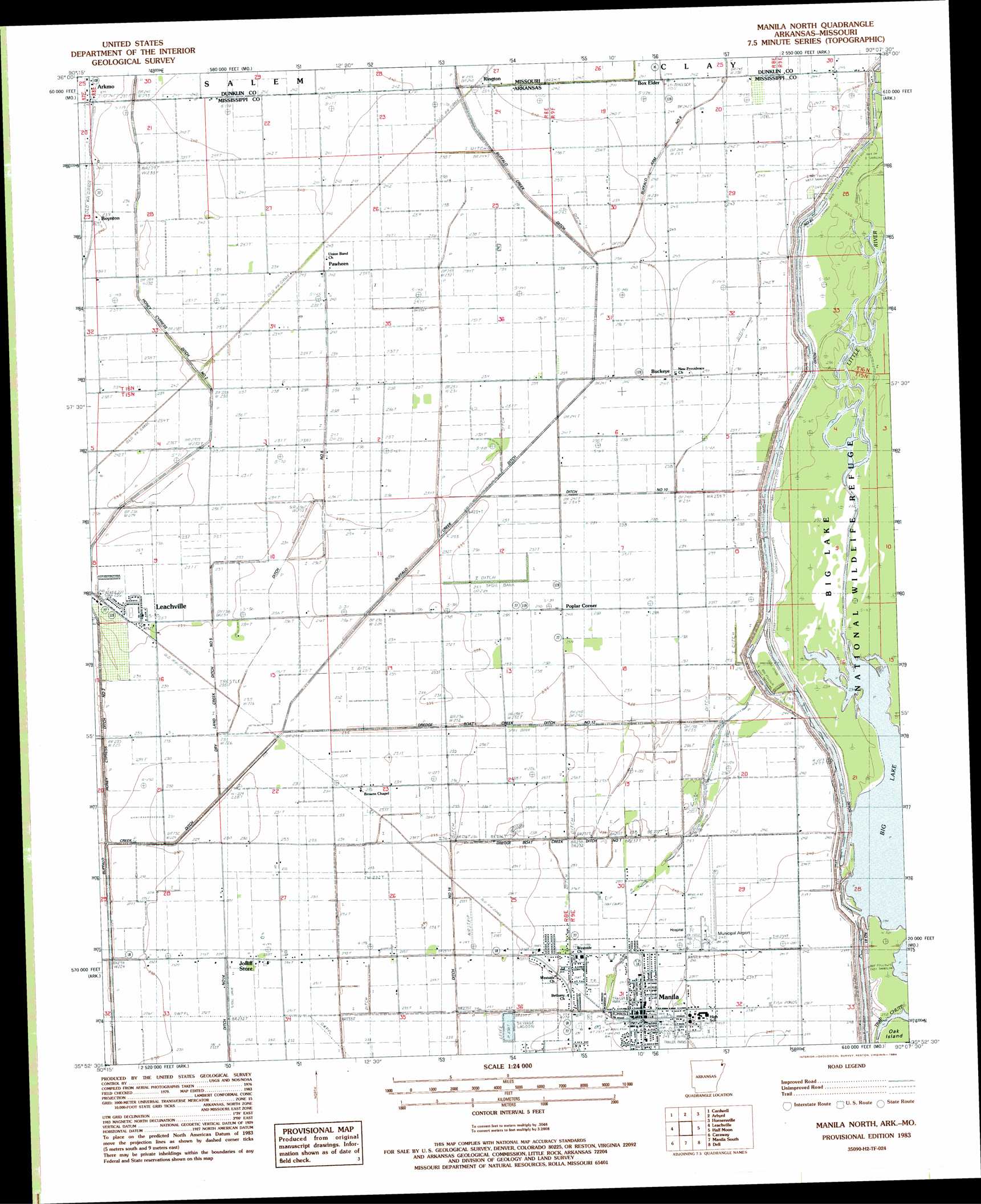
USGS Topo Quad 35090h2 - 1:24,000 scale
| Topo Map Name: | Manila North |
| USGS Topo Quad ID: | 35090h2 |
| Print Size: | ca. 21 1/4" wide x 27" high |
| Southeast Coordinates: | 35.875° N latitude / 90.125° W longitude |
| Map Center Coordinates: | 35.9375° N latitude / 90.1875° W longitude |
| U.S. States: | AR, MO |
| Filename: | o35090h2.jpg |
| Download Map JPG Image: | Manila North topo map 1:24,000 scale |
| Map Type: | Topographic |
| Topo Series: | 7.5´ |
| Map Scale: | 1:24,000 |
| Source of Map Images: | United States Geological Survey (USGS) |
| Alternate Map Versions: |
Manila North AR 1983, updated 1984 Download PDF Buy paper map Manila North AR 2011 Download PDF Buy paper map Manila North AR 2014 Download PDF Buy paper map |
1:24,000 Topo Quads surrounding Manila North
Marmaduke |
Mounds |
Senath |
Kennett South |
Deering |
Paragould East |
Cardwell |
Arbyrd |
Hornersville |
Denton |
Dixie |
Leachville |
Manila North |
Half Moon |
Blytheville |
Lake City |
Caraway |
Manila South |
Dell |
Luxora |
Hatchie Coon |
Riverdale |
Etowah |
Keiser |
Osceola |
> Back to 35090e1 at 1:100,000 scale
> Back to 35090a1 at 1:250,000 scale
> Back to U.S. Topo Maps home
Manila North topo map: Gazetteer
Manila North: Airports
Manila Municipal Airport elevation 73m 239′Manila North: Canals
Buffalo Arm Number 8 elevation 73m 239′Buffalo Ditch Number 1 elevation 73m 239′
Ditch Number 10 elevation 73m 239′
Ditch Number 14 elevation 69m 226′
Ditch Number 16 elevation 71m 232′
Ditch Number 17 elevation 71m 232′
Ditch Number 6 elevation 72m 236′
Dredge Boat Creek Ditch Number 1 elevation 72m 236′
Dredge Boat Creek Ditch Number 12 elevation 74m 242′
Dry Land Creek Ditch Number 5 elevation 71m 232′
Hone Cypress Ditch Number 2 elevation 74m 242′
Manila North: Capes
Bucks Point elevation 74m 242′Cottonwood Point elevation 74m 242′
Tims Point elevation 72m 236′
Manila North: Populated Places
Arkmo elevation 73m 239′Boynton elevation 73m 239′
Brown (historical) elevation 71m 232′
Buckeye elevation 74m 242′
Garson elevation 73m 239′
Manila elevation 73m 239′
Pawheen elevation 73m 239′
Poplar Corner elevation 72m 236′
Rington elevation 72m 236′
Manila North: Streams
Little River elevation 72m 236′Manila North: Swamps
Honey Cypress Swamp (historical) elevation 71m 232′Manila North digital topo map on disk
Buy this Manila North topo map showing relief, roads, GPS coordinates and other geographical features, as a high-resolution digital map file on DVD: