Gem Topo Map Texas
To zoom in, hover over the map of Gem
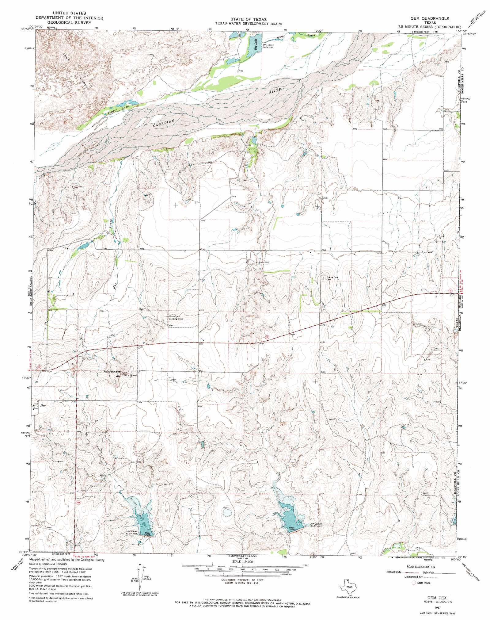
USGS Topo Quad 35100g1 - 1:24,000 scale
| Topo Map Name: | Gem |
| USGS Topo Quad ID: | 35100g1 |
| Print Size: | ca. 21 1/4" wide x 27" high |
| Southeast Coordinates: | 35.75° N latitude / 100° W longitude |
| Map Center Coordinates: | 35.8125° N latitude / 100.0625° W longitude |
| U.S. State: | TX |
| Filename: | o35100g1.jpg |
| Download Map JPG Image: | Gem topo map 1:24,000 scale |
| Map Type: | Topographic |
| Topo Series: | 7.5´ |
| Map Scale: | 1:24,000 |
| Source of Map Images: | United States Geological Survey (USGS) |
| Alternate Map Versions: |
Gem TX 1967, updated 1969 Download PDF Buy paper map Gem TX 2010 Download PDF Buy paper map Gem TX 2012 Download PDF Buy paper map Gem TX 2016 Download PDF Buy paper map |
| FStopo: | US Forest Service topo Gem is available: Download FStopo PDF Download FStopo TIF |
1:24,000 Topo Quads surrounding Gem
Glazier |
Coburn |
Higgins South |
Arnett Sw |
Arnett Se |
Canadian East |
Lake Marvin |
Dreyfoos |
Antelope Hills |
Antelope Hills Ne |
Canadian Se |
Blue Ridge School |
Gem |
Durham |
Crawford |
Dads Creek |
Lake June |
Hackberry Creek |
Reydon |
Mackie |
Briscoe |
Allison Sw |
Allison |
Reydon Sw |
Dempsey |
> Back to 35100e1 at 1:100,000 scale
> Back to 35100a1 at 1:250,000 scale
> Back to U.S. Topo Maps home
Gem topo map: Gazetteer
Gem: Dams
Kritzer Lake Dam elevation 667m 2188′Soil Conservation Service Site 29 Dam elevation 716m 2349′
Soil Conservation Service Site 30 Dam elevation 695m 2280′
Gem: Lakes
Timber Lakes elevation 673m 2208′Gem: Populated Places
Gem elevation 777m 2549′Gem: Reservoirs
Big Lake elevation 667m 2188′Kritzer Lake elevation 667m 2188′
Soil Conservation Service Site 29 Reservoir elevation 716m 2349′
Soil Conservation Service Site 30 Reservoir elevation 695m 2280′
Gem: Streams
Cat Creek elevation 672m 2204′Hay Creek elevation 669m 2194′
Gem: Summits
Rattlesnake Hill elevation 788m 2585′Gem digital topo map on disk
Buy this Gem topo map showing relief, roads, GPS coordinates and other geographical features, as a high-resolution digital map file on DVD: