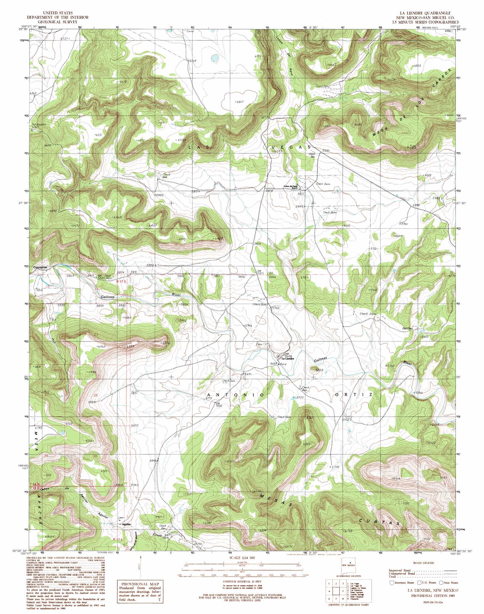
La Liendre Topo Map New Mexico
To zoom in, hover over the map of La Liendre
USGS Topo Quad 35105d1 - 1:24,000 scale
| Topo Map Name: | La Liendre |
| USGS Topo Quad ID: | 35105d1 |
| Print Size: | ca. 21 1/4" wide x 27" high |
| Southeast Coordinates: | 35.375° N latitude / 105° W longitude |
| Map Center Coordinates: | 35.4375° N latitude / 105.0625° W longitude |
| U.S. State: | NM |
| Filename: | o35105d1.jpg |
| Download Map JPG Image: | La Liendre topo map 1:24,000 scale |
| Map Type: | Topographic |
| Topo Series: | 7.5´ |
| Map Scale: | 1:24,000 |
| Source of Map Images: | United States Geological Survey (USGS) |
| Alternate Map Versions: |
La Liendre NM 1989, updated 1989 Download PDF Buy paper map La Liendre NM 2010 Download PDF Buy paper map La Liendre NM 2013 Download PDF Buy paper map La Liendre NM 2017 Download PDF Buy paper map |
1:24,000 Topo Quads surrounding La Liendre
Montezuma |
Las Vegas Nw |
Onava |
Goetsch Lake |
Canon Pedroso |
Ojitos Frios |
Las Vegas |
Las Vegas Se |
Laguna La Monia |
Laguna Huerfana |
Tecolote |
Los Montoyas |
La Liendre |
Mesa Lauriano |
Flagstone Mountain |
Villanueva |
Apache Springs |
Mesa Chupinas |
Chaperito |
Cactus Tank |
San Juan |
Anton Chico |
Dilia |
Pedro Miguel Peak |
Horse Pasture Tank |
> Back to 35105a1 at 1:100,000 scale
> Back to 35104a1 at 1:250,000 scale
> Back to U.S. Topo Maps home
La Liendre topo map: Gazetteer
La Liendre: Populated Places
La Liendre elevation 1735m 5692′La Liendre: Post Offices
La Liendre Post Office (historical) elevation 1749m 5738′La Liendre: Summits
Mesa Apache elevation 2067m 6781′La Liendre: Valleys
Cañon de Aguilar elevation 1793m 5882′Cañon de las Mujeras elevation 1798m 5898′
Cañon del Agua elevation 1837m 6026′
La Liendre digital topo map on disk
Buy this La Liendre topo map showing relief, roads, GPS coordinates and other geographical features, as a high-resolution digital map file on DVD: