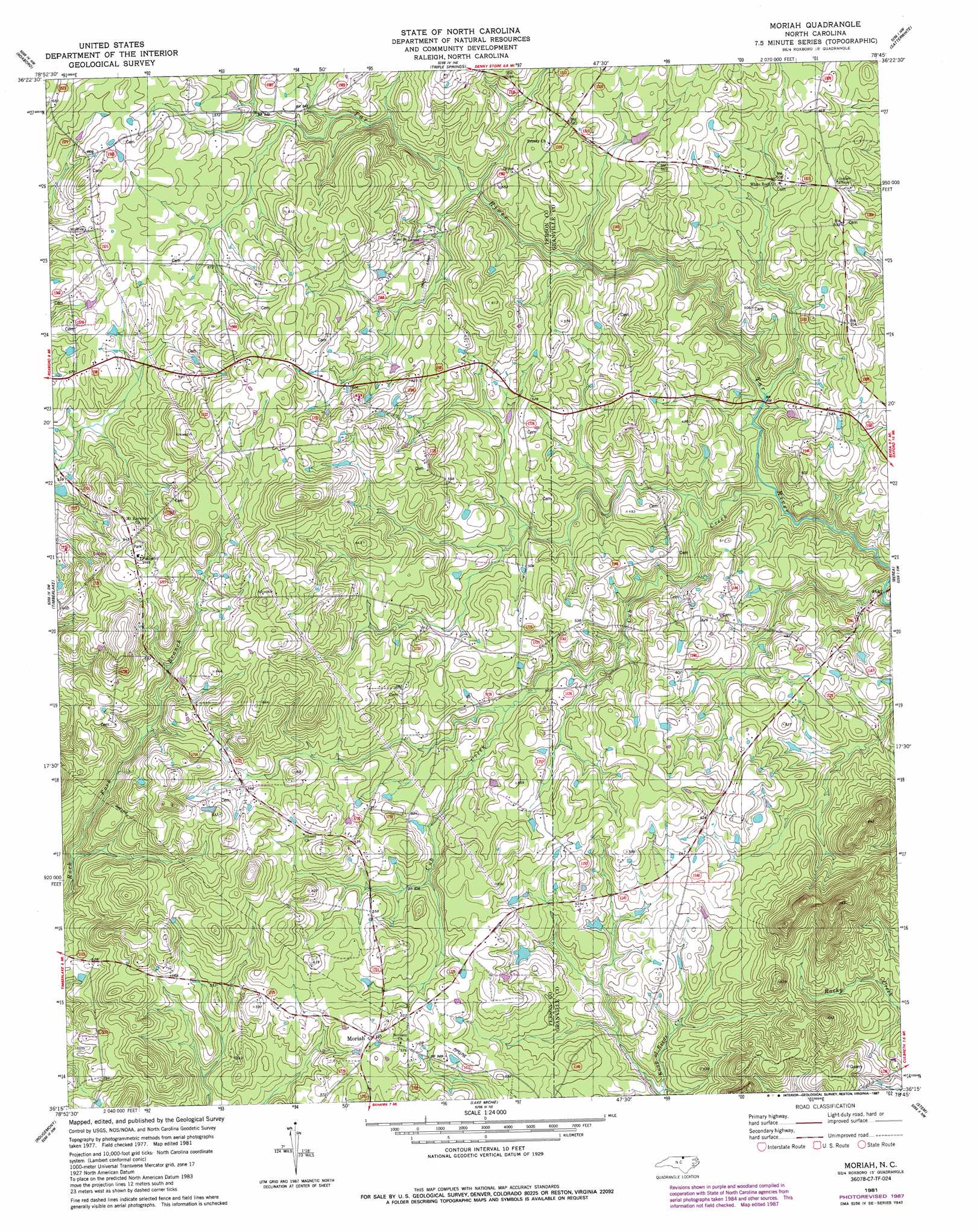
Moriah Topo Map North Carolina
To zoom in, hover over the map of Moriah
USGS Topo Quad 36078c7 - 1:24,000 scale
| Topo Map Name: | Moriah |
| USGS Topo Quad ID: | 36078c7 |
| Print Size: | ca. 21 1/4" wide x 27" high |
| Southeast Coordinates: | 36.25° N latitude / 78.75° W longitude |
| Map Center Coordinates: | 36.3125° N latitude / 78.8125° W longitude |
| U.S. State: | NC |
| Filename: | o36078c7.jpg |
| Download Map JPG Image: | Moriah topo map 1:24,000 scale |
| Map Type: | Topographic |
| Topo Series: | 7.5´ |
| Map Scale: | 1:24,000 |
| Source of Map Images: | United States Geological Survey (USGS) |
| Alternate Map Versions: |
Moriah NC 1981, updated 1981 Download PDF Buy paper map Moriah NC 1981, updated 1987 Download PDF Buy paper map Moriah NC 2010 Download PDF Buy paper map Moriah NC 2013 Download PDF Buy paper map Moriah NC 2016 Download PDF Buy paper map |
1:24,000 Topo Quads surrounding Moriah
Alton |
Cluster Springs |
Virgilina |
Nelson |
Clarksville South |
Olive Hill |
Roxboro |
Triple Springs |
Satterwhite |
Stovall |
Hurdle Mills |
Timberlake |
Moriah |
Berea |
Oxford |
Caldwell |
Rougemont |
Lake Michie |
Stem |
Wilton |
Hillsborough |
Northwest Durham |
Northeast Durham |
Creedmoor |
Grissom |
> Back to 36078a1 at 1:100,000 scale
> Back to 36078a1 at 1:250,000 scale
> Back to U.S. Topo Maps home
Moriah topo map: Gazetteer
Moriah: Dams
Uzzles Lake Dam elevation 150m 492′Moriah: Populated Places
Moriah elevation 179m 587′Moriah: Reservoirs
Uzzles Lake elevation 150m 492′Moriah: Streams
Cub Creek elevation 128m 419′Moriah digital topo map on disk
Buy this Moriah topo map showing relief, roads, GPS coordinates and other geographical features, as a high-resolution digital map file on DVD:
Western Virginia & Southern West Virginia
Buy digital topo maps: Western Virginia & Southern West Virginia