Timberlake Topo Map North Carolina
To zoom in, hover over the map of Timberlake
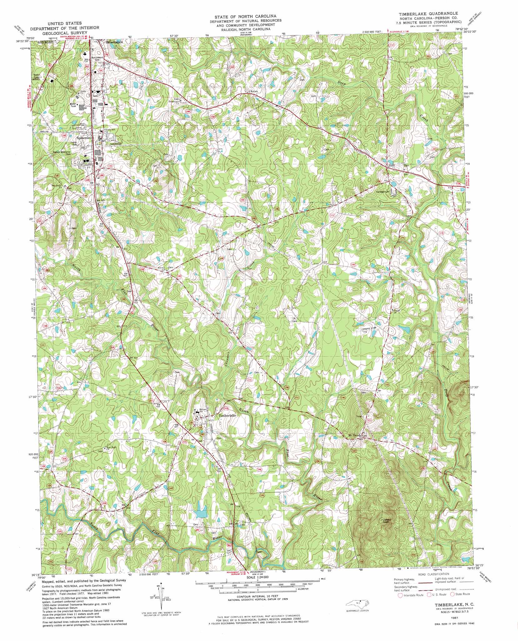
USGS Topo Quad 36078c8 - 1:24,000 scale
| Topo Map Name: | Timberlake |
| USGS Topo Quad ID: | 36078c8 |
| Print Size: | ca. 21 1/4" wide x 27" high |
| Southeast Coordinates: | 36.25° N latitude / 78.875° W longitude |
| Map Center Coordinates: | 36.3125° N latitude / 78.9375° W longitude |
| U.S. State: | NC |
| Filename: | o36078c8.jpg |
| Download Map JPG Image: | Timberlake topo map 1:24,000 scale |
| Map Type: | Topographic |
| Topo Series: | 7.5´ |
| Map Scale: | 1:24,000 |
| Source of Map Images: | United States Geological Survey (USGS) |
| Alternate Map Versions: |
Timberlake NC 1981, updated 1982 Download PDF Buy paper map Timberlake NC 1981, updated 1982 Download PDF Buy paper map Timberlake NC 2010 Download PDF Buy paper map Timberlake NC 2013 Download PDF Buy paper map Timberlake NC 2016 Download PDF Buy paper map |
1:24,000 Topo Quads surrounding Timberlake
Milton |
Alton |
Cluster Springs |
Virgilina |
Nelson |
Leasburg |
Olive Hill |
Roxboro |
Triple Springs |
Satterwhite |
Ridgeville |
Hurdle Mills |
Timberlake |
Moriah |
Berea |
Cedar Grove |
Caldwell |
Rougemont |
Lake Michie |
Stem |
Efland |
Hillsborough |
Northwest Durham |
Northeast Durham |
Creedmoor |
> Back to 36078a1 at 1:100,000 scale
> Back to 36078a1 at 1:250,000 scale
> Back to U.S. Topo Maps home
Timberlake topo map: Gazetteer
Timberlake: Dams
Horton Pond Dam Number One elevation 153m 501′M L Blalock Dam elevation 162m 531′
Timberlake: Populated Places
Ai elevation 186m 610′Brooksdale elevation 222m 728′
Cates elevation 184m 603′
Greenwood Acres elevation 196m 643′
Mount Tirzah elevation 205m 672′
Somerset elevation 199m 652′
Surl elevation 184m 603′
Timberlake elevation 180m 590′
Timberlake: Reservoirs
Horton Pond Number One elevation 153m 501′M L Blalock Lake elevation 162m 531′
Timberlake: Streams
Chappels Creek elevation 151m 495′North Flat River elevation 141m 462′
Rock Fork Branch elevation 133m 436′
South Flat River elevation 141m 462′
Timberlake: Summits
Glenns Mountain elevation 244m 800′Timberlake digital topo map on disk
Buy this Timberlake topo map showing relief, roads, GPS coordinates and other geographical features, as a high-resolution digital map file on DVD:
Western Virginia & Southern West Virginia
Buy digital topo maps: Western Virginia & Southern West Virginia