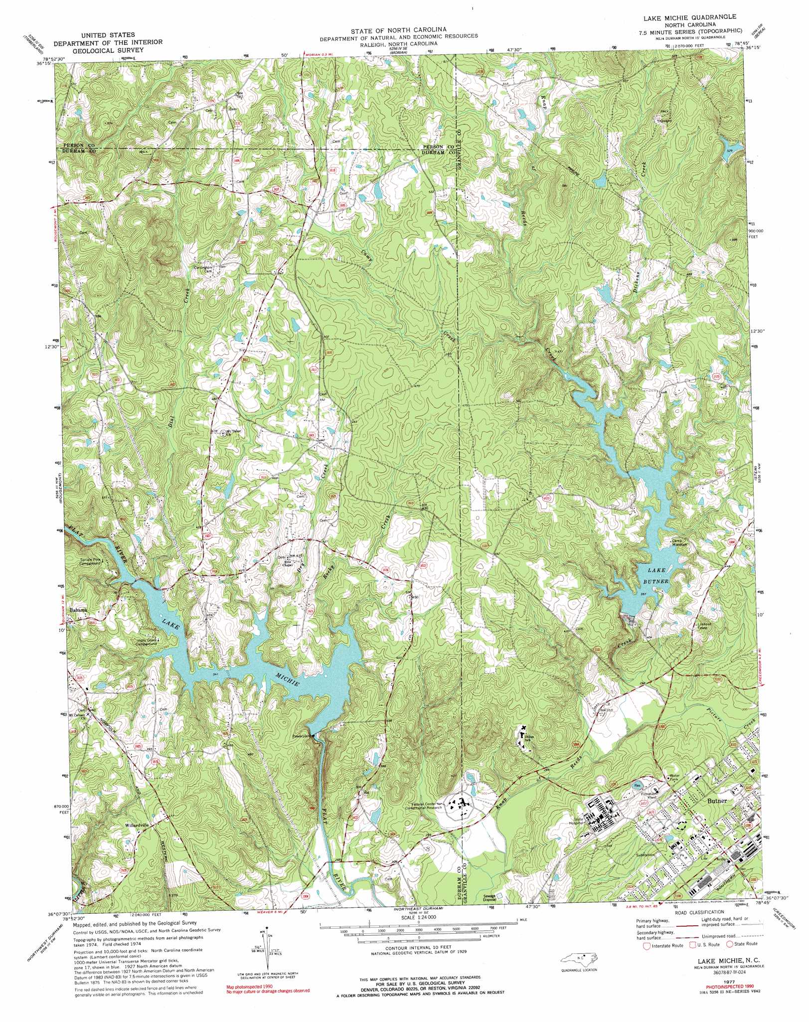
Lake Michie Topo Map North Carolina
To zoom in, hover over the map of Lake Michie
USGS Topo Quad 36078b7 - 1:24,000 scale
| Topo Map Name: | Lake Michie |
| USGS Topo Quad ID: | 36078b7 |
| Print Size: | ca. 21 1/4" wide x 27" high |
| Southeast Coordinates: | 36.125° N latitude / 78.75° W longitude |
| Map Center Coordinates: | 36.1875° N latitude / 78.8125° W longitude |
| U.S. State: | NC |
| Filename: | o36078b7.jpg |
| Download Map JPG Image: | Lake Michie topo map 1:24,000 scale |
| Map Type: | Topographic |
| Topo Series: | 7.5´ |
| Map Scale: | 1:24,000 |
| Source of Map Images: | United States Geological Survey (USGS) |
| Alternate Map Versions: |
Lake Michie NC 1977, updated 1977 Download PDF Buy paper map Lake Michie NC 1977, updated 1992 Download PDF Buy paper map Lake Michie NC 2010 Download PDF Buy paper map Lake Michie NC 2013 Download PDF Buy paper map Lake Michie NC 2016 Download PDF Buy paper map |
1:24,000 Topo Quads surrounding Lake Michie
Olive Hill |
Roxboro |
Triple Springs |
Satterwhite |
Stovall |
Hurdle Mills |
Timberlake |
Moriah |
Berea |
Oxford |
Caldwell |
Rougemont |
Lake Michie |
Stem |
Wilton |
Hillsborough |
Northwest Durham |
Northeast Durham |
Creedmoor |
Grissom |
Chapel Hill |
Southwest Durham |
Southeast Durham |
Bayleaf |
Wake Forest |
> Back to 36078a1 at 1:100,000 scale
> Back to 36078a1 at 1:250,000 scale
> Back to U.S. Topo Maps home
Lake Michie topo map: Gazetteer
Lake Michie: Dams
Gantt Lake Dam elevation 144m 472′Hester Lake Number One Dam elevation 146m 479′
Lake Butner Water Supply Dam elevation 107m 351′
Lake Michie Dam elevation 81m 265′
Pyrophyllite Mine Lake Dam elevation 162m 531′
Lake Michie: Parks
Camp Butner Wildlife Management Area elevation 122m 400′Lake Michie: Populated Places
Butner elevation 113m 370′Hampton elevation 167m 547′
Knap of Reeds elevation 92m 301′
Mangum Store elevation 140m 459′
Willardville elevation 144m 472′
Lake Michie: Reservoirs
Gantt Lake elevation 144m 472′Hester Lake elevation 146m 479′
Lake Butner elevation 107m 351′
Lake Michie elevation 81m 265′
Pyrophyllite Mine Lake elevation 162m 531′
Lake Michie: Streams
Camp Creek elevation 114m 374′Dial Creek elevation 101m 331′
Dickens Creek elevation 108m 354′
Dry Creek elevation 106m 347′
Picture Creek elevation 82m 269′
Rocky Creek elevation 106m 347′
Lake Michie digital topo map on disk
Buy this Lake Michie topo map showing relief, roads, GPS coordinates and other geographical features, as a high-resolution digital map file on DVD:
Western Virginia & Southern West Virginia
Buy digital topo maps: Western Virginia & Southern West Virginia