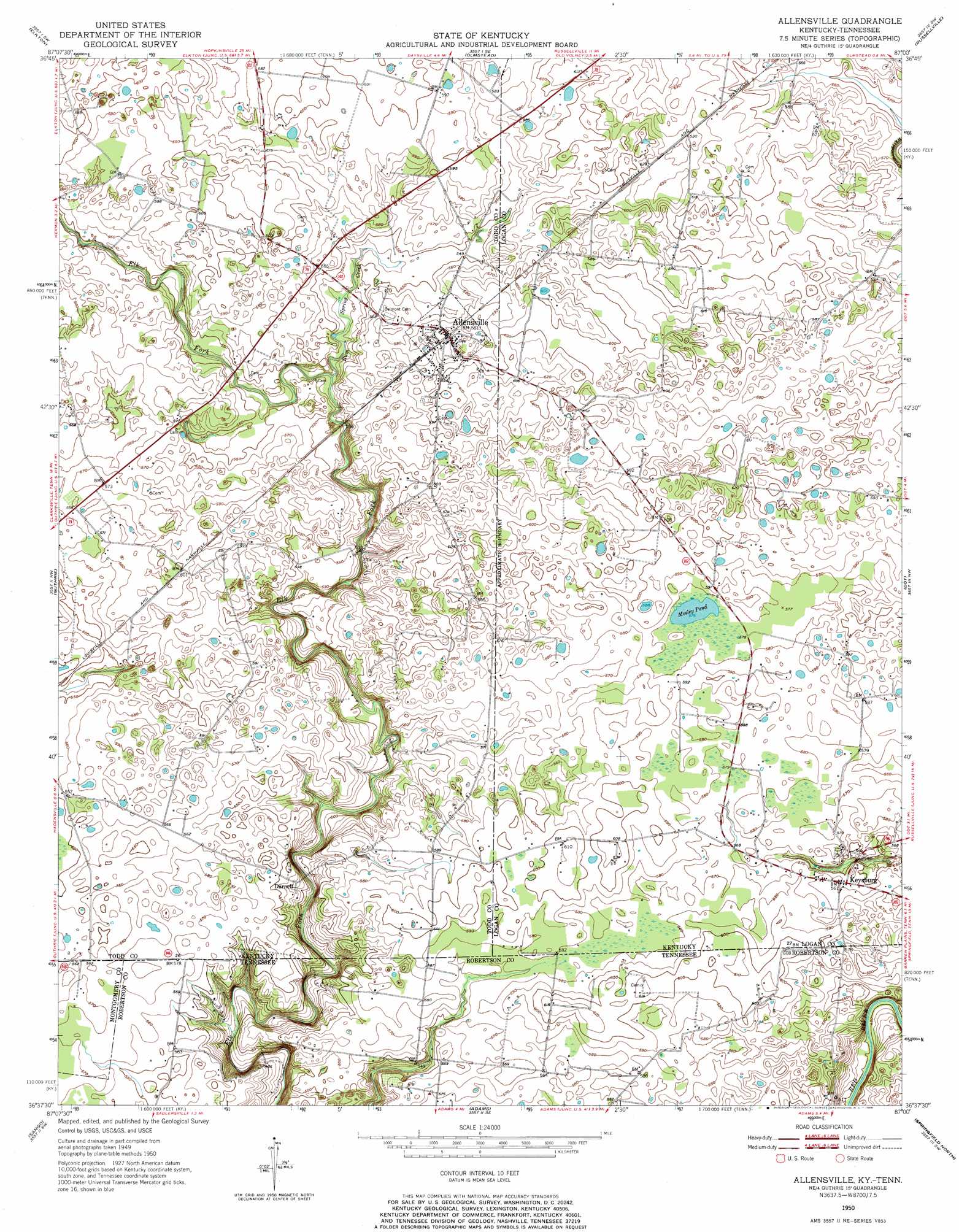
Allensville Topo Map Kentucky
To zoom in, hover over the map of Allensville
USGS Topo Quad 36087f1 - 1:24,000 scale
| Topo Map Name: | Allensville |
| USGS Topo Quad ID: | 36087f1 |
| Print Size: | ca. 21 1/4" wide x 27" high |
| Southeast Coordinates: | 36.625° N latitude / 87° W longitude |
| Map Center Coordinates: | 36.6875° N latitude / 87.0625° W longitude |
| U.S. States: | KY, TN |
| Filename: | o36087f1.jpg |
| Download Map JPG Image: | Allensville topo map 1:24,000 scale |
| Map Type: | Topographic |
| Topo Series: | 7.5´ |
| Map Scale: | 1:24,000 |
| Source of Map Images: | United States Geological Survey (USGS) |
| Alternate Map Versions: |
Allensville KY 1950, updated 1952 Download PDF Buy paper map Allensville KY 1950, updated 1966 Download PDF Buy paper map Allensville KY 2010 Download PDF Buy paper map Allensville KY 2013 Download PDF Buy paper map Allensville KY 2016 Download PDF Buy paper map |
1:24,000 Topo Quads surrounding Allensville
Honey Grove |
Allegre |
Sharon Grove |
Lewisburg |
Homer |
Pembroke |
Elkton |
Olmstead |
Russellville |
Dennis |
Trenton |
Guthrie |
Allensville |
Dot |
Adairville |
Clarksville |
Sango |
Adams |
Springfield North |
Youngville |
Excell |
Henrietta |
Pleasant View |
Springfield South |
Greenbrier |
> Back to 36087e1 at 1:100,000 scale
> Back to 36086a1 at 1:250,000 scale
> Back to U.S. Topo Maps home
Allensville topo map: Gazetteer
Allensville: Lakes
Mosley Pond elevation 176m 577′Allensville: Populated Places
Allensville elevation 180m 590′Darnell elevation 159m 521′
Kent (historical) elevation 177m 580′
Keysburg elevation 170m 557′
Allensville: Streams
Rum Spring Creek elevation 158m 518′Allensville digital topo map on disk
Buy this Allensville topo map showing relief, roads, GPS coordinates and other geographical features, as a high-resolution digital map file on DVD: