Sullivan Draw North Topo Map Arizona
To zoom in, hover over the map of Sullivan Draw North
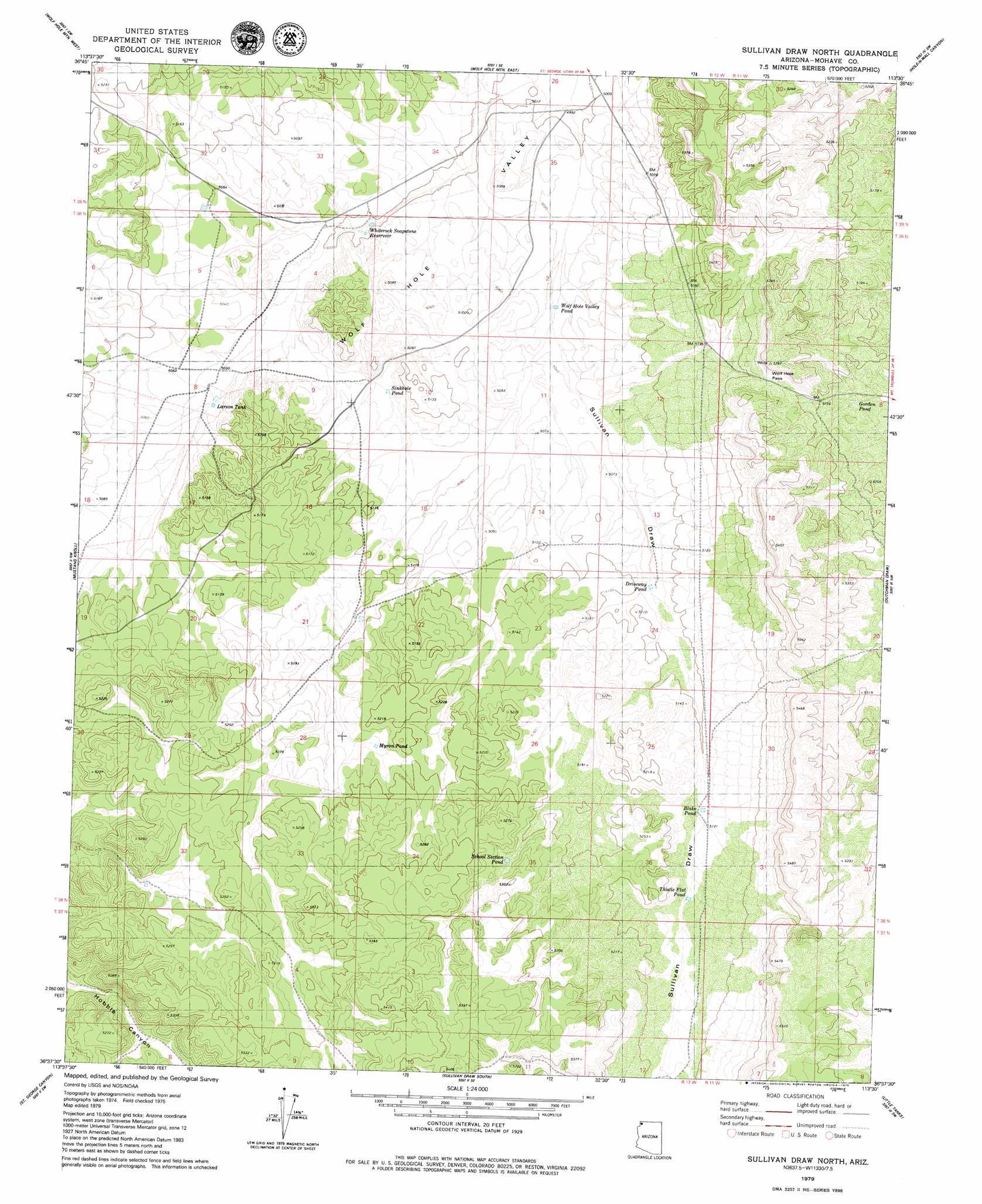
USGS Topo Quad 36113f5 - 1:24,000 scale
| Topo Map Name: | Sullivan Draw North |
| USGS Topo Quad ID: | 36113f5 |
| Print Size: | ca. 21 1/4" wide x 27" high |
| Southeast Coordinates: | 36.625° N latitude / 113.5° W longitude |
| Map Center Coordinates: | 36.6875° N latitude / 113.5625° W longitude |
| U.S. State: | AZ |
| Filename: | o36113f5.jpg |
| Download Map JPG Image: | Sullivan Draw North topo map 1:24,000 scale |
| Map Type: | Topographic |
| Topo Series: | 7.5´ |
| Map Scale: | 1:24,000 |
| Source of Map Images: | United States Geological Survey (USGS) |
| Alternate Map Versions: |
Sullivan Draw North AZ 2011 Download PDF Buy paper map Sullivan Draw North AZ 2014 Download PDF Buy paper map |
1:24,000 Topo Quads surrounding Sullivan Draw North
Mountain Sheep Spring |
Purgatory Canyon |
Lizard Point |
Yellowhorse Flat |
Rock Canyon |
Mount Bangs |
Wolf Hole Mountain West |
Wolf Hole Mountain East |
Hole-N-Wall Canyon |
Gyp Pocket |
Cane Springs |
Mustang Knoll |
Sullivan Draw North |
Dutchman Draw |
The Grandstand |
Cane Springs Se |
Saint George Canyon |
Sullivan Draw South |
Little Tanks |
Russell Spring |
Olaf Knolls |
Last Chance Canyon |
Poverty Spring |
Poverty Knoll |
Jones Hill |
> Back to 36113e1 at 1:100,000 scale
> Back to 36112a1 at 1:250,000 scale
> Back to U.S. Topo Maps home
Sullivan Draw North topo map: Gazetteer
Sullivan Draw North: Gaps
Wolf Hole Pass elevation 1595m 5232′Sullivan Draw North: Reservoirs
Blake Pond elevation 1571m 5154′Driveway Pond elevation 1546m 5072′
Gordon Pond elevation 1565m 5134′
Larson Tank elevation 1534m 5032′
Myron Pond elevation 1572m 5157′
School Section Pond elevation 1591m 5219′
Sinkhole Pond elevation 1536m 5039′
Thistle Flat Pond elevation 1566m 5137′
White Rock Tanks elevation 1525m 5003′
Whiterock Soapstone Reservoir elevation 1525m 5003′
Wolf Hole Valley Pond elevation 1534m 5032′
Sullivan Draw North: Valleys
Sullivan Draw elevation 1525m 5003′Sullivan Draw North digital topo map on disk
Buy this Sullivan Draw North topo map showing relief, roads, GPS coordinates and other geographical features, as a high-resolution digital map file on DVD: