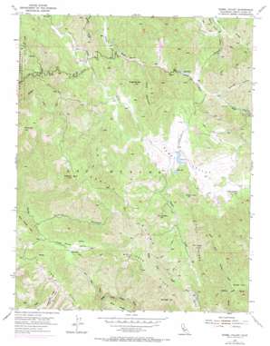
Isabel Valley Topo Map California
To zoom in, hover over the map of Isabel Valley
USGS Topo Quad 37121c5 - 1:24,000 scale
| Topo Map Name: | Isabel Valley |
| USGS Topo Quad ID: | 37121c5 |
| Print Size: | ca. 21 1/4" wide x 27" high |
| Southeast Coordinates: | 37.25° N latitude / 121.5° W longitude |
| Map Center Coordinates: | 37.3125° N latitude / 121.5625° W longitude |
| U.S. State: | CA |
| Filename: | o37121c5.jpg |
| Download Map JPG Image: | Isabel Valley topo map 1:24,000 scale |
| Map Type: | Topographic |
| Topo Series: | 7.5´ |
| Map Scale: | 1:24,000 |
| Source of Map Images: | United States Geological Survey (USGS) |
| Alternate Map Versions: |
Isabel Valley CA 1955, updated 1957 Download PDF Buy paper map Isabel Valley CA 1955, updated 1965 Download PDF Buy paper map Isabel Valley CA 1955, updated 1972 Download PDF Buy paper map Isabel Valley CA 2012 Download PDF Buy paper map Isabel Valley CA 2015 Download PDF Buy paper map |
1:24,000 Topo Quads surrounding Isabel Valley
> Back to 37121a1 at 1:100,000 scale
> Back to 37120a1 at 1:250,000 scale
> Back to U.S. Topo Maps home
Isabel Valley topo map: Gazetteer
Isabel Valley: Flats
Grizzly Flats elevation 548m 1797′Isabel Valley: Ridges
Bollinger Ridge elevation 1015m 3330′Castle Ridge elevation 985m 3231′
Jays Ridge elevation 918m 3011′
Isabel Valley: Springs
Indian Springs elevation 726m 2381′Isabel Valley: Streams
Jumpoff Creek elevation 585m 1919′North Fork Grizzly Creek elevation 519m 1702′
Soup Bowl Creek elevation 644m 2112′
Isabel Valley: Summits
Bollinger Mountain elevation 1044m 3425′Brush Mountain elevation 867m 2844′
Cow Hill elevation 989m 3244′
Mount Helen elevation 915m 3001′
Mount Isabel elevation 1275m 4183′
Pyramid Rock elevation 1220m 4002′
Round Mountain elevation 939m 3080′
Sugarloaf Mountain elevation 841m 2759′
Isabel Valley: Valleys
Bollinger Canyon elevation 643m 2109′Castle Canyon elevation 789m 2588′
Horse Valley elevation 799m 2621′
Isabel Valley elevation 695m 2280′
Jack Canyon elevation 596m 1955′
Lion Canyon elevation 532m 1745′
Sawtooth Canyon elevation 588m 1929′
Skunk Hollow elevation 522m 1712′
Isabel Valley digital topo map on disk
Buy this Isabel Valley topo map showing relief, roads, GPS coordinates and other geographical features, as a high-resolution digital map file on DVD:


