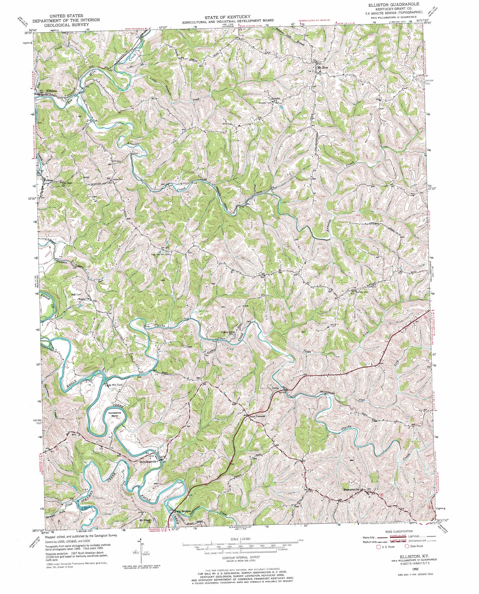
Elliston Topo Map Kentucky
To zoom in, hover over the map of Elliston
USGS Topo Quad 38084f6 - 1:24,000 scale
| Topo Map Name: | Elliston |
| USGS Topo Quad ID: | 38084f6 |
| Print Size: | ca. 21 1/4" wide x 27" high |
| Southeast Coordinates: | 38.625° N latitude / 84.625° W longitude |
| Map Center Coordinates: | 38.6875° N latitude / 84.6875° W longitude |
| U.S. State: | KY |
| Filename: | o38084f6.jpg |
| Download Map JPG Image: | Elliston topo map 1:24,000 scale |
| Map Type: | Topographic |
| Topo Series: | 7.5´ |
| Map Scale: | 1:24,000 |
| Source of Map Images: | United States Geological Survey (USGS) |
| Alternate Map Versions: |
Elliston KY 1950, updated 1952 Download PDF Buy paper map Elliston KY 1950, updated 1971 Download PDF Buy paper map Elliston KY 2010 Download PDF Buy paper map Elliston KY 2013 Download PDF Buy paper map Elliston KY 2016 Download PDF Buy paper map |
1:24,000 Topo Quads surrounding Elliston
Aberdeen |
Rising Sun |
Union |
Independence |
Alexandria |
Florence |
Patriot |
Verona |
Walton |
De Mossville |
Sanders |
Glencoe |
Elliston |
Williamstown |
Goforth |
New Liberty |
Owenton |
Lawrenceville |
Mason |
Berry |
Gratz |
Monterey |
New Columbus |
Sadieville |
Breckinridge |
> Back to 38084e1 at 1:100,000 scale
> Back to 38084a1 at 1:250,000 scale
> Back to U.S. Topo Maps home
Elliston topo map: Gazetteer
Elliston: Bends
Horseshoe Bend elevation 186m 610′Elliston: Populated Places
Delia elevation 206m 675′Downingsville elevation 184m 603′
Elliston elevation 180m 590′
Folsom elevation 180m 590′
Four Corners elevation 268m 879′
Jericho elevation 278m 912′
Mount Zion elevation 281m 921′
Stewartsville elevation 276m 905′
Elliston: Streams
Arnolds Creek elevation 171m 561′Clarks Creek elevation 183m 600′
Clay Lick elevation 214m 702′
Jacks Lick elevation 198m 649′
Little Ten Mile Creek elevation 176m 577′
Napoleon Branch elevation 171m 561′
Rattlesnake Creek elevation 188m 616′
Stevens Creek elevation 183m 600′
Straight Fork Creek elevation 194m 636′
Sycamore Creek elevation 182m 597′
Williams Branch elevation 221m 725′
Elliston digital topo map on disk
Buy this Elliston topo map showing relief, roads, GPS coordinates and other geographical features, as a high-resolution digital map file on DVD: