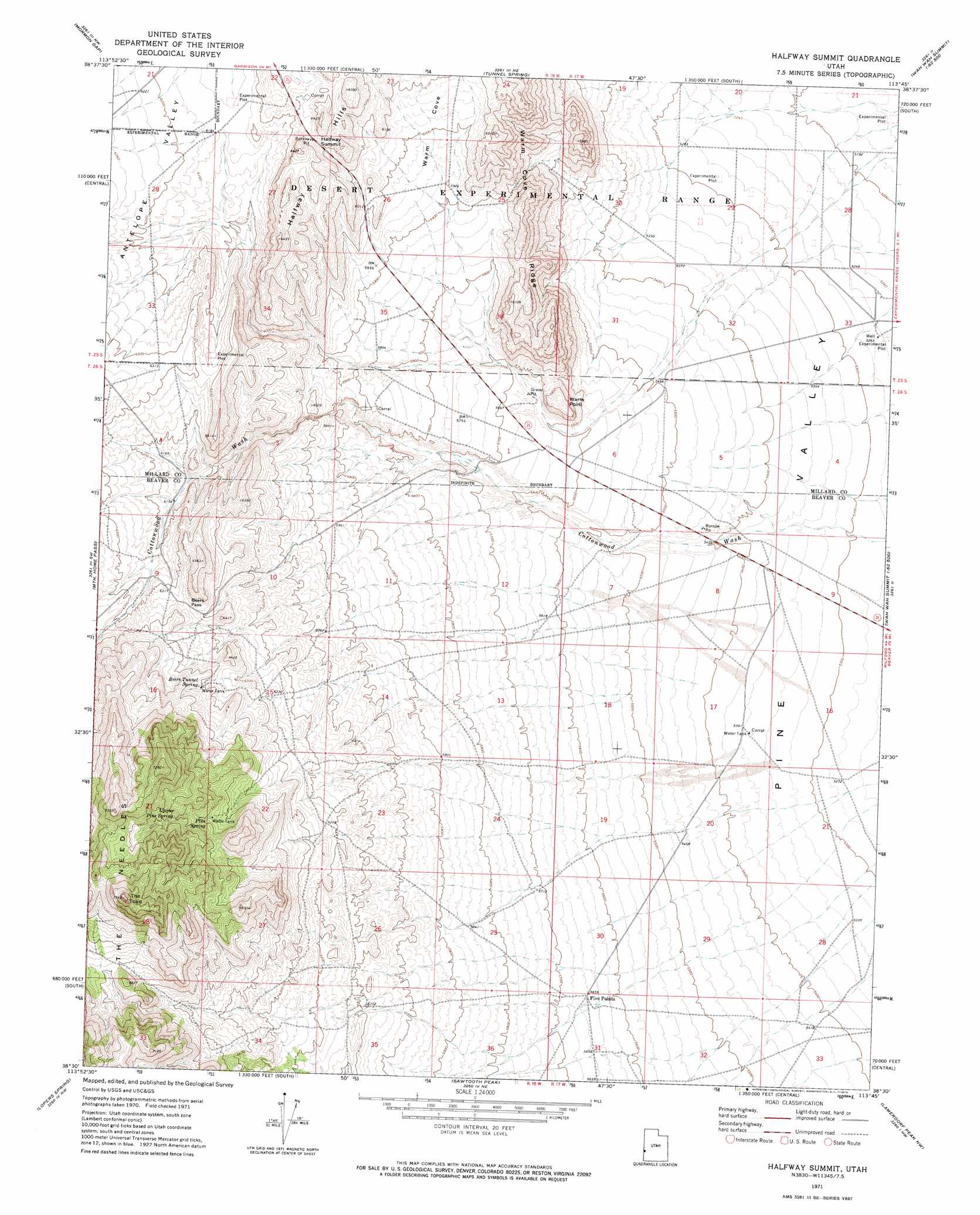
Halfway Summit Topo Map Utah
To zoom in, hover over the map of Halfway Summit
USGS Topo Quad 38113e7 - 1:24,000 scale
| Topo Map Name: | Halfway Summit |
| USGS Topo Quad ID: | 38113e7 |
| Print Size: | ca. 21 1/4" wide x 27" high |
| Southeast Coordinates: | 38.5° N latitude / 113.75° W longitude |
| Map Center Coordinates: | 38.5625° N latitude / 113.8125° W longitude |
| U.S. State: | UT |
| Filename: | o38113e7.jpg |
| Download Map JPG Image: | Halfway Summit topo map 1:24,000 scale |
| Map Type: | Topographic |
| Topo Series: | 7.5´ |
| Map Scale: | 1:24,000 |
| Source of Map Images: | United States Geological Survey (USGS) |
| Alternate Map Versions: |
Halfway Summit UT 1971, updated 1974 Download PDF Buy paper map Halfway Summit UT 2010 Download PDF Buy paper map Halfway Summit UT 2014 Download PDF Buy paper map |
| FStopo: | US Forest Service topo Halfway Summit is available: Download FStopo PDF Download FStopo TIF |
1:24,000 Topo Quads surrounding Halfway Summit
Needle Point Spring |
Cedar Pass |
Big Jensen Pass |
Middle Mountain |
Crystal Peak |
Tweedy Wash |
Mormon Gap |
Tunnel Spring |
Pine Valley Hardpan North |
Grassy Cove |
Miller Wash |
Mountain Home Pass |
Halfway Summit |
Pine Valley Hardpan South |
Wah Wah Summit |
Hamlin Well |
Lopers Spring |
Sawtooth Peak |
Lamerdorf Peak Nw |
Sewing Machine Pass |
Gleason Basin |
Miners Cabin Wash |
Buckhorn Spring |
Pine Grove Reservoir |
Lamerdorf Peak |
> Back to 38113e1 at 1:100,000 scale
> Back to 38112a1 at 1:250,000 scale
> Back to U.S. Topo Maps home
Halfway Summit topo map: Gazetteer
Halfway Summit: Cliffs
Warm Point elevation 1783m 5849′Halfway Summit: Gaps
Beers Pass elevation 1932m 6338′Halfway Summit: Springs
Beers Tunnel Spring elevation 1954m 6410′Pine Spring elevation 2002m 6568′
Upper Pine Spring elevation 2045m 6709′
Halfway Summit: Summits
Halfway Summit elevation 1922m 6305′The Toad elevation 2288m 7506′
Halfway Summit: Valleys
Cottonwood Wash elevation 1616m 5301′Warm Cove elevation 1796m 5892′
Halfway Summit digital topo map on disk
Buy this Halfway Summit topo map showing relief, roads, GPS coordinates and other geographical features, as a high-resolution digital map file on DVD: