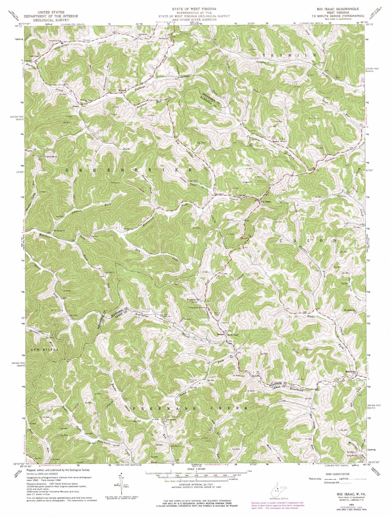
Big Isaac Topo Map West Virginia
To zoom in, hover over the map of Big Isaac
USGS Topo Quad 39080b5 - 1:24,000 scale
| Topo Map Name: | Big Isaac |
| USGS Topo Quad ID: | 39080b5 |
| Print Size: | ca. 21 1/4" wide x 27" high |
| Southeast Coordinates: | 39.125° N latitude / 80.5° W longitude |
| Map Center Coordinates: | 39.1875° N latitude / 80.5625° W longitude |
| U.S. State: | WV |
| Filename: | o39080b5.jpg |
| Download Map JPG Image: | Big Isaac topo map 1:24,000 scale |
| Map Type: | Topographic |
| Topo Series: | 7.5´ |
| Map Scale: | 1:24,000 |
| Source of Map Images: | United States Geological Survey (USGS) |
| Alternate Map Versions: |
Big Isaac WV 1964, updated 1966 Download PDF Buy paper map Big Isaac WV 1964, updated 1977 Download PDF Buy paper map Big Isaac WV 2011 Download PDF Buy paper map Big Isaac WV 2014 Download PDF Buy paper map Big Isaac WV 2016 Download PDF Buy paper map |
1:24,000 Topo Quads surrounding Big Isaac
Shirley |
Center Point |
Folsom |
Wallace |
Shinnston |
West Union |
Smithburg |
Salem |
Wolf Summit |
Clarksburg |
Oxford |
New Milton |
Big Isaac |
West Milford |
Mount Clare |
Auburn |
Vadis |
Camden |
Weston |
Berlin |
Glenville |
Gilmer |
Peterson |
Roanoke |
Adrian |
> Back to 39080a1 at 1:100,000 scale
> Back to 39080a1 at 1:250,000 scale
> Back to U.S. Topo Maps home
Big Isaac topo map: Gazetteer
Big Isaac: Dams
Kitt Mine Number One Sludge Pond Dam elevation 430m 1410′Big Isaac: Parks
Smoke Camp Wildlife Management Area elevation 430m 1410′Big Isaac: Populated Places
Benson elevation 327m 1072′Big Isaac elevation 300m 984′
Kincheloe elevation 310m 1017′
Miletus elevation 281m 921′
Zinnia elevation 272m 892′
Big Isaac: Streams
Big Isaac Creek elevation 285m 935′Birch Run elevation 274m 898′
Bonnet Fork elevation 284m 931′
Dry Fork elevation 279m 915′
Eldercamp Run elevation 282m 925′
Elk Lick elevation 307m 1007′
Greenbrier Creek elevation 268m 879′
Hog Camp Run elevation 309m 1013′
Indian Fork elevation 271m 889′
Johnson Fork elevation 272m 892′
Laurel Run elevation 285m 935′
Little Isaac Creek elevation 288m 944′
Right Fork Kincheloe Creek elevation 307m 1007′
Rush Run elevation 321m 1053′
Sand Fork elevation 319m 1046′
Shaw Run elevation 324m 1062′
Stutler Fork elevation 316m 1036′
Tanner Fork elevation 321m 1053′
Traugh Fork elevation 288m 944′
Turtletree Fork elevation 331m 1085′
Wolfpen Run elevation 281m 921′
Big Isaac digital topo map on disk
Buy this Big Isaac topo map showing relief, roads, GPS coordinates and other geographical features, as a high-resolution digital map file on DVD:
 map DVD")