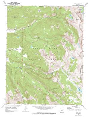
Nast Topo Map Colorado
To zoom in, hover over the map of Nast
USGS Topo Quad 39106c5 - 1:24,000 scale
| Topo Map Name: | Nast |
| USGS Topo Quad ID: | 39106c5 |
| Print Size: | ca. 21 1/4" wide x 27" high |
| Southeast Coordinates: | 39.25° N latitude / 106.5° W longitude |
| Map Center Coordinates: | 39.3125° N latitude / 106.5625° W longitude |
| U.S. State: | CO |
| Filename: | o39106c5.jpg |
| Download Map JPG Image: | Nast topo map 1:24,000 scale |
| Map Type: | Topographic |
| Topo Series: | 7.5´ |
| Map Scale: | 1:24,000 |
| Source of Map Images: | United States Geological Survey (USGS) |
| Alternate Map Versions: |
Nast CO 1970, updated 1973 Download PDF Buy paper map Nast CO 1970, updated 1973 Download PDF Buy paper map Nast CO 1994, updated 1998 Download PDF Buy paper map Nast CO 2011 Download PDF Buy paper map Nast CO 2013 Download PDF Buy paper map Nast CO 2016 Download PDF Buy paper map |
| FStopo: | US Forest Service topo Nast is available: Download FStopo PDF Download FStopo TIF |
1:24,000 Topo Quads surrounding Nast
> Back to 39106a1 at 1:100,000 scale
> Back to 39106a1 at 1:250,000 scale
> Back to U.S. Topo Maps home
Nast topo map: Gazetteer
Nast: Dams
Ivanhoe Dam elevation 3349m 10987′Nast: Flats
Henderson Park elevation 3177m 10423′Sellar Park elevation 2937m 9635′
Nast: Gaps
Hell Gap elevation 3197m 10488′Nast: Lakes
Brady Lake elevation 3350m 10990′Carter Lake elevation 3140m 10301′
Diemer Lake elevation 2903m 9524′
Lily Pad Lake elevation 3398m 11148′
Lyle Lake elevation 3467m 11374′
Mormon Lake elevation 3495m 11466′
Nast E Lake elevation 2655m 8710′
Savage Lakes elevation 3386m 11108′
Sellar Lake elevation 3116m 10223′
Sopris Lake elevation 3360m 11023′
Nast: Mines
Carter and Moran Tunnels Mine elevation 3050m 10006′Cunningham Tunnel Mine elevation 3223m 10574′
Nast: Populated Places
Nast elevation 2702m 8864′Nast: Reservoirs
Ivanhoe Lake elevation 3349m 10987′Nast: Streams
Carter Creek elevation 2909m 9543′Cunningham Creek elevation 2781m 9124′
Granite Creek elevation 2886m 9468′
Ivanhoe Creek elevation 2667m 8750′
Lily Pad Creek elevation 2941m 9648′
Lyle Creek elevation 3226m 10583′
Middle Cunningham Creek elevation 2964m 9724′
Mormon Creek elevation 3003m 9852′
Reed Creek elevation 2919m 9576′
South Cunningham Creek elevation 2949m 9675′
South Fork Fryingpan River elevation 2629m 8625′
Nast: Summits
Mount Nast elevation 3796m 12454′Sellar Peak elevation 3676m 12060′
Wildcat Mountain elevation 3686m 12093′
Nast: Trails
Last Chance Trail elevation 2912m 9553′Nast: Tunnels
Chapman Tunnel elevation 3561m 11683′Granite Adit elevation 3095m 10154′
Nast Tunnel elevation 3172m 10406′
Nast digital topo map on disk
Buy this Nast topo map showing relief, roads, GPS coordinates and other geographical features, as a high-resolution digital map file on DVD:


