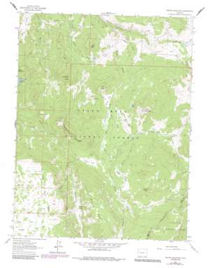
Porter Mountain Topo Map Colorado
To zoom in, hover over the map of Porter Mountain
USGS Topo Quad 39107b6 - 1:24,000 scale
| Topo Map Name: | Porter Mountain |
| USGS Topo Quad ID: | 39107b6 |
| Print Size: | ca. 21 1/4" wide x 27" high |
| Southeast Coordinates: | 39.125° N latitude / 107.625° W longitude |
| Map Center Coordinates: | 39.1875° N latitude / 107.6875° W longitude |
| U.S. State: | CO |
| Filename: | o39107b6.jpg |
| Download Map JPG Image: | Porter Mountain topo map 1:24,000 scale |
| Map Type: | Topographic |
| Topo Series: | 7.5´ |
| Map Scale: | 1:24,000 |
| Source of Map Images: | United States Geological Survey (USGS) |
| Alternate Map Versions: |
Porter Mountain CO 1961, updated 1963 Download PDF Buy paper map Porter Mountain CO 1961, updated 1972 Download PDF Buy paper map Porter Mountain CO 1961, updated 1972 Download PDF Buy paper map Porter Mountain CO 1961, updated 1984 Download PDF Buy paper map Porter Mountain CO 2011 Download PDF Buy paper map Porter Mountain CO 2013 Download PDF Buy paper map Porter Mountain CO 2016 Download PDF Buy paper map |
| FStopo: | US Forest Service topo Porter Mountain is available: Download FStopo PDF Download FStopo TIF |
1:24,000 Topo Quads surrounding Porter Mountain
> Back to 39107a1 at 1:100,000 scale
> Back to 39106a1 at 1:250,000 scale
> Back to U.S. Topo Maps home
Porter Mountain topo map: Gazetteer
Porter Mountain: Canals
Bear Den Ditch elevation 2456m 8057′Bull Elk Ditch elevation 2846m 9337′
Carnahan Ditch Number 1 elevation 2374m 7788′
Castle Ditch elevation 2507m 8225′
Elizabethe Ditch elevation 2651m 8697′
Porter Mountain: Flats
Buzzard Park elevation 2964m 9724′Dead Mare Park elevation 2772m 9094′
Grass Park elevation 2790m 9153′
Lowell Flat elevation 2556m 8385′
Plateau Park elevation 2887m 9471′
Porter Flat elevation 2694m 8838′
Stillwater Park elevation 3048m 10000′
Wagon Park elevation 2885m 9465′
Porter Mountain: Lakes
Elk Lake elevation 2802m 9192′Gander Pond elevation 2512m 8241′
Porter Mountain: Mines
Deep Creek Mine elevation 3090m 10137′Porter Mountain: Ridges
Plateau Ridge elevation 2961m 9714′Willow Ridge elevation 3310m 10859′
Porter Mountain: Streams
Castle Creek elevation 2379m 7805′East Porter Creek elevation 2651m 8697′
Owens Creek elevation 2506m 8221′
Porter Creek elevation 2403m 7883′
Steep Creek elevation 2928m 9606′
Stubb Creek elevation 2439m 8001′
Walt Creek elevation 2642m 8667′
West Porter Creek elevation 2651m 8697′
Porter Mountain: Summits
Baldridge Point elevation 2782m 9127′Bronco Knob elevation 3089m 10134′
Lenna Peak elevation 2714m 8904′
Porter Mountain elevation 3036m 9960′
The Flat Tops elevation 3258m 10688′
Two Peak elevation 2837m 9307′
Porter Mountain: Trails
High Trail elevation 3249m 10659′Silver Spruce Trail elevation 2445m 8021′
Porter Mountain: Valleys
Hanson Draw elevation 2440m 8005′Porter Mountain digital topo map on disk
Buy this Porter Mountain topo map showing relief, roads, GPS coordinates and other geographical features, as a high-resolution digital map file on DVD:


