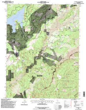
La Porte Topo Map California
To zoom in, hover over the map of La Porte
USGS Topo Quad 39120f8 - 1:24,000 scale
| Topo Map Name: | La Porte |
| USGS Topo Quad ID: | 39120f8 |
| Print Size: | ca. 21 1/4" wide x 27" high |
| Southeast Coordinates: | 39.625° N latitude / 120.875° W longitude |
| Map Center Coordinates: | 39.6875° N latitude / 120.9375° W longitude |
| U.S. State: | CA |
| Filename: | o39120f8.jpg |
| Download Map JPG Image: | La Porte topo map 1:24,000 scale |
| Map Type: | Topographic |
| Topo Series: | 7.5´ |
| Map Scale: | 1:24,000 |
| Source of Map Images: | United States Geological Survey (USGS) |
| Alternate Map Versions: |
La Porte CA 1951, updated 1952 Download PDF Buy paper map La Porte CA 1951, updated 1957 Download PDF Buy paper map La Porte CA 1951, updated 1977 Download PDF Buy paper map La Porte CA 1994, updated 1998 Download PDF Buy paper map La Porte CA 2012 Download PDF Buy paper map La Porte CA 2015 Download PDF Buy paper map |
| FStopo: | US Forest Service topo La Porte is available: Download FStopo PDF Download FStopo TIF |
1:24,000 Topo Quads surrounding La Porte
> Back to 39120e1 at 1:100,000 scale
> Back to 39120a1 at 1:250,000 scale
> Back to U.S. Topo Maps home
La Porte topo map: Gazetteer
La Porte: Bars
China Bar elevation 1264m 4146′La Porte: Capes
Gardners Point elevation 1529m 5016′La Porte: Dams
Gardners Point Dam elevation 1484m 4868′Little Table Rock Dam elevation 1800m 5905′
La Porte: Flats
Clamper Flat elevation 1340m 4396′Craigs Flat elevation 1542m 5059′
Oats Meadow elevation 1535m 5036′
Spanish Flat elevation 1443m 4734′
La Porte: Mines
Barnards Diggings elevation 1446m 4744′Bellevue Mine elevation 1479m 4852′
Caledonia Mine elevation 1528m 5013′
California Mine elevation 1721m 5646′
Claybank Mine elevation 1444m 4737′
Clippership Mine elevation 1571m 5154′
Davis Motor Mine elevation 1494m 4901′
Independence Mine elevation 1442m 4730′
Lucky Hill Mine elevation 1511m 4957′
Monumental Mine elevation 1498m 4914′
Mountain Boy Mine elevation 1463m 4799′
Pacific Mine elevation 1552m 5091′
Pioneer Mine Placer Diggings elevation 1463m 4799′
Secret Diggings elevation 1484m 4868′
Taber Mine elevation 1616m 5301′
Union Keystone Mine elevation 1689m 5541′
Upper Dutch Diggings elevation 1526m 5006′
West Coast Mine elevation 1546m 5072′
Woods Mine elevation 1545m 5068′
La Porte: Populated Places
Gibsonville elevation 1655m 5429′Grass Flat elevation 1481m 4858′
Howland Flat elevation 1721m 5646′
La Porte elevation 1518m 4980′
Maredith Mill elevation 1658m 5439′
Morristown elevation 1590m 5216′
Queen City elevation 1516m 4973′
Saint Louis elevation 1532m 5026′
La Porte: Reservoirs
Little Table Rock Reservoir elevation 1800m 5905′La Porte: Ridges
Gibsonville Ridge elevation 1913m 6276′Illinois Ridge elevation 1508m 4947′
Morristown Ridge elevation 1651m 5416′
Port Wine Ridge elevation 1607m 5272′
Sawmill Ridge elevation 1765m 5790′
La Porte: Springs
Knuts Spring elevation 1654m 5426′La Porte: Streams
East Branch Little Canyon Creek elevation 1352m 4435′East Branch Rabbit Creek elevation 1499m 4917′
East Branch Slate Creek elevation 1442m 4730′
Gibson Creek elevation 1518m 4980′
Old Mill Creek elevation 1299m 4261′
Pine Grove Creek elevation 1491m 4891′
Potosi Creek elevation 1542m 5059′
Rabbit Creek elevation 1265m 4150′
Tooms Creek elevation 1535m 5036′
Wallace Creek elevation 1398m 4586′
La Porte: Summits
Devils Post Pile elevation 1813m 5948′Goat Mountain elevation 1737m 5698′
La Porte Bald Mountain elevation 1794m 5885′
Little Table Rock elevation 1683m 5521′
Plug Point elevation 1807m 5928′
Poverty Hill elevation 1673m 5488′
Sugarloaf elevation 1747m 5731′
Table Rock elevation 2107m 6912′
Yankee Hill elevation 1446m 4744′
La Porte: Trails
Little Grass Valley Trail elevation 1631m 5351′La Porte: Valleys
Bella Union Ravine elevation 1203m 3946′Bon Ton Ravine elevation 1216m 3989′
Cedar Grove Ravine elevation 1330m 4363′
Clarks Ravine elevation 1243m 4078′
Creed Ravine elevation 1571m 5154′
Dark Ravine elevation 1296m 4251′
Deacon Long Ravine elevation 1334m 4376′
Deadwood Ravine elevation 1340m 4396′
Happy Hollow Ravine elevation 1295m 4248′
Johnson Ravine elevation 1233m 4045′
Kenzie Ravine elevation 1546m 5072′
Lucky Hill Ravine elevation 1242m 4074′
Morristown Ravine elevation 1272m 4173′
Morrs Ravine elevation 1243m 4078′
Pancake Ravine elevation 1536m 5039′
Pats Gulch elevation 1282m 4206′
Pearson Ravine elevation 1566m 5137′
Port Wine Ravine elevation 1330m 4363′
Reese Ravine elevation 1629m 5344′
Sacketts Gulch elevation 1430m 4691′
Sawmill Ravine elevation 1339m 4393′
Sears Ravine elevation 1392m 4566′
Sheep Ranch Ravine elevation 1674m 5492′
Spanish Ravine elevation 1267m 4156′
Stahis Ravine elevation 1538m 5045′
Wisconsin Ravine elevation 1279m 4196′
La Porte digital topo map on disk
Buy this La Porte topo map showing relief, roads, GPS coordinates and other geographical features, as a high-resolution digital map file on DVD:


