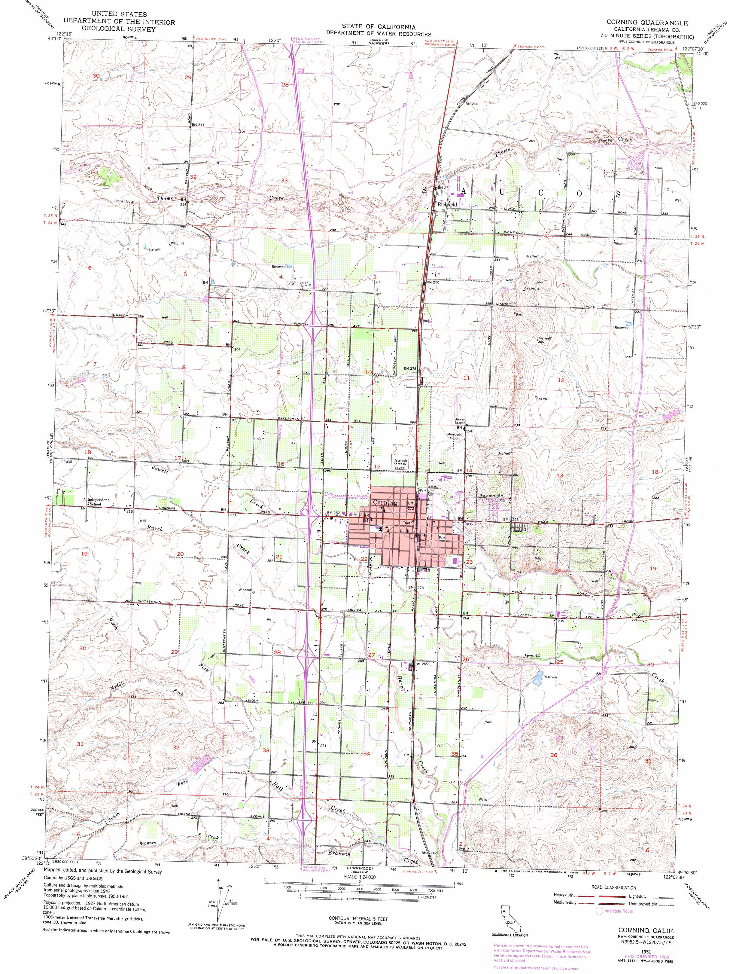
Corning Topo Map California
To zoom in, hover over the map of Corning
USGS Topo Quad 39122h2 - 1:24,000 scale
| Topo Map Name: | Corning |
| USGS Topo Quad ID: | 39122h2 |
| Print Size: | ca. 21 1/4" wide x 27" high |
| Southeast Coordinates: | 39.875° N latitude / 122.125° W longitude |
| Map Center Coordinates: | 39.9375° N latitude / 122.1875° W longitude |
| U.S. State: | CA |
| Filename: | o39122h2.jpg |
| Download Map JPG Image: | Corning topo map 1:24,000 scale |
| Map Type: | Topographic |
| Topo Series: | 7.5´ |
| Map Scale: | 1:24,000 |
| Source of Map Images: | United States Geological Survey (USGS) |
| Alternate Map Versions: |
Corning CA 1951, updated 1952 Download PDF Buy paper map Corning CA 1951, updated 1956 Download PDF Buy paper map Corning CA 1951, updated 1970 Download PDF Buy paper map Corning CA 1951, updated 1970 Download PDF Buy paper map Corning CA 2012 Download PDF Buy paper map Corning CA 2015 Download PDF Buy paper map |
1:24,000 Topo Quads surrounding Corning
Blossom |
Red Bluff West |
Red Bluff East |
Tuscan Springs |
Dewitt Peak |
Red Bank |
West Of Gerber |
Gerber |
Los Molinos |
Acorn Hollow |
Flournoy |
Henleyville |
Corning |
Vina |
Richardson Springs Nw |
Sehorn Creek |
Black Butte Dam |
Kirkwood |
Foster Island |
Nord |
Julian Rocks |
Fruto Ne |
Orland |
Hamilton City |
Ord Ferry |
> Back to 39122e1 at 1:100,000 scale
> Back to 39122a1 at 1:250,000 scale
> Back to U.S. Topo Maps home
Corning topo map: Gazetteer
Corning: Airports
Corning Municipal Airport elevation 89m 291′Corning: Canals
Tehama Colusa Canal elevation 69m 226′Corning: Dams
Top Cat 1260 Dam elevation 92m 301′Corning: Oilfields
Corning Gas Field elevation 83m 272′South Corning Gas Field elevation 74m 242′
Corning: Parks
Estil C Clark Park elevation 80m 262′Northside Park elevation 85m 278′
Woodson Park elevation 82m 269′
Yost Park elevation 83m 272′
Corning: Populated Places
Corning elevation 84m 275′Richfield elevation 83m 272′
Corning: Post Offices
Corning Post Office elevation 84m 275′Corning: Streams
Hall Creek elevation 72m 236′Middle Fork Hall Creek elevation 83m 272′
North Fork Hall Creek elevation 83m 272′
South Fork Hall Creek elevation 83m 272′
Corning digital topo map on disk
Buy this Corning topo map showing relief, roads, GPS coordinates and other geographical features, as a high-resolution digital map file on DVD: