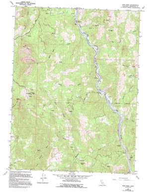
Iron Peak Topo Map California
To zoom in, hover over the map of Iron Peak
USGS Topo Quad 39123g4 - 1:24,000 scale
| Topo Map Name: | Iron Peak |
| USGS Topo Quad ID: | 39123g4 |
| Print Size: | ca. 21 1/4" wide x 27" high |
| Southeast Coordinates: | 39.75° N latitude / 123.375° W longitude |
| Map Center Coordinates: | 39.8125° N latitude / 123.4375° W longitude |
| U.S. State: | CA |
| Filename: | o39123g4.jpg |
| Download Map JPG Image: | Iron Peak topo map 1:24,000 scale |
| Map Type: | Topographic |
| Topo Series: | 7.5´ |
| Map Scale: | 1:24,000 |
| Source of Map Images: | United States Geological Survey (USGS) |
| Alternate Map Versions: |
Iron Peak CA 1967, updated 1969 Download PDF Buy paper map Iron Peak CA 1967, updated 1981 Download PDF Buy paper map Iron Peak CA 1967, updated 1994 Download PDF Buy paper map Iron Peak CA 2012 Download PDF Buy paper map Iron Peak CA 2015 Download PDF Buy paper map |
1:24,000 Topo Quads surrounding Iron Peak
> Back to 39123e1 at 1:100,000 scale
> Back to 39122a1 at 1:250,000 scale
> Back to U.S. Topo Maps home
Iron Peak topo map: Gazetteer
Iron Peak: Areas
River Garden elevation 239m 784′Iron Peak: Cliffs
White Rock elevation 1186m 3891′Iron Peak: Populated Places
Card Place elevation 251m 823′Dunlap Place elevation 269m 882′
Heath Place elevation 634m 2080′
Jim Leggett Place elevation 453m 1486′
Nashmead elevation 248m 813′
Ralph Leggett Place elevation 619m 2030′
Reyes Place elevation 380m 1246′
River Garden (historical) elevation 243m 797′
Woodman elevation 265m 869′
Iron Peak: Post Offices
Woodman Pots Office (historical) elevation 265m 869′Iron Peak: Springs
Grapevine Spring elevation 559m 1833′Iron Peak: Streams
Black Oak Creek elevation 234m 767′Cherry Creek elevation 242m 793′
Corbet Creek elevation 233m 764′
Gill Creek elevation 241m 790′
Iron Creek elevation 432m 1417′
Shell Creek elevation 233m 764′
Shell Rock Creek elevation 224m 734′
Stoner Creek elevation 244m 800′
Stoney Creek elevation 252m 826′
Tin Cabin Creek elevation 228m 748′
White Rock Creek elevation 386m 1266′
Woodman Creek elevation 245m 803′
Iron Peak: Summits
Buck Rock elevation 591m 1938′Iron Peak elevation 1373m 4504′
Shell Rock elevation 1350m 4429′
Spyrock elevation 308m 1010′
Iron Peak: Valleys
Board Tree Canyon elevation 546m 1791′Iron Peak digital topo map on disk
Buy this Iron Peak topo map showing relief, roads, GPS coordinates and other geographical features, as a high-resolution digital map file on DVD:


