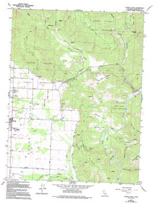
Covelo East Topo Map California
To zoom in, hover over the map of Covelo East
USGS Topo Quad 39123g2 - 1:24,000 scale
| Topo Map Name: | Covelo East |
| USGS Topo Quad ID: | 39123g2 |
| Print Size: | ca. 21 1/4" wide x 27" high |
| Southeast Coordinates: | 39.75° N latitude / 123.125° W longitude |
| Map Center Coordinates: | 39.8125° N latitude / 123.1875° W longitude |
| U.S. State: | CA |
| Filename: | o39123g2.jpg |
| Download Map JPG Image: | Covelo East topo map 1:24,000 scale |
| Map Type: | Topographic |
| Topo Series: | 7.5´ |
| Map Scale: | 1:24,000 |
| Source of Map Images: | United States Geological Survey (USGS) |
| Alternate Map Versions: |
Covelo East CA 1967, updated 1969 Download PDF Buy paper map Covelo East CA 1967, updated 1969 Download PDF Buy paper map Covelo East CA 1967, updated 1994 Download PDF Buy paper map Covelo East CA 2012 Download PDF Buy paper map Covelo East CA 2015 Download PDF Buy paper map |
1:24,000 Topo Quads surrounding Covelo East
> Back to 39123e1 at 1:100,000 scale
> Back to 39122a1 at 1:250,000 scale
> Back to U.S. Topo Maps home
Covelo East topo map: Gazetteer
Covelo East: Basins
Blueschist Narrows elevation 529m 1735′Poor Mans Valley elevation 478m 1568′
Round Valley elevation 414m 1358′
Williams Valley elevation 474m 1555′
Covelo East: Crossings
Etsel Crossing elevation 399m 1309′Covelo East: Dams
Williams Valley 1381 Dam elevation 462m 1515′Covelo East: Flats
Atkinson Flat elevation 424m 1391′Etsel Flat elevation 413m 1354′
Simmerley Flat elevation 440m 1443′
Covelo East: Populated Places
Covelo elevation 426m 1397′Cubbler Place elevation 492m 1614′
Covelo East: Ridges
Dingman Ridge elevation 640m 2099′Covelo East: Streams
Grist Creek elevation 406m 1332′Little Salt Creek elevation 492m 1614′
Murphy Creek elevation 469m 1538′
Poor Mans Creek elevation 444m 1456′
Short Creek elevation 406m 1332′
Silver Creek elevation 414m 1358′
Tank Creek elevation 465m 1525′
Town Creek elevation 421m 1381′
Turner Creek elevation 400m 1312′
Williams Creek elevation 423m 1387′
Covelo East: Summits
Coyote Rock elevation 733m 2404′Panther Rock elevation 534m 1751′
Covelo East: Valleys
George Lambert Canyon elevation 390m 1279′Green Lambert Canyon elevation 389m 1276′
Covelo East digital topo map on disk
Buy this Covelo East topo map showing relief, roads, GPS coordinates and other geographical features, as a high-resolution digital map file on DVD:


