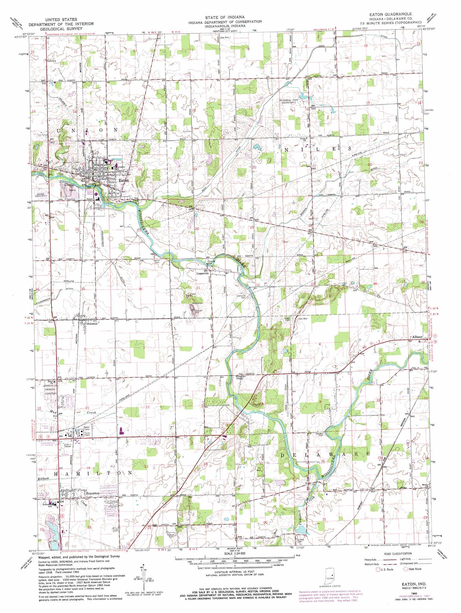
Eaton Topo Map Indiana
To zoom in, hover over the map of Eaton
USGS Topo Quad 40085c3 - 1:24,000 scale
| Topo Map Name: | Eaton |
| USGS Topo Quad ID: | 40085c3 |
| Print Size: | ca. 21 1/4" wide x 27" high |
| Southeast Coordinates: | 40.25° N latitude / 85.25° W longitude |
| Map Center Coordinates: | 40.3125° N latitude / 85.3125° W longitude |
| U.S. State: | IN |
| Filename: | o40085c3.jpg |
| Download Map JPG Image: | Eaton topo map 1:24,000 scale |
| Map Type: | Topographic |
| Topo Series: | 7.5´ |
| Map Scale: | 1:24,000 |
| Source of Map Images: | United States Geological Survey (USGS) |
| Alternate Map Versions: |
Eaton IN 1960, updated 1961 Download PDF Buy paper map Eaton IN 1960, updated 1977 Download PDF Buy paper map Eaton IN 1960, updated 1982 Download PDF Buy paper map Eaton IN 2010 Download PDF Buy paper map Eaton IN 2013 Download PDF Buy paper map Eaton IN 2016 Download PDF Buy paper map |
1:24,000 Topo Quads surrounding Eaton
Van Buren |
Roll |
Montpelier |
Petroleum |
Domestic |
Gas City |
Hartford City West |
Hartford City East |
Pennville |
Blaine |
Gaston |
Wheeling |
Eaton |
Redkey |
Ridgeville |
Gilman |
Muncie West |
Muncie East |
Farmland |
Maxville |
Middletown |
Sulphur Springs |
Mount Pleasant |
Modoc |
Carlos |
> Back to 40085a1 at 1:100,000 scale
> Back to 40084a1 at 1:250,000 scale
> Back to U.S. Topo Maps home
Eaton topo map: Gazetteer
Eaton: Canals
Bosman Ditch elevation 281m 921′Holdren Ditch elevation 280m 918′
Rees Ditch elevation 276m 905′
Swearengen Ditch elevation 274m 898′
Eaton: Populated Places
Eaton elevation 277m 908′Granville elevation 275m 902′
Royerton elevation 283m 928′
Shideler elevation 279m 915′
Eaton: Streams
Campbell Creek elevation 277m 908′Eaton digital topo map on disk
Buy this Eaton topo map showing relief, roads, GPS coordinates and other geographical features, as a high-resolution digital map file on DVD:
Northern Illinois, Northern Indiana & Southwestern Michigan
Buy digital topo maps: Northern Illinois, Northern Indiana & Southwestern Michigan