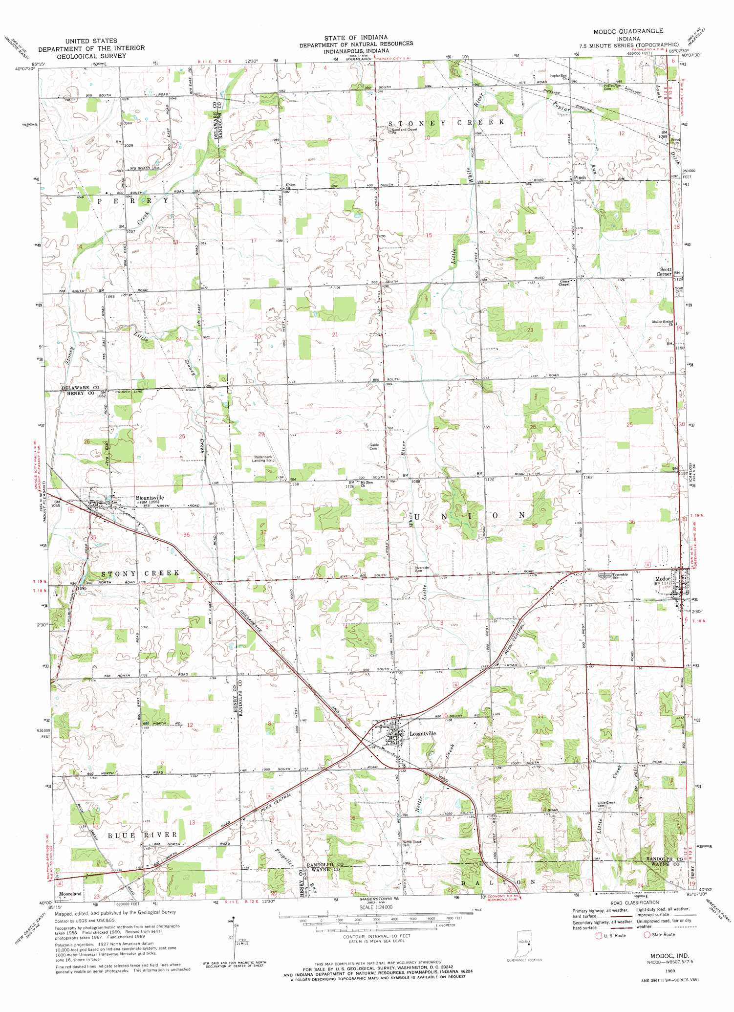
Modoc Topo Map Indiana
To zoom in, hover over the map of Modoc
USGS Topo Quad 40085a2 - 1:24,000 scale
| Topo Map Name: | Modoc |
| USGS Topo Quad ID: | 40085a2 |
| Print Size: | ca. 21 1/4" wide x 27" high |
| Southeast Coordinates: | 40° N latitude / 85.125° W longitude |
| Map Center Coordinates: | 40.0625° N latitude / 85.1875° W longitude |
| U.S. State: | IN |
| Filename: | o40085a2.jpg |
| Download Map JPG Image: | Modoc topo map 1:24,000 scale |
| Map Type: | Topographic |
| Topo Series: | 7.5´ |
| Map Scale: | 1:24,000 |
| Source of Map Images: | United States Geological Survey (USGS) |
| Alternate Map Versions: |
Modoc IN 1960, updated 1961 Download PDF Buy paper map Modoc IN 1969, updated 1970 Download PDF Buy paper map Modoc IN 2010 Download PDF Buy paper map Modoc IN 2013 Download PDF Buy paper map Modoc IN 2016 Download PDF Buy paper map |
1:24,000 Topo Quads surrounding Modoc
Wheeling |
Eaton |
Redkey |
Ridgeville |
Deerfield |
Muncie West |
Muncie East |
Farmland |
Maxville |
Winchester |
Sulphur Springs |
Mount Pleasant |
Modoc |
Carlos |
Lynn |
New Castle West |
New Castle East |
Hagerstown |
Greens Fork |
Fountain City |
Dunreith |
Lewisville |
Cambridge City |
Jacksonburg |
Richmond |
> Back to 40085a1 at 1:100,000 scale
> Back to 40084a1 at 1:250,000 scale
> Back to U.S. Topo Maps home
Modoc topo map: Gazetteer
Modoc: Canals
Conningham Ditch elevation 310m 1017′Lamb Ditch elevation 325m 1066′
Modoc: Populated Places
Blountsville elevation 333m 1092′Losantville elevation 346m 1135′
Modoc elevation 358m 1174′
Pinch elevation 336m 1102′
Scott Corner elevation 344m 1128′
Modoc: Streams
Little Stoney Creek elevation 318m 1043′Poplar Run elevation 323m 1059′
Modoc digital topo map on disk
Buy this Modoc topo map showing relief, roads, GPS coordinates and other geographical features, as a high-resolution digital map file on DVD:
Northern Illinois, Northern Indiana & Southwestern Michigan
Buy digital topo maps: Northern Illinois, Northern Indiana & Southwestern Michigan