Bedford Sw Topo Map Missouri
To zoom in, hover over the map of Bedford Sw
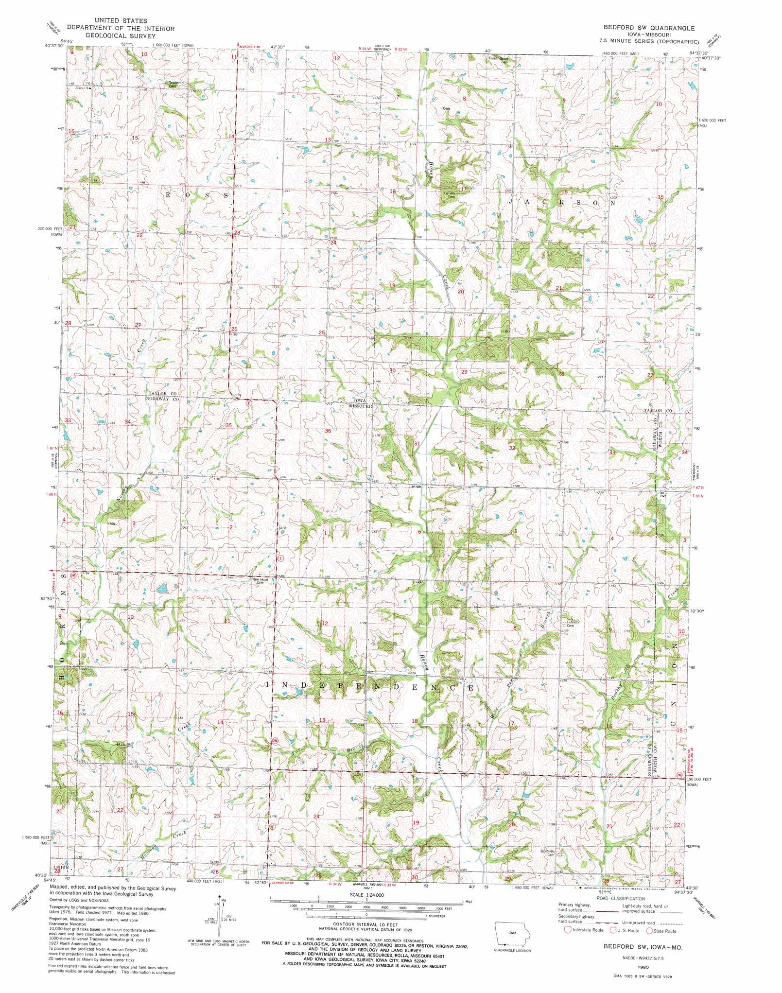
USGS Topo Quad 40094e6 - 1:24,000 scale
| Topo Map Name: | Bedford Sw |
| USGS Topo Quad ID: | 40094e6 |
| Print Size: | ca. 21 1/4" wide x 27" high |
| Southeast Coordinates: | 40.5° N latitude / 94.625° W longitude |
| Map Center Coordinates: | 40.5625° N latitude / 94.6875° W longitude |
| U.S. States: | MO, IA |
| Filename: | o40094e6.jpg |
| Download Map JPG Image: | Bedford Sw topo map 1:24,000 scale |
| Map Type: | Topographic |
| Topo Series: | 7.5´ |
| Map Scale: | 1:24,000 |
| Source of Map Images: | United States Geological Survey (USGS) |
| Alternate Map Versions: |
Bedford SW MO 1980, updated 1981 Download PDF Buy paper map Bedford SW MO 2010 Download PDF Buy paper map Bedford SW MO 2011 Download PDF Buy paper map Bedford SW MO 2014 Download PDF Buy paper map |
1:24,000 Topo Quads surrounding Bedford Sw
Hawleyville |
Guss |
Gravity |
Merle Junction |
Clearfield |
New Market |
Ladoga |
Bedford |
Conway |
Maloy |
Hopkins Sw |
Hopkins |
Bedford Sw |
Sheridan |
Blockton |
Wilcox |
Pickering |
Parnell West |
Parnell East |
Grant City |
Maryville West |
Maryville East |
Ravenwood |
Alanthus Grove |
Gentry |
> Back to 40094e1 at 1:100,000 scale
> Back to 40094a1 at 1:250,000 scale
> Back to U.S. Topo Maps home
Bedford Sw topo map: Gazetteer
Bedford Sw: Dams
Allen Lake Dam elevation 351m 1151′James Lake Dam elevation 338m 1108′
Bedford Sw: Populated Places
Allison elevation 363m 1190′Bedford Sw: Post Offices
Allison Post Office elevation 363m 1190′Enod Post Office (historical) elevation 343m 1125′
Bedford Sw: Reservoirs
Allen Lake elevation 351m 1151′James Lake elevation 338m 1108′
Bedford Sw: Streams
Fox Branch elevation 323m 1059′Wolf Pen Branch elevation 326m 1069′
Bedford Sw digital topo map on disk
Buy this Bedford Sw topo map showing relief, roads, GPS coordinates and other geographical features, as a high-resolution digital map file on DVD: