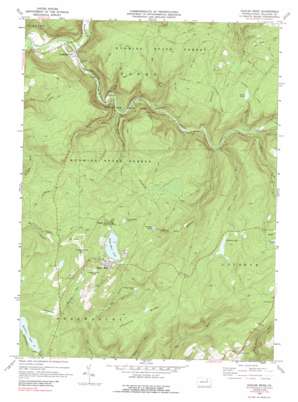
Eagles Mere Topo Map Pennsylvania
To zoom in, hover over the map of Eagles Mere
USGS Topo Quad 41076d5 - 1:24,000 scale
| Topo Map Name: | Eagles Mere |
| USGS Topo Quad ID: | 41076d5 |
| Print Size: | ca. 21 1/4" wide x 27" high |
| Southeast Coordinates: | 41.375° N latitude / 76.5° W longitude |
| Map Center Coordinates: | 41.4375° N latitude / 76.5625° W longitude |
| U.S. State: | PA |
| Filename: | o41076d5.jpg |
| Download Map JPG Image: | Eagles Mere topo map 1:24,000 scale |
| Map Type: | Topographic |
| Topo Series: | 7.5´ |
| Map Scale: | 1:24,000 |
| Source of Map Images: | United States Geological Survey (USGS) |
| Alternate Map Versions: |
Eagles Mere PA 1969, updated 1972 Download PDF Buy paper map Eagles Mere PA 1969, updated 1989 Download PDF Buy paper map Eagles Mere PA 1993, updated 1999 Download PDF Buy paper map Eagles Mere PA 2010 Download PDF Buy paper map Eagles Mere PA 2013 Download PDF Buy paper map Eagles Mere PA 2016 Download PDF Buy paper map |
1:24,000 Topo Quads surrounding Eagles Mere
> Back to 41076a1 at 1:100,000 scale
> Back to 41076a1 at 1:250,000 scale
> Back to U.S. Topo Maps home
Eagles Mere topo map: Gazetteer
Eagles Mere: Airports
Eagles Mere Field elevation 579m 1899′Merritt Field elevation 614m 2014′
Eagles Mere: Areas
Rock Garden elevation 567m 1860′Eagles Mere: Bars
Haystacks elevation 414m 1358′Eagles Mere: Dams
Hunters Lake Dam elevation 493m 1617′Sones Pond Dam elevation 550m 1804′
Eagles Mere: Falls
Cold Run Road Falls elevation 541m 1774′Wenonan Falls elevation 413m 1354′
Eagles Mere: Lakes
Celestial Lake elevation 558m 1830′Eagles Mere Lake elevation 608m 1994′
Hunters Lake elevation 493m 1617′
Rainbow Lake elevation 548m 1797′
Eagles Mere: Parks
Worlds End State Park elevation 358m 1174′Eagles Mere: Pillars
Castle Rock elevation 551m 1807′Labyrinth elevation 555m 1820′
Eagles Mere: Populated Places
Canyon Vista elevation 530m 1738′Crestmont elevation 651m 2135′
Eagles Mere elevation 629m 2063′
Eagles Mere Park elevation 615m 2017′
Forksville elevation 310m 1017′
Wrights View elevation 550m 1804′
Eagles Mere: Post Offices
Crestmont Post Office (historical) elevation 651m 2135′Eagles Mere Chautauqua Post Office (historical) elevation 629m 2063′
Eagles Mere: Reservoirs
Sones Pond elevation 551m 1807′Eagles Mere: Ridges
Chestnut Ridge elevation 586m 1922′Devils Garden elevation 579m 1899′
Sugar Camp Spur elevation 522m 1712′
Eagles Mere: Streams
Bear Run elevation 415m 1361′Big Run elevation 360m 1181′
Coal Run elevation 400m 1312′
Double Run elevation 342m 1122′
High Rock Run elevation 336m 1102′
Little Loyalsock Creek elevation 301m 987′
Mackeys Run elevation 431m 1414′
Mill Creek elevation 408m 1338′
Pole Bridge Run elevation 394m 1292′
Rusty Run elevation 487m 1597′
Shanerburg Run elevation 391m 1282′
Tamarack Run elevation 386m 1266′
Eagles Mere: Summits
Lovers Rock elevation 609m 1998′Pole Hill elevation 585m 1919′
Prospect Hill elevation 653m 2142′
Eagles Mere: Trails
Ash Ridge Spur elevation 596m 1955′Big Run Spur elevation 518m 1699′
Big Timber Spur elevation 574m 1883′
Crane Spur elevation 560m 1837′
Double Run Trail elevation 527m 1729′
Fox Hollow Spur elevation 598m 1961′
High Rock Spur elevation 590m 1935′
Irish Settlement Trail elevation 598m 1961′
Loyalsock Trail elevation 591m 1938′
Pole Bridge Trail elevation 564m 1850′
Rock Run Trail elevation 549m 1801′
World End Trail elevation 573m 1879′
Eagles Mere digital topo map on disk
Buy this Eagles Mere topo map showing relief, roads, GPS coordinates and other geographical features, as a high-resolution digital map file on DVD:
New York, Vermont, Connecticut & Western Massachusetts
Buy digital topo maps: New York, Vermont, Connecticut & Western Massachusetts


