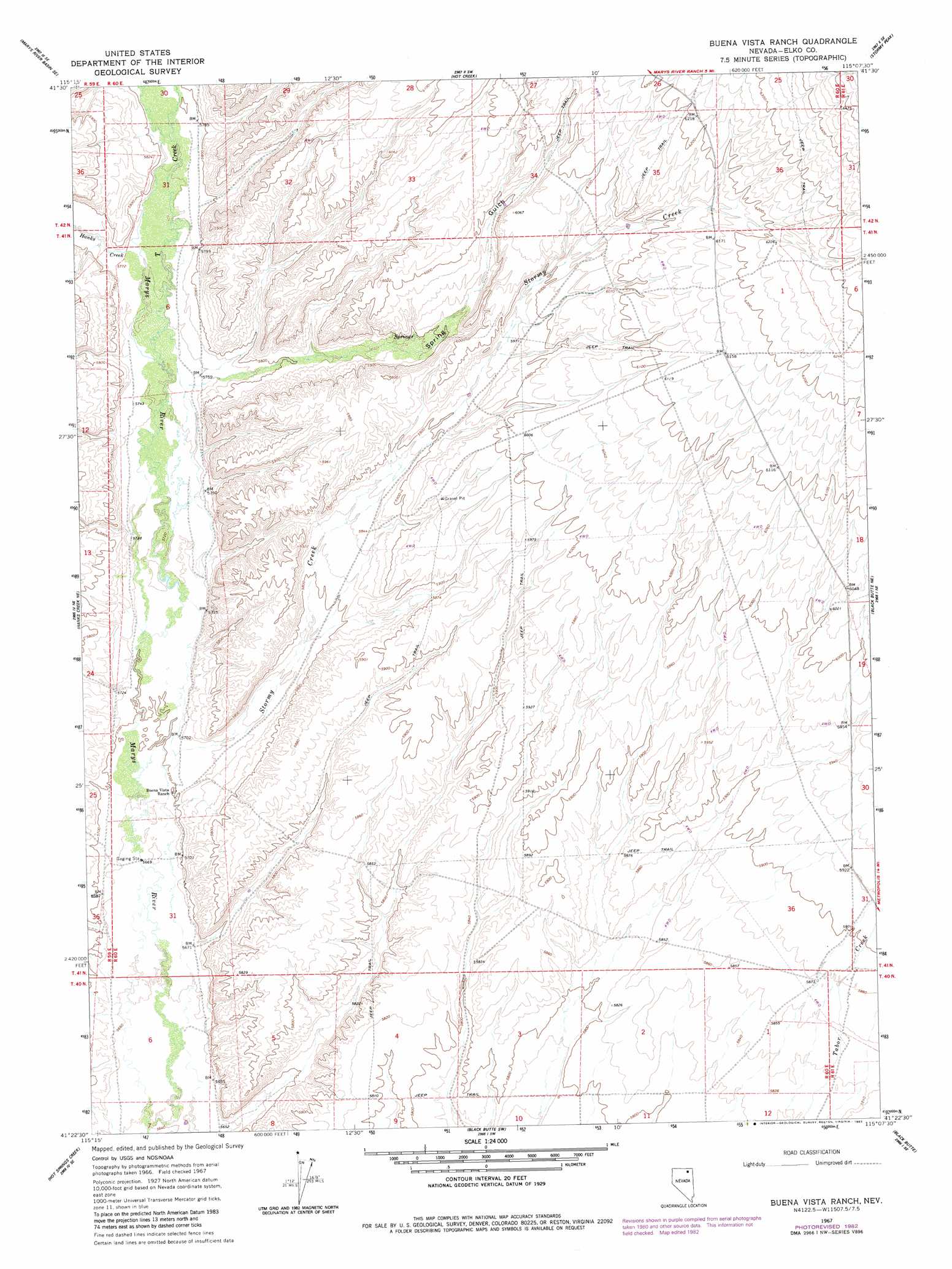
Buena Vista Ranch Topo Map Nevada
To zoom in, hover over the map of Buena Vista Ranch
USGS Topo Quad 41115d2 - 1:24,000 scale
| Topo Map Name: | Buena Vista Ranch |
| USGS Topo Quad ID: | 41115d2 |
| Print Size: | ca. 21 1/4" wide x 27" high |
| Southeast Coordinates: | 41.375° N latitude / 115.125° W longitude |
| Map Center Coordinates: | 41.4375° N latitude / 115.1875° W longitude |
| U.S. State: | NV |
| Filename: | o41115d2.jpg |
| Download Map JPG Image: | Buena Vista Ranch topo map 1:24,000 scale |
| Map Type: | Topographic |
| Topo Series: | 7.5´ |
| Map Scale: | 1:24,000 |
| Source of Map Images: | United States Geological Survey (USGS) |
| Alternate Map Versions: |
Buena Vista Ranch NV 1967, updated 1971 Download PDF Buy paper map Buena Vista Ranch NV 1967, updated 1983 Download PDF Buy paper map Buena Vista Ranch NV 2012 Download PDF Buy paper map Buena Vista Ranch NV 2014 Download PDF Buy paper map |
1:24,000 Topo Quads surrounding Buena Vista Ranch
Marys River Basin Nw |
Marys River Basin Ne |
Sun Creek Nw |
Gilmer Ranch |
Hubbard Basin |
Charleston Reservoir |
Marys River Basin Se |
Hot Creek |
Stormy Peak |
Boies Reservoir |
Stag Mountain |
Hanks Creek Ne |
Buena Vista Ranch |
Black Butte Ne |
Loomis Mountain |
Hanks Creek Sw |
Hot Springs Creek |
Black Butte Sw |
Black Butte |
Summer Camp |
Peko Peak |
Twin Buttes |
Tabor Flats |
Metropolis |
Oxley Peak |
> Back to 41115a1 at 1:100,000 scale
> Back to 41114a1 at 1:250,000 scale
> Back to U.S. Topo Maps home
Buena Vista Ranch topo map: Gazetteer
Buena Vista Ranch: Streams
Hanks Creek elevation 1762m 5780′Spring Creek elevation 1745m 5725′
Stormy Creek elevation 1739m 5705′
T Creek elevation 1751m 5744′
Buena Vista Ranch: Valleys
Spring Gulch elevation 1755m 5757′Buena Vista Ranch: Wells
Marys River Well Number 1 elevation 1804m 5918′Buena Vista Ranch digital topo map on disk
Buy this Buena Vista Ranch topo map showing relief, roads, GPS coordinates and other geographical features, as a high-resolution digital map file on DVD: