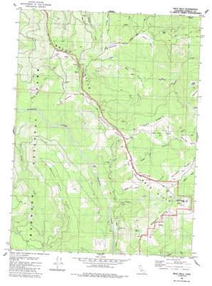
Bald Hills Topo Map California
To zoom in, hover over the map of Bald Hills
USGS Topo Quad 41123b8 - 1:24,000 scale
| Topo Map Name: | Bald Hills |
| USGS Topo Quad ID: | 41123b8 |
| Print Size: | ca. 21 1/4" wide x 27" high |
| Southeast Coordinates: | 41.125° N latitude / 123.875° W longitude |
| Map Center Coordinates: | 41.1875° N latitude / 123.9375° W longitude |
| U.S. State: | CA |
| Filename: | o41123b8.jpg |
| Download Map JPG Image: | Bald Hills topo map 1:24,000 scale |
| Map Type: | Topographic |
| Topo Series: | 7.5´ |
| Map Scale: | 1:24,000 |
| Source of Map Images: | United States Geological Survey (USGS) |
| Alternate Map Versions: |
Bald Hills CA 1982, updated 1983 Download PDF Buy paper map Bald Hills CA 1982, updated 1991 Download PDF Buy paper map Bald Hills CA 2012 Download PDF Buy paper map Bald Hills CA 2015 Download PDF Buy paper map |
1:24,000 Topo Quads surrounding Bald Hills
> Back to 41123a1 at 1:100,000 scale
> Back to 41122a1 at 1:250,000 scale
> Back to U.S. Topo Maps home
Bald Hills topo map: Gazetteer
Bald Hills: Areas
Bear Prairie elevation 540m 1771′Cagle Ridge Prairie elevation 584m 1916′
Childs Hill Prairie elevation 685m 2247′
Counts Hill Prairie elevation 549m 1801′
Cuddy Prairie elevation 495m 1624′
Doiason Hill Prairie elevation 680m 2230′
Hog Prairie elevation 115m 377′
Little Bear Prairie elevation 440m 1443′
Roach Creek Hole elevation 514m 1686′
Schoolhouse Pasture elevation 789m 2588′
Sidehill Prairie elevation 515m 1689′
Smith Prairie elevation 577m 1893′
Thompson Prairie elevation 609m 1998′
Tick Prairie elevation 232m 761′
Bald Hills: Flats
Pitt Place Prairie elevation 728m 2388′Bald Hills: Pillars
Schoolhouse Pasture Rock elevation 787m 2582′Bald Hills: Ranges
Bald Hills elevation 705m 2312′Bald Hills: Ridges
Bridge Creek Ridge elevation 688m 2257′Cagle Ridge elevation 660m 2165′
Bald Hills: Streams
Bridge Creek elevation 58m 190′Copper Creek elevation 85m 278′
Devils Creek elevation 112m 367′
Harry Weir Creek elevation 41m 134′
Harry Weir Creek elevation 43m 141′
Bald Hills: Summits
Schoolhouse Peak elevation 933m 3061′Bald Hills digital topo map on disk
Buy this Bald Hills topo map showing relief, roads, GPS coordinates and other geographical features, as a high-resolution digital map file on DVD:


