Prairie View School Topo Map Wyoming
To zoom in, hover over the map of Prairie View School
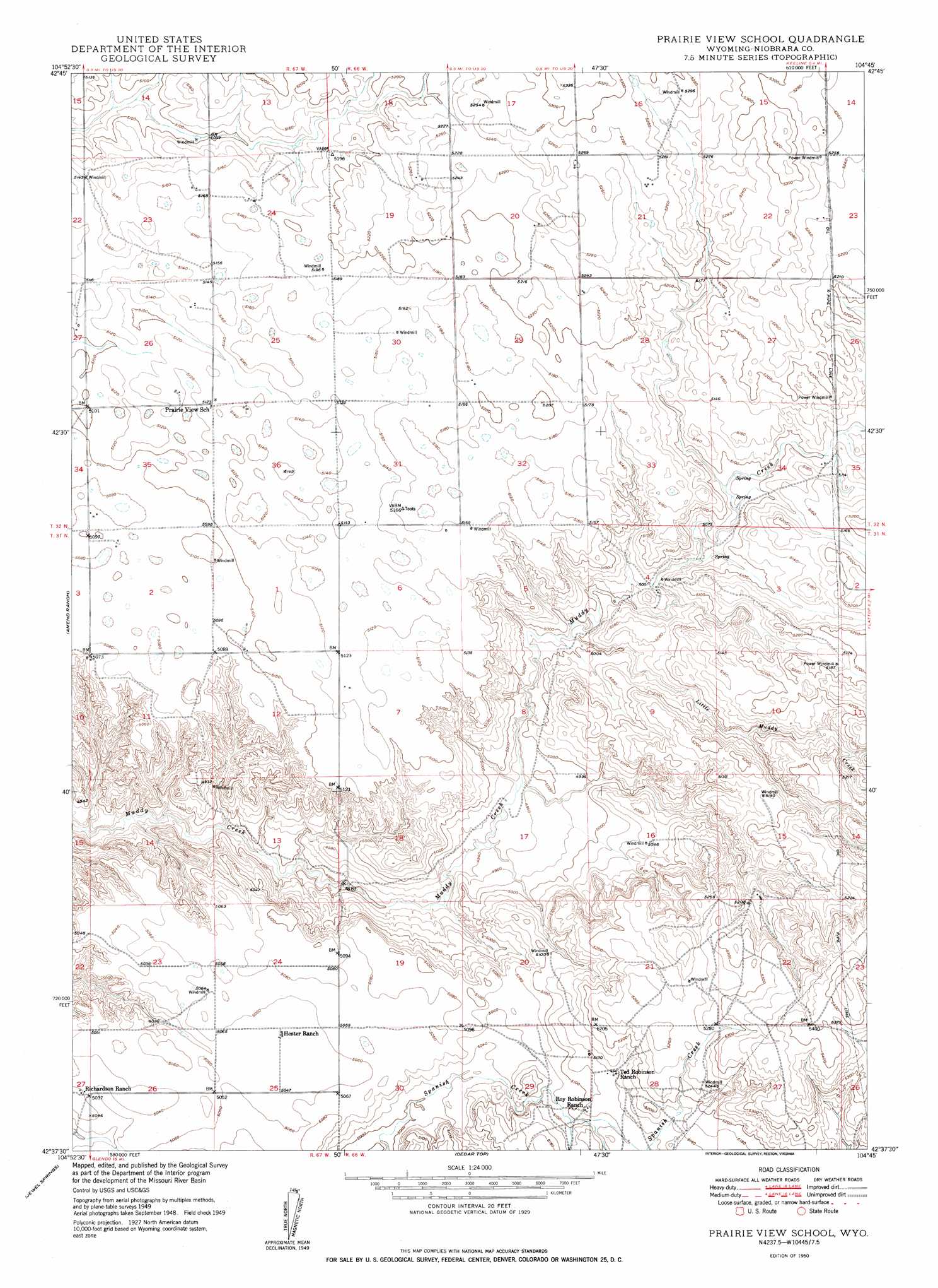
USGS Topo Quad 42104f7 - 1:24,000 scale
| Topo Map Name: | Prairie View School |
| USGS Topo Quad ID: | 42104f7 |
| Print Size: | ca. 21 1/4" wide x 27" high |
| Southeast Coordinates: | 42.625° N latitude / 104.75° W longitude |
| Map Center Coordinates: | 42.6875° N latitude / 104.8125° W longitude |
| U.S. State: | WY |
| Filename: | o42104f7.jpg |
| Download Map JPG Image: | Prairie View School topo map 1:24,000 scale |
| Map Type: | Topographic |
| Topo Series: | 7.5´ |
| Map Scale: | 1:24,000 |
| Source of Map Images: | United States Geological Survey (USGS) |
| Alternate Map Versions: |
Prairie View School WY 1950 Download PDF Buy paper map Prairie View School WY 1950 Download PDF Buy paper map Prairie View School WY 2012 Download PDF Buy paper map Prairie View School WY 2015 Download PDF Buy paper map |
1:24,000 Topo Quads surrounding Prairie View School
Walker Creek School |
Lost Springs Nw |
Cooley Draw |
Flat Top |
Manville Ne |
The Park |
Lost Springs |
Keeline |
Bills Creek |
Manville |
Shawnee |
Amend Ranch |
Prairie View School |
Lone Tree Hill |
Silver Springs |
Glendo |
Jewel Springs |
Cedar Top |
Meadowdale |
Rawhide Butte West |
Sibley Peak |
Cassa |
Haushar Ranch |
Hell Gap |
Moore Spring |
> Back to 42104e1 at 1:100,000 scale
> Back to 42104a1 at 1:250,000 scale
> Back to U.S. Topo Maps home
Prairie View School topo map: Gazetteer
Prairie View School: Streams
Little Muddy Creek elevation 1519m 4983′Prairie View School digital topo map on disk
Buy this Prairie View School topo map showing relief, roads, GPS coordinates and other geographical features, as a high-resolution digital map file on DVD:
Eastern Wyoming & Western South Dakota
Buy digital topo maps: Eastern Wyoming & Western South Dakota