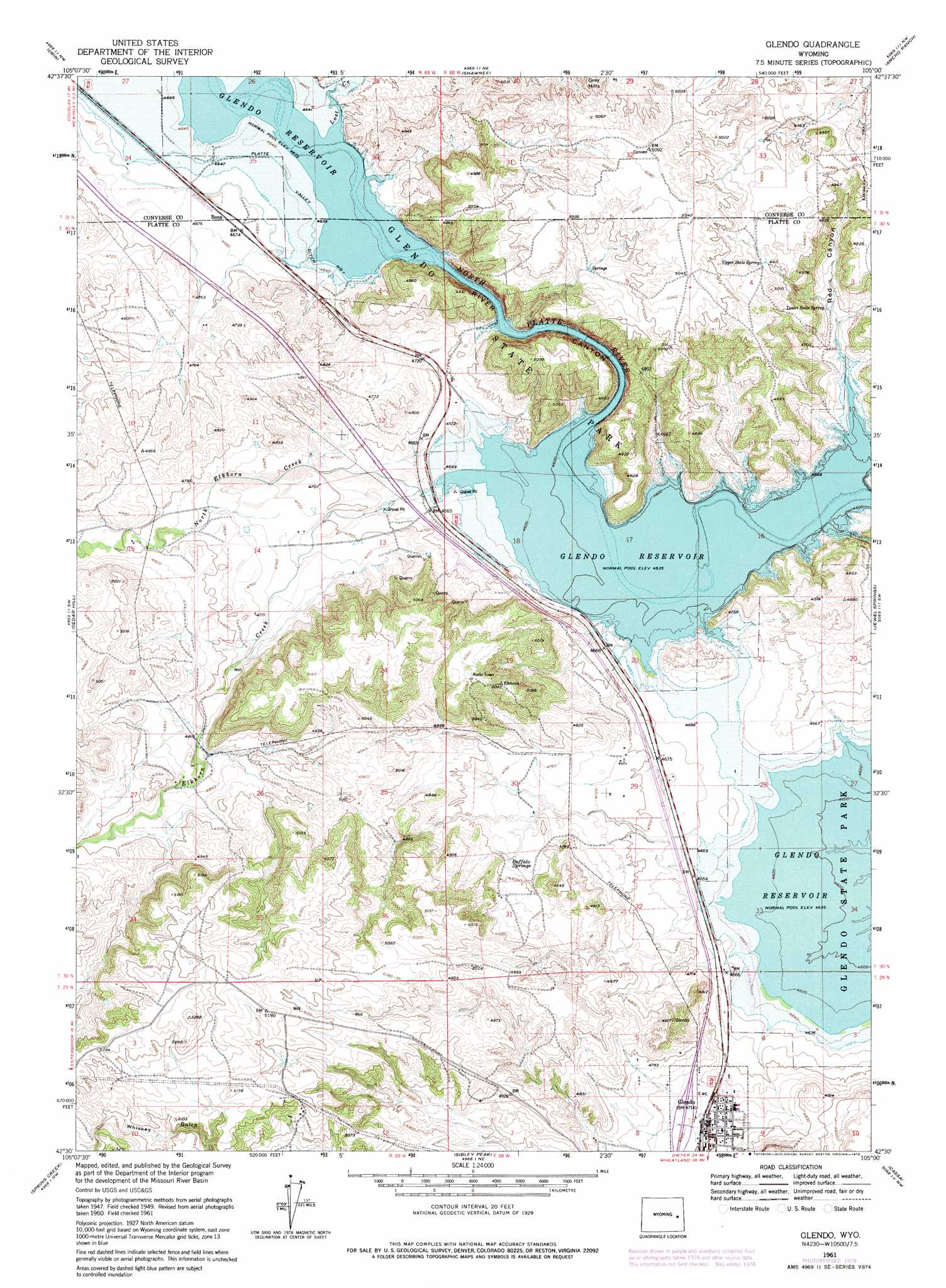
Glendo Topo Map Wyoming
To zoom in, hover over the map of Glendo
USGS Topo Quad 42105e1 - 1:24,000 scale
| Topo Map Name: | Glendo |
| USGS Topo Quad ID: | 42105e1 |
| Print Size: | ca. 21 1/4" wide x 27" high |
| Southeast Coordinates: | 42.5° N latitude / 105° W longitude |
| Map Center Coordinates: | 42.5625° N latitude / 105.0625° W longitude |
| U.S. State: | WY |
| Filename: | o42105e1.jpg |
| Download Map JPG Image: | Glendo topo map 1:24,000 scale |
| Map Type: | Topographic |
| Topo Series: | 7.5´ |
| Map Scale: | 1:24,000 |
| Source of Map Images: | United States Geological Survey (USGS) |
| Alternate Map Versions: |
Glendo WY 1950 Download PDF Buy paper map Glendo WY 1961, updated 1965 Download PDF Buy paper map Glendo WY 1961, updated 1975 Download PDF Buy paper map Glendo WY 1961, updated 1978 Download PDF Buy paper map Glendo WY 2012 Download PDF Buy paper map Glendo WY 2015 Download PDF Buy paper map |
1:24,000 Topo Quads surrounding Glendo
Antelope Creek |
Simpson Draw |
The Park |
Lost Springs |
Keeline |
Irvine |
Orin |
Shawnee |
Amend Ranch |
Prairie View School |
Dilts Ranch |
Cedar Hill |
Glendo |
Jewel Springs |
Cedar Top |
Esterbrook |
Spring Creek |
Sibley Peak |
Cassa |
Haushar Ranch |
Harris Park |
Cottonwood Falls |
Coleman Butte |
Herman Ranch |
Guernsey Reservoir |
> Back to 42105e1 at 1:100,000 scale
> Back to 42104a1 at 1:250,000 scale
> Back to U.S. Topo Maps home
Glendo topo map: Gazetteer
Glendo: Airports
Thomas Memorial Airport elevation 1419m 4655′Glendo: Canals
Platte Valley Ditch Number 1 elevation 1420m 4658′Glendo: Dams
Black Reservoir Number 2 Dam elevation 1450m 4757′Buck Dam elevation 1457m 4780′
Glendo: Populated Places
Glendo elevation 1440m 4724′Glendo: Reservoirs
Black Reservoir Number 2 elevation 1450m 4757′Buck Reservoir elevation 1457m 4780′
Glendo: Springs
Buffalo Springs elevation 1450m 4757′Lower State Spring elevation 1429m 4688′
Upper State Spring elevation 1502m 4927′
Glendo: Streams
Elkhorn Creek elevation 1419m 4655′Lost Creek elevation 1419m 4655′
North Elkhorn Creek elevation 1417m 4648′
Glendo: Valleys
Red Canyon elevation 1421m 4662′River Canyon elevation 1419m 4655′
Glendo digital topo map on disk
Buy this Glendo topo map showing relief, roads, GPS coordinates and other geographical features, as a high-resolution digital map file on DVD:
Eastern Wyoming & Western South Dakota
Buy digital topo maps: Eastern Wyoming & Western South Dakota