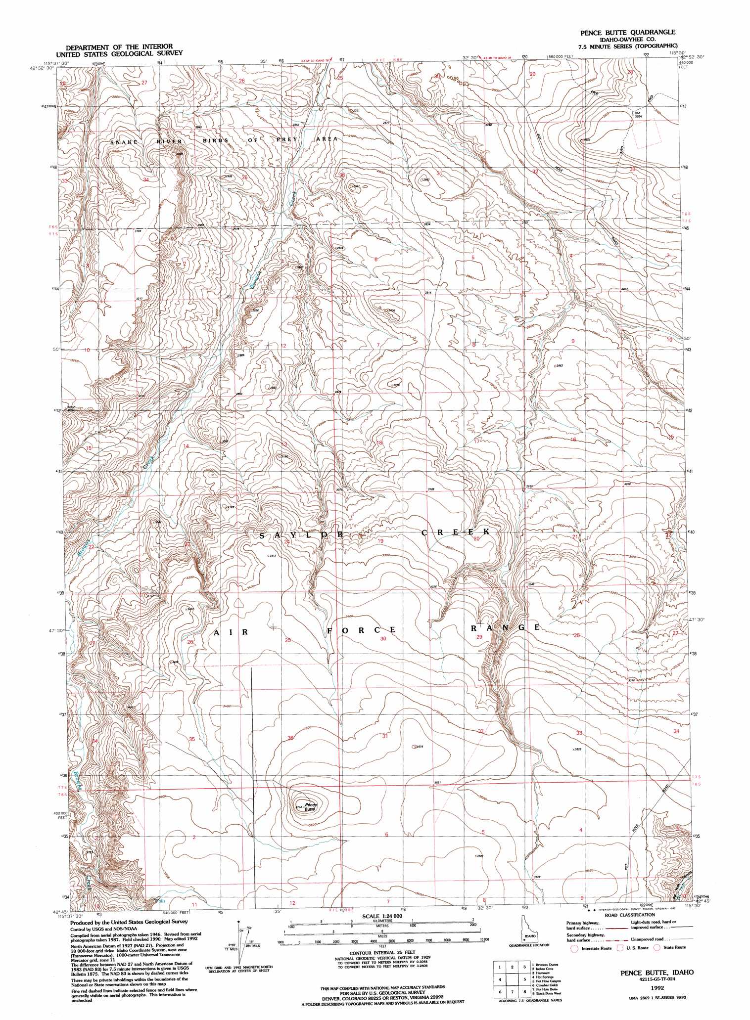
Pence Butte Topo Map Idaho
To zoom in, hover over the map of Pence Butte
USGS Topo Quad 42115g5 - 1:24,000 scale
| Topo Map Name: | Pence Butte |
| USGS Topo Quad ID: | 42115g5 |
| Print Size: | ca. 21 1/4" wide x 27" high |
| Southeast Coordinates: | 42.75° N latitude / 115.5° W longitude |
| Map Center Coordinates: | 42.8125° N latitude / 115.5625° W longitude |
| U.S. State: | ID |
| Filename: | o42115g5.jpg |
| Download Map JPG Image: | Pence Butte topo map 1:24,000 scale |
| Map Type: | Topographic |
| Topo Series: | 7.5´ |
| Map Scale: | 1:24,000 |
| Source of Map Images: | United States Geological Survey (USGS) |
| Alternate Map Versions: |
Pence Butte ID 1948, updated 1967 Download PDF Buy paper map Pence Butte ID 1949, updated 1949 Download PDF Buy paper map Pence Butte ID 1976, updated 1984 Download PDF Buy paper map Pence Butte ID 1992, updated 1992 Download PDF Buy paper map Pence Butte ID 2010 Download PDF Buy paper map Pence Butte ID 2013 Download PDF Buy paper map |
1:24,000 Topo Quads surrounding Pence Butte
Crater Rings Se |
Mountain Home South |
Reverse |
Hot Springs Creek Reservoir |
Morrow Reservoir |
Bruneau |
Bruneau Dunes |
Indian Cove |
Hammett |
Glenns Ferry |
Sugar Valley |
Hot Spring |
Pence Butte |
Pot Hole Canyon |
Grindstone Butte |
Broken Wagon Flat |
Crowbar Gulch |
Pot Hole Butte |
Black Butte West |
Black Butte East |
Table Butte |
Austin Butte |
Winter Camp |
Hodge Station |
Crows Nest Butte |
> Back to 42115e1 at 1:100,000 scale
> Back to 42114a1 at 1:250,000 scale
> Back to U.S. Topo Maps home
Pence Butte digital topo map on disk
Buy this Pence Butte topo map showing relief, roads, GPS coordinates and other geographical features, as a high-resolution digital map file on DVD: