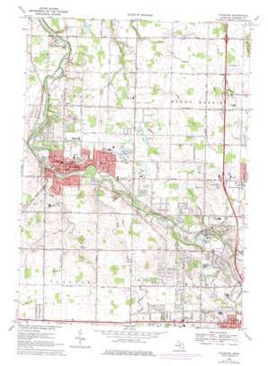
Flushing Topo Map Michigan
To zoom in, hover over the map of Flushing
USGS Topo Quad 43083a7 - 1:24,000 scale
| Topo Map Name: | Flushing |
| USGS Topo Quad ID: | 43083a7 |
| Print Size: | ca. 21 1/4" wide x 27" high |
| Southeast Coordinates: | 43° N latitude / 83.75° W longitude |
| Map Center Coordinates: | 43.0625° N latitude / 83.8125° W longitude |
| U.S. State: | MI |
| Filename: | o43083a7.jpg |
| Download Map JPG Image: | Flushing topo map 1:24,000 scale |
| Map Type: | Topographic |
| Topo Series: | 7.5´ |
| Map Scale: | 1:24,000 |
| Source of Map Images: | United States Geological Survey (USGS) |
| Alternate Map Versions: |
Flushing MI 1969, updated 1971 Download PDF Buy paper map Flushing MI 1975, updated 1976 Download PDF Buy paper map Flushing MI 2011 Download PDF Buy paper map Flushing MI 2014 Download PDF Buy paper map Flushing MI 2017 Download PDF Buy paper map |
1:24,000 Topo Quads surrounding Flushing
> Back to 43083a1 at 1:100,000 scale
> Back to 43082a1 at 1:250,000 scale
> Back to U.S. Topo Maps home
Flushing topo map: Gazetteer
Flushing: Airports
Cedarville Airport elevation 219m 718′Daltons Airport elevation 223m 731′
Flushing: Canals
Bowman Drain elevation 219m 718′Cattail Swamp Drain elevation 221m 725′
Cottrell Drain elevation 219m 718′
Goyer Drain elevation 224m 734′
Hartshorn Drain elevation 223m 731′
Messmore Cronk Drain elevation 229m 751′
Root Drain elevation 219m 718′
Seymour McKinley Drain elevation 229m 751′
Stadler Drain elevation 225m 738′
Flushing: Crossings
Interchange 122 elevation 233m 764′Interchange 125 elevation 228m 748′
Interchange 126 elevation 231m 757′
Flushing: Parks
Amos Woodruff Historical Marker elevation 219m 718′Amos Woodruff House Historical Marker elevation 219m 718′
Eastview Park elevation 220m 721′
First Methodist Episcopal Church Historical Marker elevation 213m 698′
Flushing Park elevation 220m 721′
Harrison Homestead Historical Marker elevation 220m 721′
Mutton Park elevation 224m 734′
River Road Park elevation 216m 708′
Flushing: Populated Places
Birchwood Mobile Home Park elevation 231m 757′Flushing elevation 213m 698′
Flushing Estates Mobile Home Park elevation 206m 675′
Heather Hill Estates Mobile Home Park elevation 229m 751′
Meadowbrook Manor Estates Mobile Home Park elevation 216m 708′
Pheasant Run Mobile Home Park elevation 230m 754′
Westwood Heights Mobile Home Park elevation 232m 761′
White Oak Estates Mobile Home Park elevation 228m 748′
White Oaks Estates Mobile Home Park elevation 227m 744′
Flushing: Post Offices
Flushing Post Office elevation 210m 688′Flushing: Streams
Cole Creek elevation 202m 662′Monroe Brook elevation 218m 715′
Mud Creek elevation 207m 679′
Pirnie Creek elevation 209m 685′
Pollock Brook elevation 207m 679′
Flushing digital topo map on disk
Buy this Flushing topo map showing relief, roads, GPS coordinates and other geographical features, as a high-resolution digital map file on DVD:


